Della: ‘A warning to those considering hiking Tasmania’s South Coast Track.
It is now a full week since we reached Cockle Creek after completing the South Coast Track wilderness walk. After a week, I finally feel a little recovered and therefore equal to the task of recording the experience, so that others contemplating the walk may be better prepared than we were.
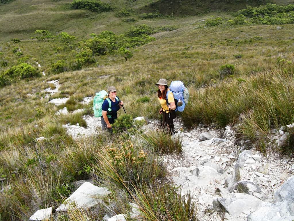
First of all, we thought ourselves well enough prepared for the trip. We had read John Chapman’s book, checked out reports and video footage on the web, were experienced lightweight backpackers and were reasonably fit. Most reports of the walk described it as ‘easy’ while some suggested that it might challenge those inexperienced at long hikes. John Chapman’s book recorded the estimated track times as being fairly reasonable: apart from 2 long days (6-9 hours and 5-7 hours respectively) all the track times seemed to suggest a comfortable half-day’s walk. It was our trust in this document that was our undoing!
Day 1 Melaleuca to Freney Lagoon
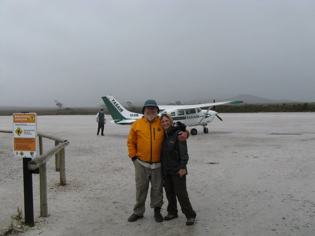
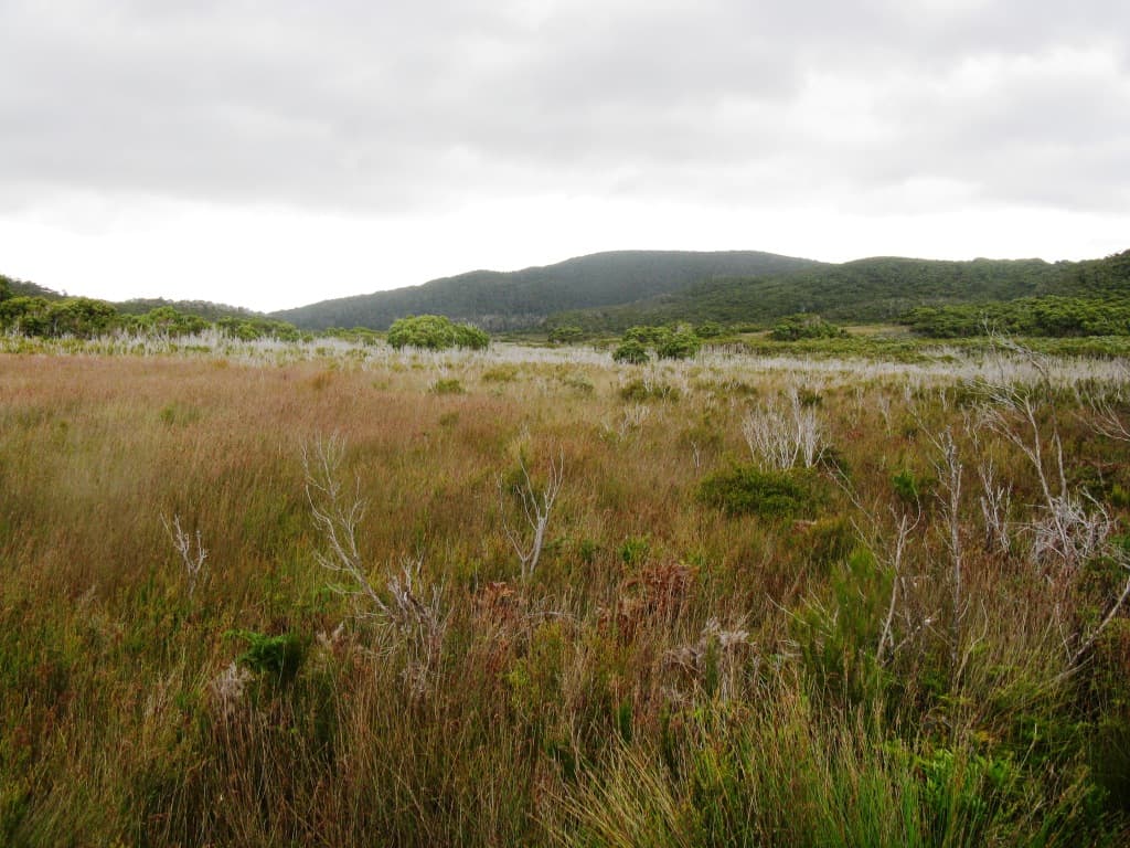
Having left our warm beds at 2.45 am for the drive to Melbourne Airport, we were already a little groggy by the time our Cessna touched down on the airstrip at Melaleuca. Despite the glowing weather forecast for the whole period of our walk, the cloud had closed in half way between Hobart and Melaleuca, and we disembarked to a light drizzle. Spirits high, we zipped up our jackets, hoisted our packs and set off for what was touted as an easy walk over a well-maintained track across open buttongrass plains. Perhaps it might have been once….
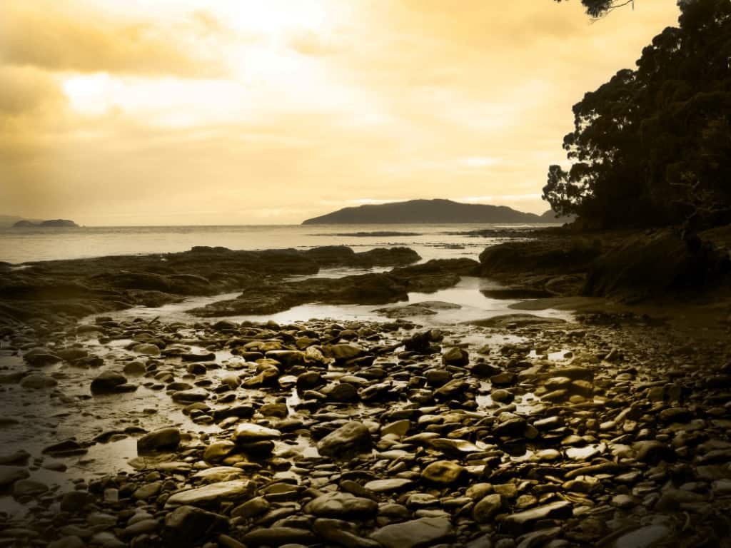
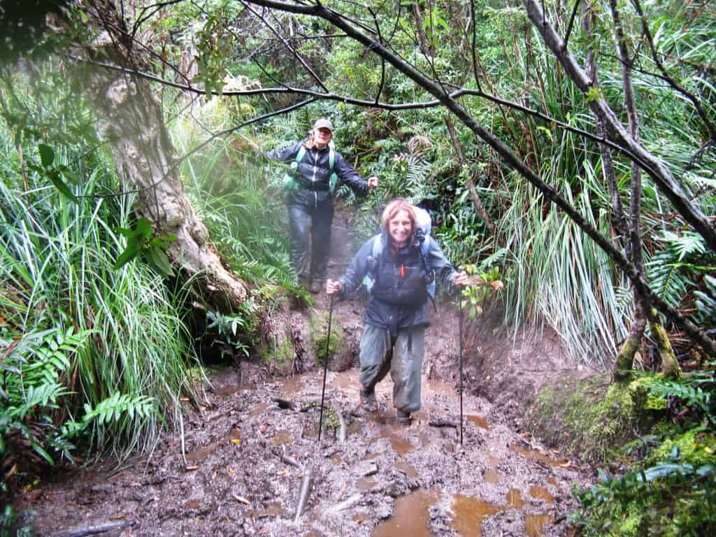
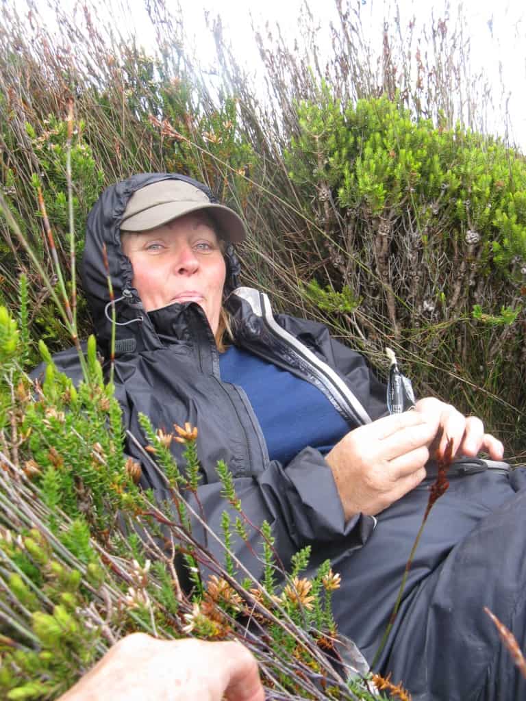
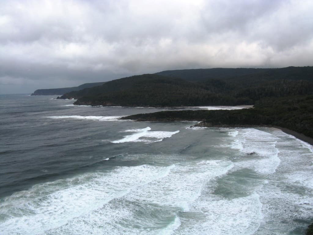
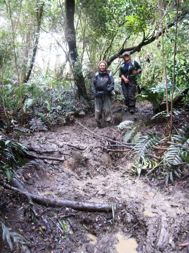
The boardwalks were deceptively accommodating, but they began and ended abruptly, frequently tipping us unceremoniously into boggy patches of mud. The worst part was the wetness of the boardwalks which were, in many places, so slimy that they were as slick as ice. Only careful, ponderous steps could ensure that we didn’t break any bones on this first section of the walk. All the while, the rain intensified, and I was thankful that I had invested in a good quality ‘Event’ rain jacket. The wind whipped mercilessly across the swamp, and the eerie lack of any sight or sound of wildlife in this endless wasteland brought to mind some half-forgotten lines of poetry from John Keats: …the grass has withered from the sedge/And no birds sing. Not quite sure of the accuracy of the line, nor of the poem’s title, but I do remember that the line was preceded by: Oh what can ail thee knight at arms/Alone and palely loitering…. The barrenness of this first day’s walk was certainly encapsulated for me in Keats’ words. We gave up looking for a suitable spot to eat our packed lunch, settling for stepping off the track and sitting atop prickly bushes to keep our backsides out of the mud while we gulped down our food before the cold could penetrate our bodies. Shortly before reaching Freney Lagoon campsite, we met a man heading back to Melaleuca. He had walked for 2 days and then decided to return to Melaleuca instead of completing the walk. We should have talked to him further! The Freney Lagoon campsite was reached via a stretch of lovely (though bleakly grey) beach, and it certainly looked as if our traverse of the ugly plains had rewarded us with some better scenery. Our aim had been to push on (perhaps another hour and a half) to reach the third campsite, Buoy Creek; but evening was not far off, and our early start was beginning to take its toll, so we called a halt and set up camp.
Day 2 Freney Lagoon to Louisa River
By the time we had broken camp, the sun was shining and our walk along the beach to Buoy Creek was lovely.
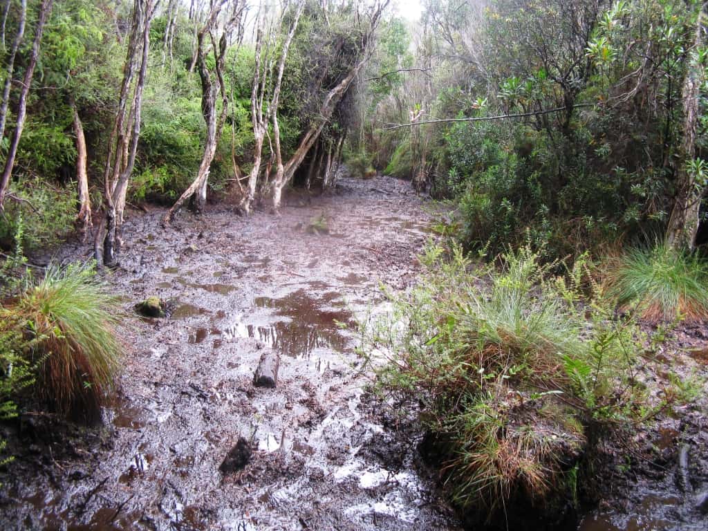
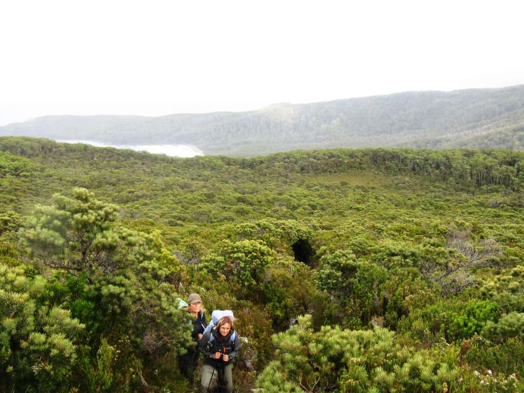
Sadly, this was over quickly, and from Buoy Creek we headed inland again over kilometres of muddy, wet plains. At first we tried to skirt what we could of the deeper mud, but eventually we had to just wade on through it to avoid the possibility of foot injuries. The track eventually led us to a steep climb (255 metres) over the Red Point Hills: hard going, but drier.
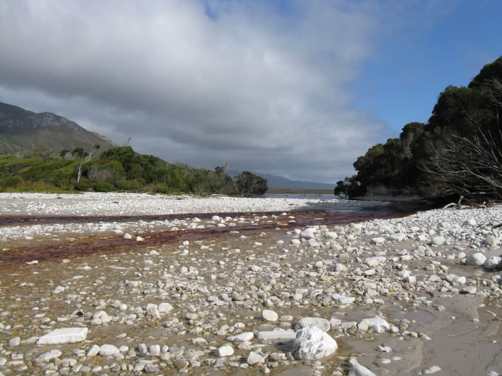
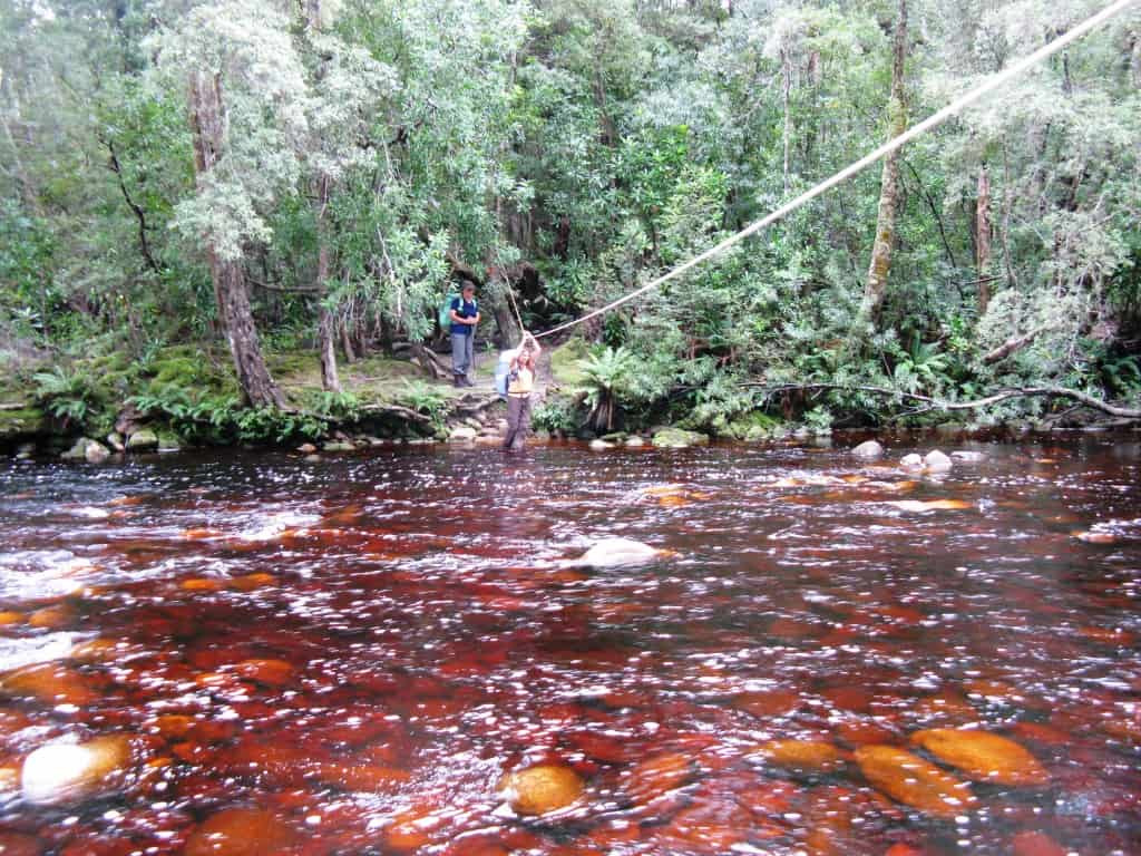
By around 3.00 pm we reached the colourful waters of the Faraway Creek crossing where we stopped for a brief swim to remove the accumulated mud and sweat. Unfortunately we didn’t dally over this, which proved to be our only opportunity to bathe on the walk… The high tanin content of the streams in this region renders the water the colour of strong urine when collected in drinking bottles. In the Faraway Creek, it was a deep orange…kind of attractive, in an odd sort of way! I may never approach Twinings Orange Pekoe tea with the same gusto again, however!
Sadly, we had misread the track guide at this point, and confused Louisa Creek with Louisa River: a small point, however it meant that we still had a good 2- 2.5 hours’ walk ahead of us, according to Chapman’s book. The fact that, despite a solid pace, this section took us 4 hours, created the first stirrings of unease in us…How could we possibly take more that twice the recommended time?
I had been dreading the Louisa River crossing after seeing footage of it on the web. For many walkers it seemed threateningly high and fast. We were in luck, however, and the river was only knee deep, so we struck a grateful camp, just before darkness fell, and left the crossing for the morning.
Day 3 Louisa River to Little Deadman’s Bay (well, not quite)
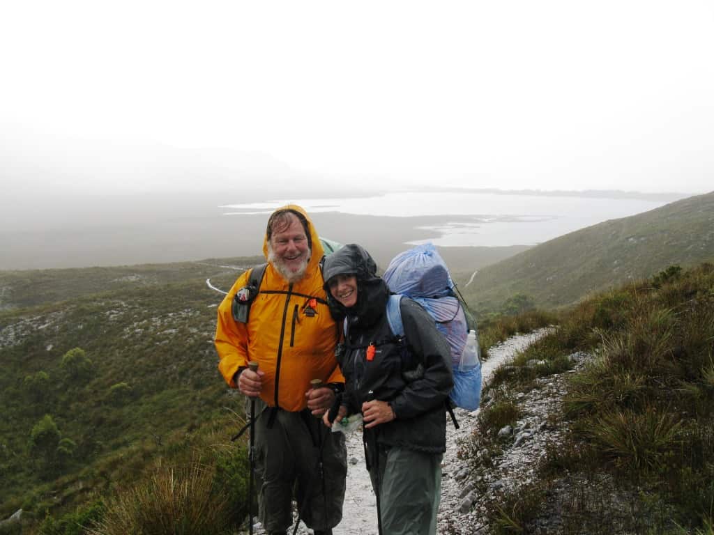
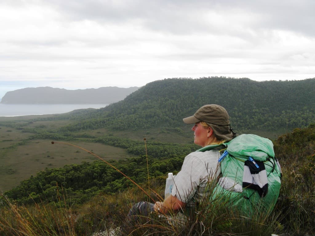
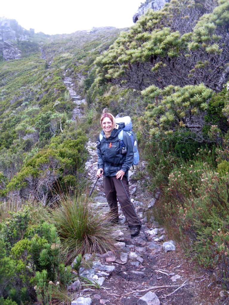
We had always expected this to be the big day, the climb of over 900 metres straight up and over the Ironbound Range. It certainly looked formidable as it towered above us in the morning! The weather forecast before we left home had this day tagged as a hot one in Hobart (high 20’s) so we hoped to accomplish the ascent before it became too warm. The track was well maintained in this section, with much step-work to make the climb safe. We happily completed the ascent in about 3 hours, which buoyed our spirits considerably.
The traverse of the summit, however, seemed endless, as the cloud engulfed us and a fine sleet set in. The way was cold, blind and windy. We forged doggedly ahead, hoping the descent would begin soon. My mother always warned me about being careful with regard to what I wished for…the descent was horrendous! Steep, plunging, muddy, heavily eroded, laced with treacherous tree roots, the descent had become a deep channel for all the water draining from the summit. And it continued for hours without let-up. The high camp was a possible lunch stop, but the alpine weather was so bleak that we just ate a muesli bar and stumbled on. By late afternoon we were only just passing the mid camp, which was unsuitable for spending the night due to a lack of water. We pushed on further, and I started to go lame in response to the jarring nature of the steep descent on a knee muscle injury I had incurred the previous day. By the time I alerted Steve and Kerri to my pain, and then waited for the pain killer and anti-inflammatory to ease things a little, time had hurried on and we could see that we had no hope of reaching Little Deadman’s Bay before dark. Our only hope was the Low Camp, which had no water. Fortunately, when we reached it half an hour before dark, there was just enough room to pitch our tents (albeit in a low, wet soak) and send Steve off to find the creek further down the track. Blessedly, the rain was not too heavy, but enough, nevertheless, to make tents and sleeping bags damp, so that we craved an earlier and drier camp the next night. Chapman’s book had this section tagged as 6-9 hours. We took 13 hours. As we descended, another poem from my past infiltrated my brain. It was written by Robert Browning, and entitled: Child Rolande to the Dark Tower Came. While I didn’t know all the words off pat, the first 2 lines came back to me strongly after simmering in my long-term memory for the last 40 years or so. The bleak atmosphere of the poem was well remembered too, and stayed with me for the rest of the walk.
My first thought was, he lied in every word,
That hoary cripple, with malicious eye
Askance to watch the working of his lie
On mine, and mouth scarce able to afford
Suppression of the glee that pursed and scored
Its edge at one more victim gained thereby.
What else should he be set for, with his staff?
What, save to waylay with his lies, ensnare
All travellers that might find him posted there,
And ask the road? I guessed what skull-like laugh
Would break, what crutch ‘gin write my epitaph
For pastime in the dusty thoroughfare…
And so on the poem goes. Apart from changing “dusty” in stanza 2 to “muddy”, I think the poem applies perfectly to Chapman, with me as his bitter victim.
Day 4 Ironbound Range Low Camp to Prion Boat Crossing
Chapman had this day tagged as 3.5-4 hours walking from Little Deadman’s Bay. We still hadn’t reached Little Deadman’s Bay, so we had to add on the extra time, however long that would be. Well, the walk to Deadman’s Bay took us a further 3 hours of treacherous, muddy descent, so even without the slight delay of my sore leg the night before, we had had no hope of reaching the camp. Good thing we camped where we did!
And so onward: more boring, buttongrass plains, but no boardwalks now, just mud….vast stretches of it, often thigh-deep, and always unavoidable.
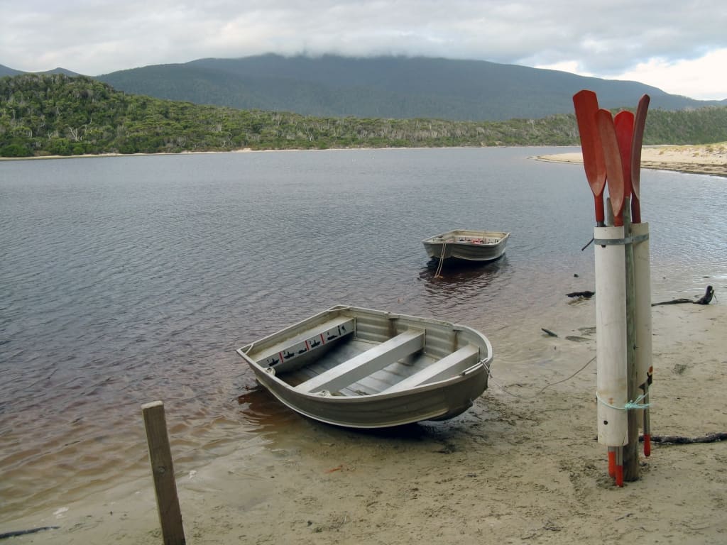
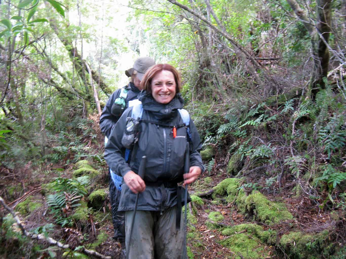
Some pretty forest sections on this day which were drier going, but all in all, 9 hours of walking without a break. The Prion Boat crossing was manageable, thanks to Steve’s capable rowing, but by then we were totally exhausted and in need of setting up camp to dry our bedding from the previous night.
Day 5 Prion Boat Crossing to Granite Beach
Chapman estimates this day as 4.5 – 6 hours: we took about 10 hours.
Muddy plains, steep climbs, light forest, some beach views, no time to stop…by now I was well and truly over this walk.
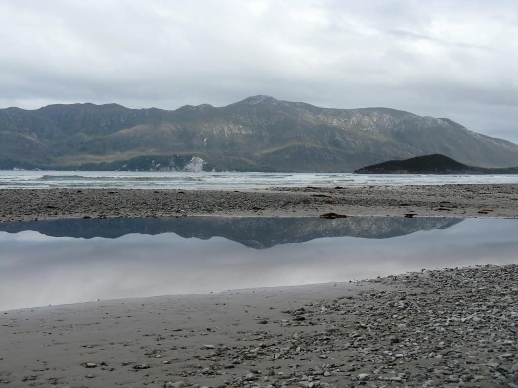
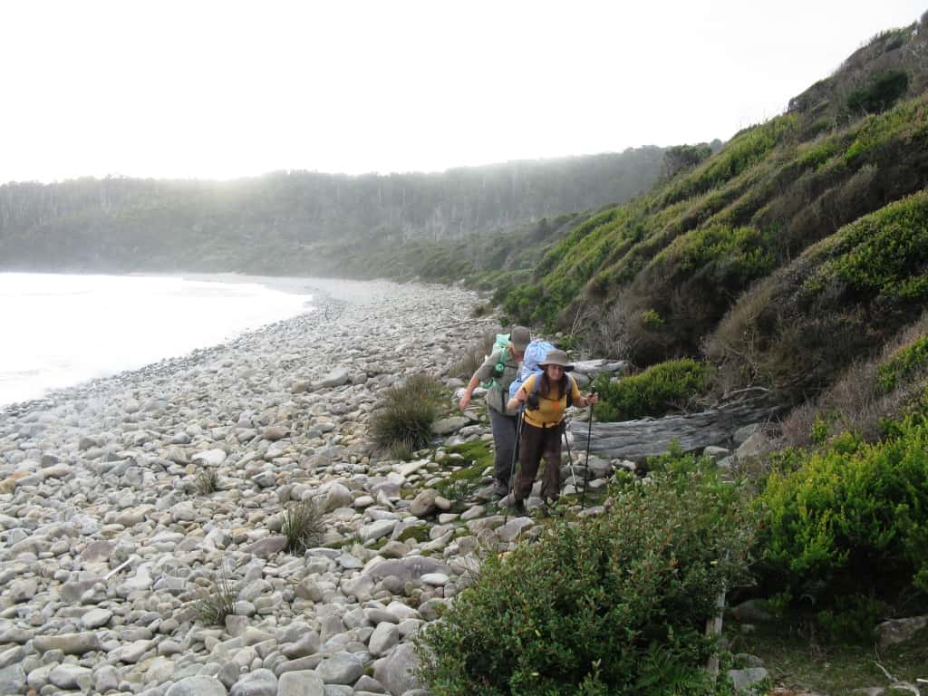
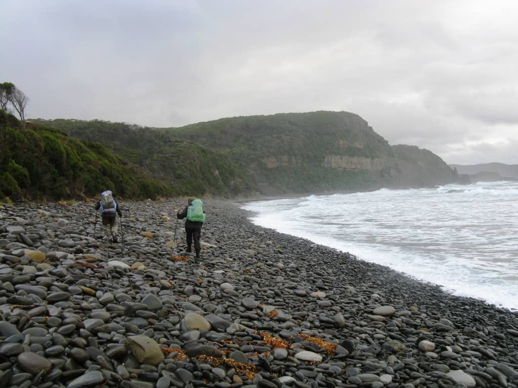
Surprise Bay had been billed as lovely, but the weather was grey and I was too tired to enjoy anything. Time to heat some real lunch would have been good, but we made do with muesli bars yet again. The final stretch along Granite Beach to the campsite was across huge boulders, so easy to balance on with full packs, cold, numb, wet feet and encroaching exhaustion.
As we neared the waterfall cliff that marked the campsite, we realised that the tide was rapidly coming in, and the small area of rocks at the base of the cliff was diminishing. Looking for the path upward, we realised that there wasn’t one: we just had to clamber up the cliff face using hand and toe holds where we could. At any other time, I would have baulked at this and said that I could not possibly achieve it. This evening, with the incoming tide pounding threateningly at my back, I shinnied up the cliff without a pause. Marvellous what fear and desperation can do!
Day 6 Granite Beach to South Cape Rivulet
Chapman says 5-7 hours for this day: yesterday we met two separate walkers coming in the opposite direction who said that they took 10 hours, and that the mud was hip- deep. A day to look forward to!
We rose at 5.45 am, in order to hit the track as early as possible, as, in addition to the reported mud, we had to climb up and over the South Cape Range – a mere 715 metres or so!
The day proved to be all it was cracked up to be: unbelievable mud stretches, hard, steep climbs, scrubby forest. We spent hours walking through tunnels in the sword grass or tunnels through the tee tree scrub – like rats in a maze.
At the top of the range, the first of 5 hail storms beset us, just as we were pausing for our cheerless jerky and nuts snack. To quote again from Browning’s Childe Roland to the Dark Tower Came…
All the day/Had been a dreary one at best/And dim was settling to its close…
…..when, at last, we came in sight of South Cape Rivulet camp. Chapman notes that at the rivulet, a ‘deep wade’ leads to the camp on the other side. He also says, as an aside, that at high tide or after heavy rain it is best to wait for water levels to drop….
We walked the length of the estuary, looking for a safe crossing point in the tanin-brown, opaque water, and found none. The river had a wild current coursing out to sea, with 2 metre high breakers pounding inwards at regular intervals. Nowhere looked shallow enough to cross. We retraced our steps into the forest, but there were no suitable camp sites to be found. We hailed the walkers at the camp, who informed us that they had crossed earlier when the tide was much lower. Should we wait out the tide, with nowhere to camp and the possibility of further rain in the night? It didn’t sound like much of an option, with the sky threatening and dwindling food supplies. It was grim… just like Childe Roland…
A sudden little river crossed my path
As unexpected as a serpent comes.
No sluggish tide congenial to the glooms –
This, as it frothed by, might have been a bath
For the fiend’s glowing hoof – to see the wrath
Of its black eddy bespate with flakes and plumes.
Steve, in his careful preparations, had added to his pack a coil of spectra cord, in case of dangerous river crossings. The lack of any trees on the far side of the estuary was a problem, but he tied one end of the cord metres behind us on the bank, and leaving his pack behind, waded across, waist-deep, between the assault of the waves. Timing was crucial, as it was necessary to wait for the incoming waves to flow and then ebb so that the water was not too deep, still leaving enough time to accomplish the crossing before the next crashing wave. He then anchored the rope while Kerri and I crossed, both losing our footings in the swift current and plunging holes, and here today only as a result of the rope.
Steve finally returned for the packs while Kerri and I anchored the rope, and last of all he reclaimed the precious rope. Without his forethought and strength, I would not have survived that crossing with my limited swimming skills.
All that remained was a shivering run to camp to remove our wet clothes before we were dangerously chilled, pitch the tents, get water, check our bedding for water infiltration (fortunately the dry-bags had held good), cook something hot, and warm up in our sleeping bags. Steve and I managed to get warm by donning padded coats and vests inside the sleeping bags. Kerri spent a colder and largely sleepless night. All of this was played out to a background symphony of wind : the raging roaring 40’s which had become gale-force.
Only half a day to go….
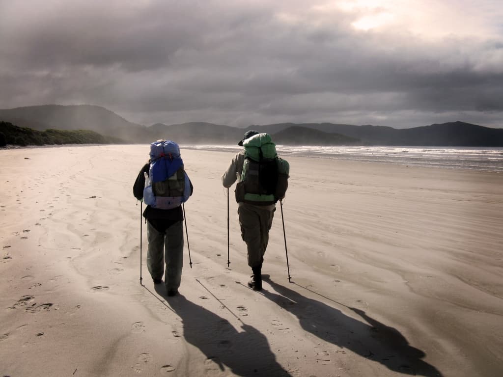
Day 7 South Cape Rivulet to Cockle Creek
“We gotta get outa this place
If it’s the last thing we ever do…”
Chapman says 3-4 hours. We hadn’t matched him before, so why should we today? We sustained our exhausted minds and bodies with images of a day in Hobart before flying home: warm motel rooms, hot showers, restaurants, shopping….we waxed lyrical over these lost delights, to make the hours pass quickly.
More long stretches of boulder beach staggering, more climbing: wild craggy cliffs towering over the Southern Ocean, with gale-force winds threatening to blow us over the edge.
More boring, buttongrass swamps: (Childe Roland again – sorry!)
So on I went. I think I never saw
Such starved ignoble nature; nothing throve….
…No! Penury, inertness, and grimace,
In some strange sort, were the land’s portion…
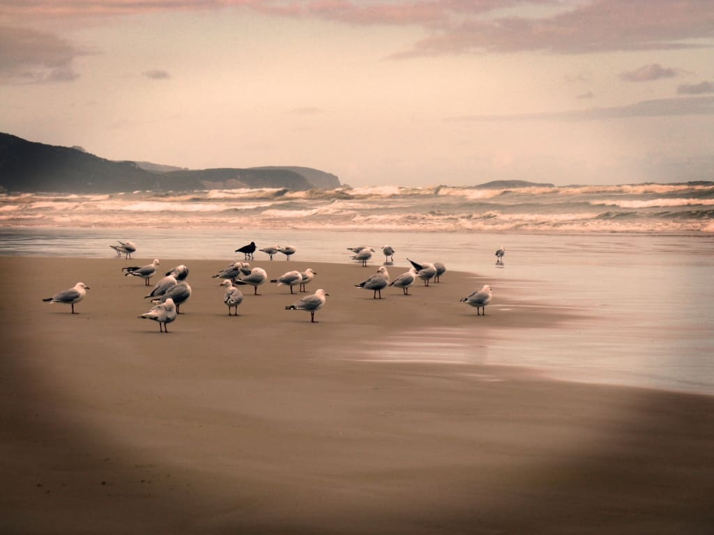
In fact, we heard a frog on this last buttongrass swamp crossing. In the entire walk, we had counted 2 frogs, 4 birds, one paddy melon wallaby, some seagulls, a dying penguin and a dying seal. Not exactly nature’s wonderland!
And now for my final quote from Childe Roland…:
As for the grass, it grew as scant as hair
In leprosy – thin dry blades pricked the mud
Which underneath looked kneaded up with blood.
Despite pushing ourselves to the limit, we took 4.5 hours for this last section. We would argue that it is impossible to do it in less.
We emerged exhausted, bitter, cold, footsore and in need of some creature comforts, which I am pleased to say, Hobart supplied amply. We will return to Hobart, in particular the excellent Mezzethes Greek Restaurant in Salamanca. We will not return to the South Coast Track’.
Published on: Mar 2, 2011
Lots more photos etc here: : South Coast Track Tasmania
PS: It simply does not compare to the South Coast Track Fiordland New Zealand
PS: Both Della and I wrote these accounts years before we started this blog so they are much shorter (and less rich in illustrations). We would approach it differently now, but ‘ the past is a foreign country from which no traveler returns’ – or words to that effect. However, we s=do not plan to return to this track though its namesake in NZ calls us yet, as does the Dusky. May 2024
See Also:
Tasmania’s Overland Track Last Day
A Taste of Tasmania’s Overland Track
South Coast Track – Hell’s Holiday
This is the most hilarious exchange! I look forward to walking the track next month. On the one hand, it sounds like the bloggers did have a particularly terrible time with the weather and trail conditions and want to blame the book. On the other hand, the book’s author comes on here and shit-talks the hikers. That’s just not cool at all. It’s fine to defend yourself but to come on here and drag people you’ve never met through the mud is just not cool. It’s allowed, but it’s pretty pathetic. They felt the book wasn’t clear enough (which is something I find with many hiking guidebooks) and it’s fine to want to defend your work and point out the sections where you feel you did clarify instructions but you really don’t have to come on here and attack people personally. Get a grip man! This doesn’t make me want to buy your guidebook!
Hi Sarah,
Thank you for your comments – and good luck with the trail. We hope the weather is kind to you. Actually we had quite good weather – others who nearly died had much worse. In fact also Della and I are almost certainly more experienced (and older) than the author of the guide. We are also more concerned to keep people safe. The track times are particularly unreliable. We also think mostly it is badly routed. We would change above half of it to improve the experience. We do recommend carrying a sat phone &/or messenger and making sure you know who to call and how to identify the Map reference where you may need assistance. We also think a long length of stout cord to help with getting across the swollen rivers was a good idea. A cutting tool to help create a few alternative camp sites is also advised (even if illegal). There just aren’t enough intermediate stops for when things aren’t working out just as you might hope. Note our post (Windy Old Weather) about tent anchors. It is the ‘Roaring Forties’. Though we have not completed my designs yet you might be interested in the post ‘Tent Stove Progress’. It can be cold down there. (This ‘solution’ will not burn the ground). Can we recommend The Upper Yarra Track (extended = https://www.theultralighthiker.com/2019/06/08/upper-yarra-track-instructions/) in Victoria as an alternative (and superior, more accessible) adventure? One advantage (of many) it has is that there are very few people (if any) on it (and it can be accessed both ends by public transport). It is now just the right time of year (November) to enjoy it. Our own track times’ always specify ‘retired person’ times though we remain pretty spry actually often still leaving much, much younger folk hobbling behind. We are just back (at a combined age of 144) from hiking in Nepal. It is far better to suggest that it may take longer than that it takes less time.
Cheers,
Steve & Della Jones.
Hi Steve, I’ve read this trip report and subsequent comments a few times now. I always have a bit of a giggle. You certainly got under John’s skin! Now, well over 10 years since your tumultuous hike, I wonder if your memory and opinion of it has mellowed a little. The South Coast track was my 1st Tassie hike in 2008 when I was 43. I was overweight, under experienced, I had too much in my pack, some of my gear was poor quality, I even got mild hyperthermia, but I still enjoyed it for the most part. I have been back to the south-west many times now and on many different walks. I remember reading John Chapmans notes and wondering “if this is easy what the hell is hard?” Sure, walking through the mud is demanding, crossing flooded rivers is dangerous, climbing steep hills tires you out and descending down those muddy. slippery tree root infested so called “tracks”, is hard on the body, but JC is not referring to the effort required so much, but more the difficulty in navigating and the ruggedness of the track. As I read your description of the climb up the cliff from the beach, I also remember being a little concerned when I was there, but when I look at the ascents I have done since then, that is child’s play. Seriously! These routes that John and others have written guides on, are not well maintained, they are not guided marked walking trails but more a rough description of the best way to get through. Things happen, mostly rain, water washes tracks away, big trees fall over the track, land slides completely remove the track. Sandhills move and cover the track. You need to be prepared for any obstacle that you may encounter. This is the wild west! I think you should have tried the Overland Track first. It has nicely maintained tracks with bridges, boardwalk, huts, toilets etc. I think you would have enjoyed that, even in poor weather.
Hi Robert, Firstly, this was my wife, Della’s post. We have walked much more difficult routes before – and since. We are off again in a week or so for yet another off-track walk in Vic’s Alps at 70+. We3 do not want to walk the Overland Track – or indeed any other tracks – too many people. Chapman’s ‘guide’ is deceptive and unprofessional. You really do need to warn people about hazards they are likely to face and suggest ways they might prepare for them. No doubt we encountered worse conditions than average, but others have encountered worse still. We have (lots of times) been in tougher conditions elsewhere (with at least decent scenery the South Coast lacks) and loved it. But we are very experienced and well-prepared which Chapman’s (clearly) intended audience are not. It is not irresponsible to warn people of the nature of the adventure they are about to undertake. The climb to Granite Beach at high tide is dangerous, should be warned about and should have been re-routed long ago. Probably the worst element of the track came after six days’ waking trying to cross the South Coast Riverlet in flood and at high tide. This is a seriously dangerous spot which could easily have been circumvented by the planners but it at least needs to be warned about. The absence of any possible spot to camp on the West bank is appalling neglect – and it is just as dreadful not to warn about it. People could easily suffer hypothermia there or be swept away – with no prospect of being able to turn back. Chapman richly deserves to be condemned for his misleading track notes. Mine and Della’s are much more honest. Also I strongly suspect we both have a lot more experience of wilderness travel than he has, or ever will have. Cheers, Steve & Della.
Peter You try to claim you are a wilderness walker, maybe you are in Victoria but walking in Victoria is very different and much easier than South West Tasmania. I live in Victoria and would argue that compared to Tasmania, there is very little true wilderness left in Victoria. The alps have roads everywhere, most of the forest has been logged and as a result is modified by man. Feral deer and horses are also creating many animal tracks which make walking through the un-tracked forest much easier than it would otherwise be. Sure, some walking is Victoria is as slow as 1km per hour but thats nothing when compared to 1km per 10 hour day scrub-bashing in some areas of the south-west. As for the reply claiming that being a runner, triathlete etc as being experienced and ideal preparation for the south-west has no bearing on being experienced in Tasmanian wildernes walking. The attraction of South West Tasmania is that it is true wilderness. With rainfall of up to 140 inches yer year, mud, flooded streams etc are all par for the course. As for the times being ridiculous, they are not, I have walked all sections at or better than the minimum times given although now that I am in my 60s my times are now around the longer end of the given range. I have looked at your images and website and while you claim to be an ‘experienced’ walker, you are certainly not experienced at rough tasmanian walking.
I never said the walk was Easy, I said ‘it is regarded as an easy walk for the South West’. No one takes any notice until they experience south west conditions. Also page 41 tells you how to interpret the times. The times are ‘for walkers experienced in the South West’ which you were clearly not. I warn that those with ‘minimal South West experience often find it takes much longer than the suggested times.’ All I can do is warn people to the reality but cannot make people read and take notice. I have stated this before, giving a time of say 3 to 10 hours to cater for everyone from the experienced to those with no south-west experience who often stop at every obstacle would not be very helpful. I decided to give times for south-west experienced walkers as thats the majority of people who use the guide. First trip you will generally be slower but with experience you work out how to quickly cross the mud, cross rivers without spending much time looking at it etc. It all comes down to experience and expectations.
As for no campsites at the west side of South Cape Rivulet, sure there is no constructed campsite but its trivial to put up a tent there, the tiny campsite is exactly that, tiny, its not ideally flat or perfectly cleared but we have had no problem using it. I did warn you not to cross at high tide. Not being able to make a rough camp at South Cape Rivulet and crossing at high tide then stating the crossing is ‘insane’ just shows how inexperienced you are with true wilderness walking. Some other river crossings in the south-west are much harder and very deep requiring a swim, experienced walkers regard South Cape Rivulet as being one of the easier large streams to cross as long as its not high tide.
As for sanitizing the South Coast with a constructed mud free track, cables and wires for river crossings etc. You might eventually get your wish with the government planning on building a series of huts but from experience many upgraded facilities will not last. As an example there was a suspension bridge over the Picton River, it got washed away in a flood and the replacement bridge was also washed away. Ropes or wires across rivers do not last and bridges get washed away. This is a true WILDERNESS area which experiences some wild weather. It is not for everyone, it does not suit track walkers, those who like to walk fast, camp anywhere, be dry all day or off track walking in drier forests. Simply put, your lack of tasmanian wilderness walking shows. Canoeing, four-wheel driving, fishing, hunting or walking through Victorian forests does not prepare you for south-west walking. The only thing that does prepare you is do a trip, many love the wilderness and return and put up with the mud and rain but many others like yourself who want to walk in more comfortable conditions find it is just too hard for them. Rather than examine their own experience and expectations, they try to run down the track and area, blame the guide book writer and criticize parks for the poor track conditions.
My advice, please do not attempt any of the harder walks in the South West (they are much harder) and I am glad to see you do not plan on returning to the South Coast Track. As many would say, its horses for courses, my final advice is, don’t let this experience turn anyone off, continue to enjoy the bush and if you want comfort, avoid the south-west and stick to easier and drier places to walk in.
BTW: You are commenting on my wife, Della’s post from ten years ago. And my name is not Peter. I have walked lots of harder things than the South Coast Track. Mostly I don’t walk tracks at all but just find my way through the bush. Lots of places I have had to swim & etc. Trying to suggest that I am not up to it is not the point. I am and I was. So was Della. For me it was relatively easy. That does not excuse you for having written a poor quality and misleading set of instructions – which are frankly full of gaps, dangerous in their inaccuracy and definitely not worth buying. You deserve to be castigated for it. It is a good thing that I have provided others with some feedback so that people can be a little better prepared if they want to walk this track or undertake other things I write about. Steve. PS: You are (still) not even telling the truth about what your ‘guide’ said ten years ago about the South Coast Rivulet crossing. I can still remember what it said though I long since threw the rubbishy thing out. You said just to wait for 15 minutes before you crossed. Nothing about being unable to cross at high tide. Nothing about the presence or absence of a tent site on the west side. There was nowhere at all one could put up a tent then though there may be now. I shudder to imagine a largish party eg of young women stuck there in freezing rain.
Very polarised discussion. Personally I find Chapmans notes accurate and helpful. Conditions change over time and a summer or autumn walk is way different to a cold and wet winter. I have experienced both including (like you) a cold swim of South Cape Rivulet in a walk with my daughter in September which included four cold fronts, raging seas and rain every day. All the pleasures of Tassie wilds to enjoy. The crossing point was a death trap in these conditions with the rivulet in full flood and the sea pushing in every five minutes or so and the level rising a metre plus before your eyes. Not waist deep but one step from shore was over my head. Counter to your assertion we camped with comfort on the west side, then with no change in conditions by morning bush bashed upstream away from the coast and swam using the current to help cross.
Your lack of appreciation of the beauty of the coastline, the temperate rain forests with life in every centimetre of space, ferns, fungi, mosses, lichens of every hue in a magnificent forest and yes the iconic button grass plains. Tough, yes for most of us. (I completed the walk with a fractured radius from the Ironbounds onward and enjoyed every second. Even the hardships.)
Perhaps Europe would be more to your liking.
Your comments (addressed to my wife, Della – if you understand) are confused and contradictory and often inaccurate – and anyway unwelcome. If you had spent any time at all on my blog you would have understood that we often go to places much more challenging than (the simply awful anyway) south or west coasts of Tasmania – much as you might admire it we do not. We would not go to Europe because we prefer wilderness places but we do much prefer ones which have rather more in beauty and conservation value than the dreadful South Coast Track which neither of us would recommend – though we recommend (again and again) much more challenging (and beautiful) routes such as the Dusky Track in Fiordland. Perhaps you should go there – or preferably just elsewhere than on our blog.
I’m sorry you guys had such a tough time of it. I did the track with a friend 5 years ago and we had a mix of drizzle and beautiful sunshine. With this more favourable weather we walked it in six days and mostly at the upper end of Chapman’s times. I wish we factored in a rest day to stop and enjoy one of the beaches. I’m keen to walk it again. Jim
Hi Jim, I’m sure it could be nice. There are bits of it I would like to see again, but Della not so much. The conditions we encountered were certainly not ideal but others have encountered much worse ones. It pays to be prepared for the worst. I took Della there because I thought the Dusky might be too hard for her. As it turned out she would have enjoyed the Dusky more. We have still not managed to do the latter together but if i can get a new knee we shall yet do so. Thanks for your feedback. Cheers, Steve.
Some people should never be allowed out of the house. Criticisms of Chapman’s trip notes are unfounded. They are excellent. His preamble notes are more than adequate.
If you think otherwise, the South Coast Track is not for you. It is moderately challenging and it justifies the description as one of the best multi-day walks in Tasmania. A hiker with reasonable fitness and experience will fit within the high end of Chapman’s times. Note: He points out in the preamble that rest stops must be added to the walk times.
I wonder about someone who quotes Browning, but can’t do better than ‘boring’ to describe a wilderness experience.
Frankly these cheap criticisms are without merit. Ignore them if you are contemplating the South Coast Track. Do your research, reading, etc, get fit and go and enjoy a wonderful experience.
It’s not for everyone, but there’s enough information out there to answer that question before you set off across the beautiful button grass plains between Melaleuca and Cox Bight.
I highly recommend the South Coast Track, mud, the Ironbounds and all.
Other people seem to agree with Della, Peter. Frankly I have more wilderness experience than most other people and Chapman’s notes were utterly misleading and dangerous. People would be well- advised to listen to people who have had bad experiences and prepare themselves accordingly. It would be very easy to walk for six days for example only to be swept away at the South Coast Riverlet – as we nearly were. People should know that. Cheers, Steve.
I simply cannot accept that Chapman’s notes are less than adequate. This is a wilderness walk, not a graded trail.
It is not for inexperienced walkers and having said that, there is an abundance of information available for anyone wishing to assess their potential to do the walk.
I re-read Chapman’s South Coast Track notes looking for errors or omissions. There are none. To quote from the note at South Cape Rivulet: “At high tide or after rain it is best to wait for water levels to drop.” Pretty clear advice I’d have thought. If it’s the attendant discomfort you are worried about, the South Coast Track is probably not for you.
For the benefit of anyone reading this blog I say again; Chapman’s notes are excellent and I thoroughly recommend the South Coast Track for a suitably prepared and experienced party.
There is nowhere to camp at the Rivulet. It would have been so easy to clear a campsite both sides and/or a path up the stream a couple of hundred yards where people could safely cross – perhaps on a walk-wire. The crossing point is quite insane. There are many other dangerous things. The climb up from the Granite beach for one. It is not clear at all that you are familiar with the walk. You may have noticed that others also disagreed with you – experienced hikers, ex-commandos & etc in the comments. Della and I are very seasoned wilderness hikers/hunters. Chapman (and you) are being foolish in the extreme to disregard the very real dangers which people have had the goodness to warn about. And BTW the walk is simply visually awful and horribly sited and mostly stupidly routed. Also we have so many better walks in Victoria and elsewhere. I think it could be improved if it was re-routed, with a few more campsites, some safety shelters here and there and some walk wires to name just a few things. When we did it after the really dangerous crossing at the Rivulet which I would not have been able to get the party across except I had brought along a very long rope, we came to a vast set of falling down wooden stairs (which had to be climbed to get to the top of he cliffs) with a sign on them, saying they were condemned, unsafe and should not be used. This was on the seventh day. There was one other very dangerous cliff-face (which people could easily be blown off) after that. There were very many other serious dangers to life and limb along the way – pretty much every day. A sane National Parks Service would have removed them long ago. A sane Chapman (or you) would warn about them. Della and I have been plenty of tougher places (and lots more scenic ones). We are not complaining about that. But it would be irresponsible not to warn people about what they might face. It would be also irresponsible not to warn people that the track is scenically dreadful. Endless days of bleak swamps and stunted trees…I opined that the whole thing should be given over to Rio to do their worst with as it wasn’t worth preserving. So there. You should come look at some of our true delights in Gippsland. I have recommended the Upper Yarra Track for people who like tracks – we do not. We almost always walk through the trackless wilderness sometimes for weeks at a time! Cheers, Steve. BTW I think this is about enough. This is not a chat site. I welcome helpful comments. Yours are not. 1500 posts yet there are people who want to get nit-picky about a word or two in one without a single word of appreciation!
We did it in our regular group of 5 in April a few years ago. We hit days of storms that the ranger later said was the worst in decades. Wind gusts of 140km/h when we were crossing Prion and offshore swells of 16m according to the Bureau of Meteorology. We nearly sunk the row boat. One of us nearly got washed into a huge shorebreak by a wave. Two of us were nearly killed by a log falling out of a tree. We had real problems crossing the creeks and “rivulets” and we came close to hypothermia on at least one occasion. I broke both of my walking poles. We are experienced walkers and count a trail runner, triathalete, distance runner and retired Australian Army Lieutenant Colonel among our number. We found it very tough. In (rare) good summer weather it would be a challenging walk. Don’t go into this part of the world unprepared. You are many kilometres from even a 4wd track and there are limited places for a helicopter to access.
Thanks for that – sounds like you had an even tougher time. it can be very dangerous. Cheers, Steve.
Yep. This sums up our experience also. Our flight in Melaleuca was cancelled due to weather (pouring rain) so we bussed into Cockle to start. Two cold fronts were forecast. We walked the first two days in squalls and sleet showers with sun breaks. So cruel. Change after change of attire. Most notable the daily kms and hours estimated were completely wrong. 9km on map was about double under foot with steep and relentless rain forest stretches. Mud, bogs and “holiday” vine (take a trip) slowed the progress, ensuring 10hour plus days on the trail to next suitable/available camp spot. Not fun. Hard hard work!! To contemplate up to 10 days under canvas, putting up, and down in the rain is not fun. We had snow at sea level day two in November. To add to our joy we had a lie saving helio extraction of one of our party due to a strep infection one day 3. Definitely no comms available so a PLB is absolutely essential. The terrain is a quantum magnitude harder than the Overland plateau. We warned.
Hi Peter, Sounds like you had a much worse time of it than we did. It was an interesting walk but poorly routed and with far too few intermediate camp sites. I favor just scratching out 1-2 tent sites wherever there is a suitable spot (ie with water) to spread the people out and so you can take your time. I suspect no-one is listening to me as they all want to be ‘iron men’. Cheers, Steve. If you carry a small saw such as this (http://www.theultralighthiker.com/2017/06/02/whoopie-slings-what-a-great-idea/) there are spots you could make your own camp site.