Victoria is on fire again – as I predicted in this post Mt Darling an Emerging Inferno (though it hasn’t actually got there yet). I suspect the hut will go before I ever get a chance to renovate it but it is still west of the fire and the fire is moving east, so who knows.Many of my beloved spots along the Wonnangatta Valley are burning (again) though. I can see I have lost two more of my camps (and caches) and may be down to one last one at the moment. Harry Gee’s hut at Black Snake Creek is threatened. The fire is just across the road this afternoon. Dargo is under extreme threat as is the Mitchell River National park – so much for our recent track marking there.
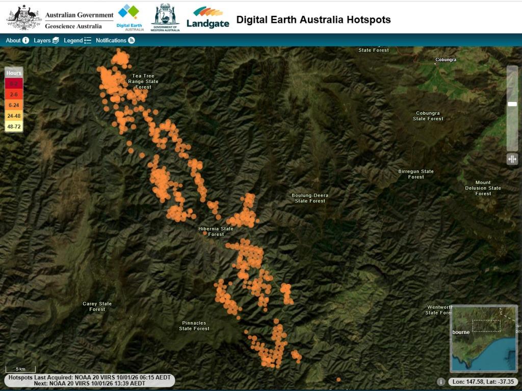
I think the best source of imagery I can see so far is this one: Digital Earth Australia Hotspots. Another useful site is Bushfire.io and of course the fairly hopeless Victorian Emergency Services site If anyone has better information I am keen to have it.
We are not threatened here at Jeeralang Junction yet but are very busy with bushfire prep ie making sure everything is well-watered and that all the fire pumps, generators etc are working smoothly. We had just come in from lunch from working on this all morning and are now going back outside to continue.
We are thoroughly sick of having this disaster scenario unfold again and again because of criminally wicked ‘management’ of our public lands and emergency responses manly inspired by the dim-witted Left and the thoroughly evil Greens.
The fire/s will burn until there is heavy rain or until they run out of things to burn ie weeks/months. However the GFS has heavy rain later on this week on the fire ground, so who knows? We may be lucky yet.
PS: Things an change very quickly. On the morning of 11th January things looked better: Good news for the Wonnangatta today https://hotspots.dea.ga.gov.au/ (I hope – though no-one can foretell the future) After 3-4 pretty awful days it seems to have cooled down overnight and Dargo can expect a good drenching Wednesday through to Friday which might actually put it out completely. Maybe we can get back to our summer canoeing up there after all? https://ozforecast.com.au/cgi-bin/weather.cgi?station=Dargo.VIC