New Zealand’s Dusky Track a wonderful challenging 8+day trek in Fiordland. My post from this day in 2014: ‘Expect a break from me: tomorrow I am off for ten days’ hiking in Fiordland. In the unlikely event that I capture a photo of a live moose, I will come back $100,000 richer as there is a prize offered. I HAVE seen one, and have seen much sign over the years: tracks, browse, fewmets…so I am in with a chance. Wish me luck. In any case, be assured I WILL enjoy myself in that vast wilderness.’ Read about it below. I will re-read them again myself It will be a welcome relief even if we can’t be there at the moment, perhaps ever again. Reposted from April 2017:
Regular readers will know I have just returned once more from hiking the Dusky Track, Fiordland New Zealand – probably NZ’s toughest and most beautiful. I have now been on the Dusky nine times. For most of its length it is more a route than a track. Take away the track markers and it would disappear completely. So many places too it goes where no sane route would take you: straight down a drop-off in the section from Lake Roe to Loch Marie, for example when any experienced off-trail person (a hunter perhaps) would follow the easier route down the Jane Burn.

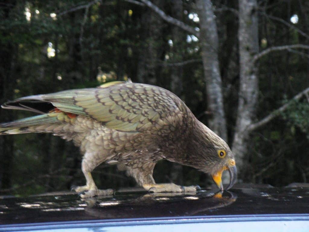
You need to beware of kea in the Lake Hauroko car park – and elsewhere. They will tear unatttended packs and tents to shreds.
Most sections take all day, so it pays to get started early (at dawn even – as you will need to do on the first day if you are to catch the bus and boat) as many places it would be extremely dangerous to be walking in poor light or at night. Also, being one of the wettest places in the world and with lethal changes of weather, it is essential you have some kind of shelter as you may easily find yourself caught out at night.
Rain strips heat from your body 25 times faster than dry air. See: http://www.theultralighthiker.com/the-importance-of-a-roof/ I chose a hammock and tarp as the often torrential rain may mean that it is impossible to find anywhere dry on the ground. At very least take a hiking umbrella: http://www.theultralighthiker.com/hiking-in-the-rain/
It might be even more desirable and less tiring especially if you are a solitary sort of person like me to slow your pace and plan to camp put some nights instead of staying in the huts (if the weather is pleasant). Most places, except when journeying across the tops, there are plenty of trees to swing a hammock – and if you are near a stream, there is the likelihood of fresh fish for supper – or breakfast!
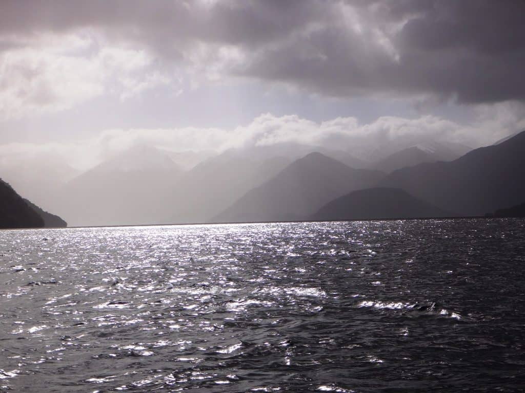
Dawn breaks through clouds over Lake Hauroko
I find the Backcountry Navigator App and the NZ Topo maps which are free, really useful for keeping track of just where you are: http://www.theultralighthiker.com/nz-topo-maps-app-for-hiking-in-nz/ You can switch the GPS on on your phone to check this from time to time, leaving it usually in the default GPS off and Flight mode to conserve batteries. This way you would not walk past the Halfway Hut, and might have a feed of fish as well.
The Halfway Hut may be the last hut in NZ which has the old-style open fire places which were so warming and efficient. The new ‘green’ stoves are absolutely hopeless. I am not convinced they put out any warmth at all for a large expense of effort and fuel. You certainly cannot cook anything on top of them, or even warm it. I never have a fire anyway, leaving whatever wood is nearby a hut for those who really need it in winter or inclement weather. It is no hardship if you are used to being outdoors all winter as I am, and have good wool/down clothing.
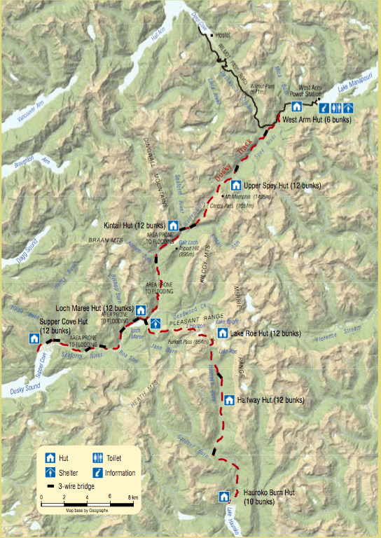
You should also download (to your phone) the map here: http://www.doc.govt.nz/parks-and-recreation/places-to-go/fiordland/places/fiordland-national-park/things-to-do/tracks/dusky-track/ and the brochure here: http://www.doc.govt.nz/Documents/parks-and-recreation/tracks-and-walks/southland/dusky-track-brochure.pdf so that you can study them beforehand and refer to them as you go along.
Especially in autumn there are often long periods of high pressure where you can walk for days without taking your raincoat out of your pack. I have found Elders 28 day Rainfall forecast for the bottom of Tasmania (http://www.eldersweather.com.au/raindates.jsp?dc=disableCookies<=wzdist&lc=t03) to be a pretty good indicator of the onset of such periods (allowing three days for them to cross the Tasman). By paying careful attention I have managed to visit Fiordland many times without getting wet. The GFS and NOAA’s Air Resources Laboratory also give a pretty good 16 day forecasts: http://ready.arl.noaa.gov/READYcmet.php
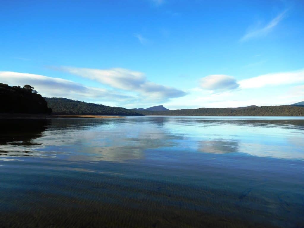
Finally a beautiful clear day as we chug North towards the Hauroko Hut and the beginning of the Dusky Track.
Most folk walk from South to North, ie from Lake Hauroko to Lake Manapouri. This is dictated by the availability of transport to begin/end the trek. Both ends are on a lake which has to be crossed, usually by boat. The regular Lake Hauroko boat drops off twice per week whilst there are several boats a day across Lake Manapouri. This means that if you wish to walk the track largely by yourself, you have only to wait at the Hauroko Hut for a day or two (fishing) whilst others get well ahead of you. I usually bring in some canned food to last these days, leaving them in the hut if I don’t need them where they are available to others who might be stranded there for a few days – but without causing a rodent problem. Of course you can charter a boat, plane or helicopter anytime.
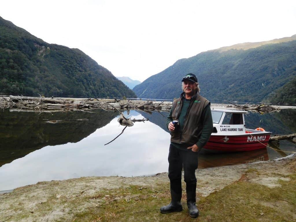 Johan & Namu tied up at the mouth of the Hauroko Burn
It is also possible to do shorter sections of the track by availing oneself of ‘back loads’ on helicopters or the ‘Wings and Water’ float plane (http://www.wingsandwater.co.nz/ ) which operates a ‘regular’ service to Supper Cove at the head of the Fiord. It can land in many other places in Fiordland too, such as Lake Hauroko in this example. Another brilliant spot it can take you is to Cromarty on Preservation Inlet from where if you are very intrepid you can walk back all the way to Tuatapere or Lake Hauroko. The float plane is cheaper per hour than a helicopter and can take five passengers, so the cost can be divided in such a way as to cost only $100-150 ea. perhaps less if there was a full load both ways. This flight from Te Anau to Supper Cove would have to rank as the most beautiful plane journey in the world! The various helicopter operators can also often provide discounted ‘back load’ type fares, so it is well worth asking them about availability: http://southernlakeshelicopters.co.nz/ & http://www.teanauhelicopters.com/ & http://www.fiordlandhelicopters.co.nz/ In any case you need to take their telephone numbers with you and a (hired) satellite phone so you can call them in if you ever need them.
As regards food you will be walking for eight days so you will need food for seven (ie 21 dehydrated meals in your pack). You will already have had breakfast on the first day. i usually grab a ready made roll from the Four Square store in te Anau (and an Ambrosia apple!) for lunch on the first day. Clearly you will not need dinner on the last day (as you will be back in Te Anau again), so your minimum food is about 7 x 500 grams or about 3.5kg. You will also need (to cook it about 500mls of methylated spirits (which I count in the weight of my food as it is also a consumable). You would add another half a kilo (3 meals to that) if you plan to stay at Supper Cove an extra night (you would be mad not to – but you will have fish, if you have a line! Some Alfoil is handy for the fish.) I usually throw in two extra days food (making ten days) in case I get stuck. I would also add a few extra mueli bars to that in case you get stuck and go on half rations. So you are looking at about 5.5 kg of consumables which diminish by .5 kg per day until by the time you are climbing the Centre Pass on your 7th or 8th day, your pack is like air, and you are flying!
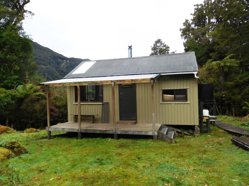
The Hauroko Hut, a comfortable hut a minute’s walk from the lake and the burn.
Boat transport to the Hauroko Hut is usually organised with Johan and Joyce at Lake Haoroko Tours https://www.wjet.co.nz/pages/lake-hauroko-tours/ (but I believe the other jet boat owner on the Wairaurahiri may now have a licence for the track now too) and bus transport to meet with them at the Clifden suspension bridge with Trips and Tramps https://tripsandtramps.com/product-detail/dusky-track-transport Johna & Joyce also operate a jet boat on the Wairaurahiri River (as does another operator) which has to be just about the best jet boat ride in the world (and a convenient way to begin or end the wonderful South Coast Track (see eg: http://www.theultralighthiker.com/south-coast-track-fiordland-nz-dellas-version/) You would probably leave your car at the long-term car-park at View St, Pearl Harbour, Manapouri, or you can catch a bus back to Te Anau from there.
The Track begins.
Track times are pretty fluid as with many NZ tracks. For reasonable fit people of my age (68) it is rare for a section to take less than six hours, and some will take more than 8. If you have a late start here, it might be better to wait until next morning so you won’t have to hurry. That way you could also do some trout fishing in the Burn which the track parallels for many hours. It is possible to walk along in the stream in many places, then rejoin the track – if the water levels are low. The sign on leaving the Lake reckons about 6 hours to the Halfway Hut, which I reckon is about right.
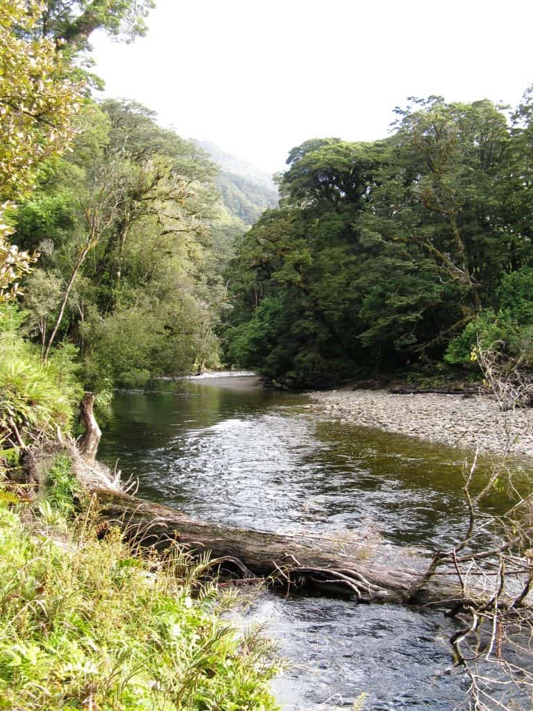
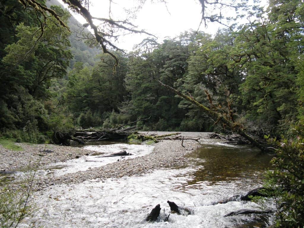
The Hauroko is a beautiful little trout stream.
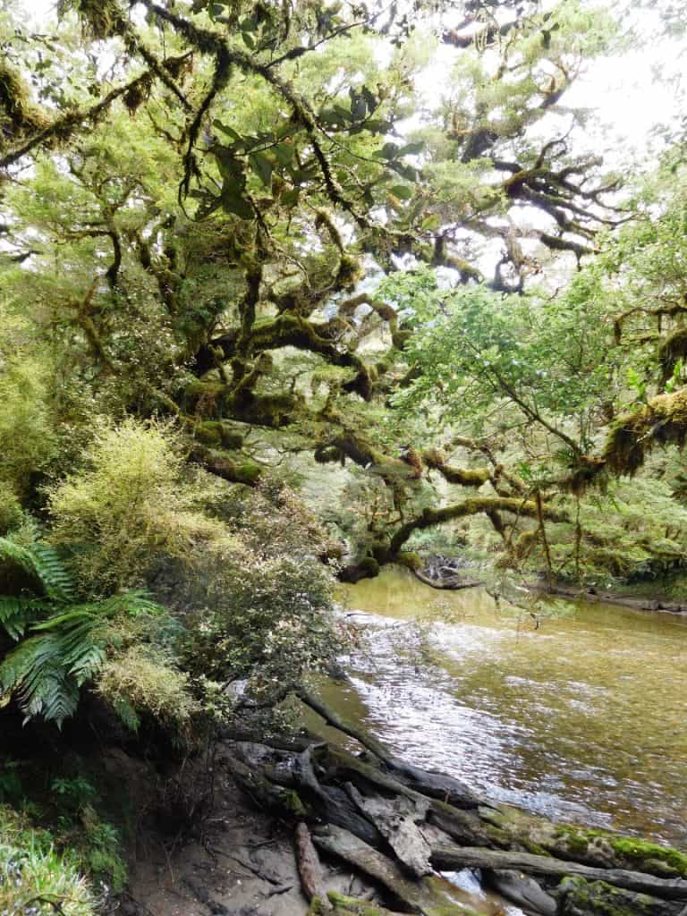
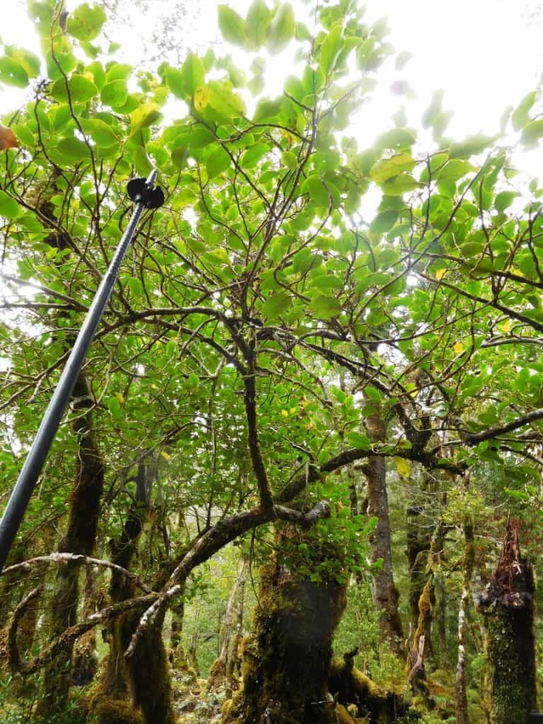
With more delights around every corner.
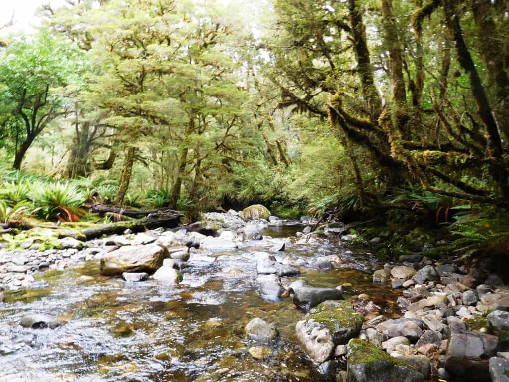
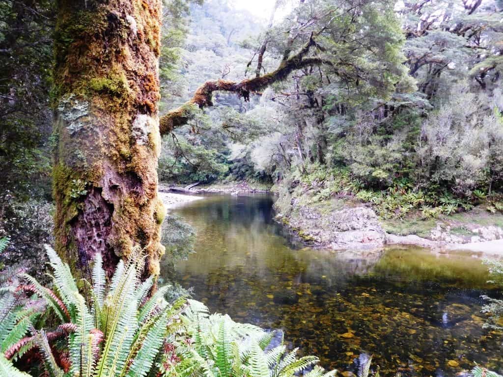
The first 3/4 of an hour after leaving the hut you are walking along on basically river flats quite by the true right bank of the Burn more or less until you come to a walk wire on a side burn. After that the track climbs and the tree hopping begins. Nonetheless it is fairly easy going until you arrive at the walk wire near the junction of the Gardner Burn. After that the track climbs around a gorge and the going gets pretty rough for an hour or so until you come out onto the flats along the Burn again (now the true left). You have nearly two hours walking along here until you come to the hut, set back a little from the stream so that you might not see it if you were walking in the stream fishing, for example.
The track begins to climb after you cross this pretty side burn.
There are some lovely views still down to the river.
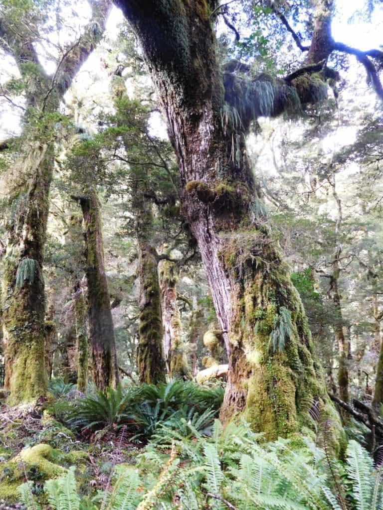
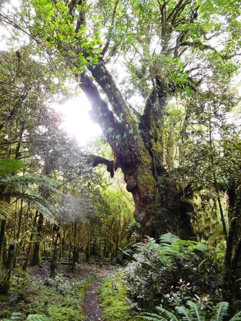
And it is not without beautiful ‘ents’.
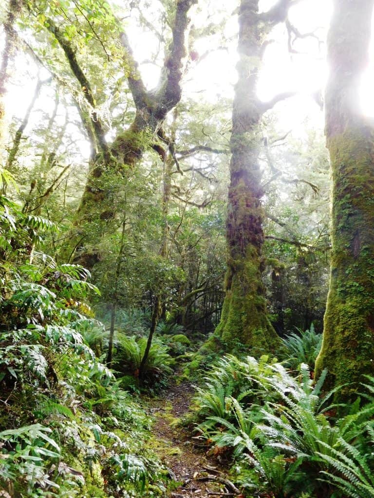
It is a magical path.
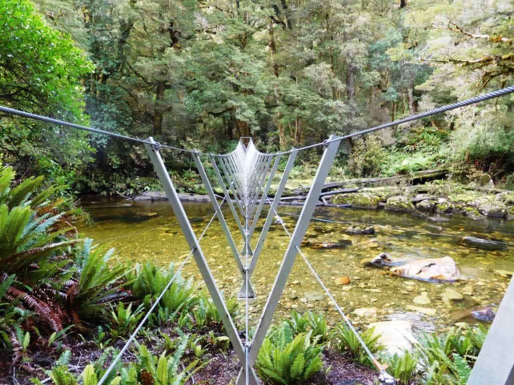
Then you come to the Gardner Burn confluence walk wire
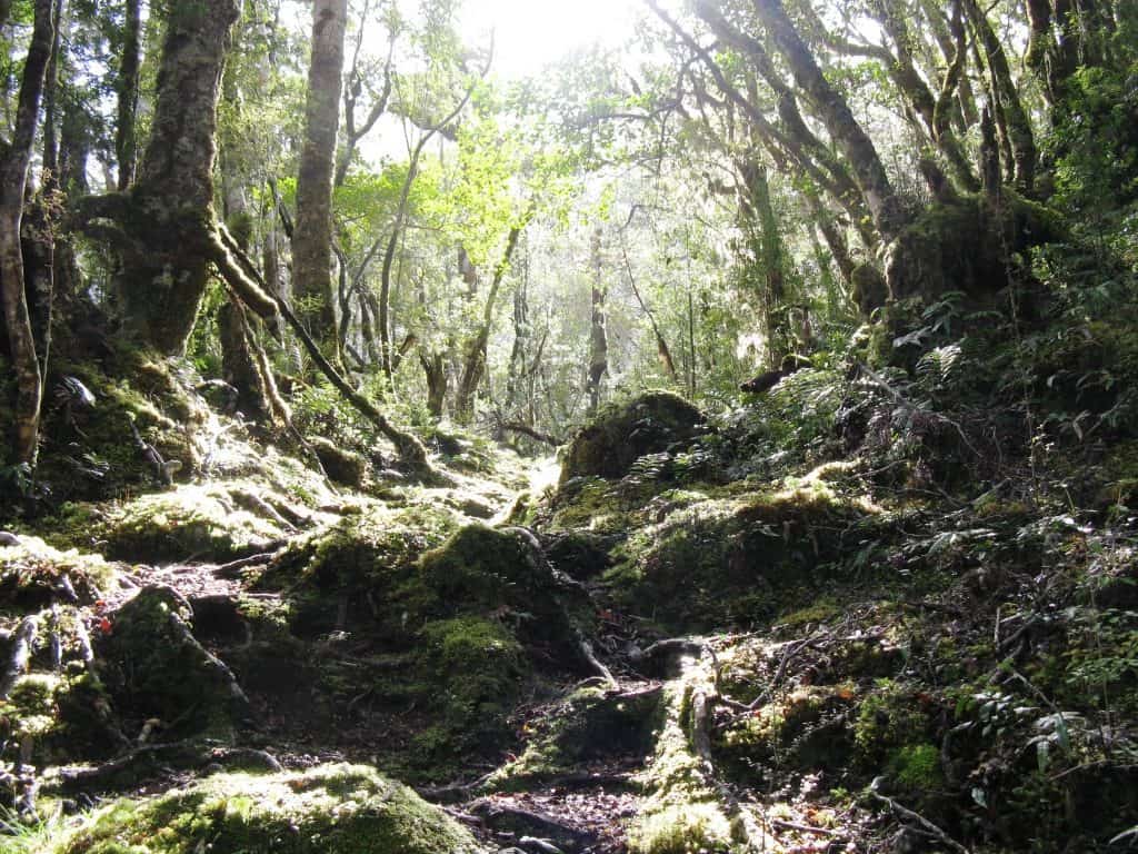
After the Gardner Burn there is a rough section.
Once you break out onto the flats again you could easily walk along in the stream fishing for your tea.
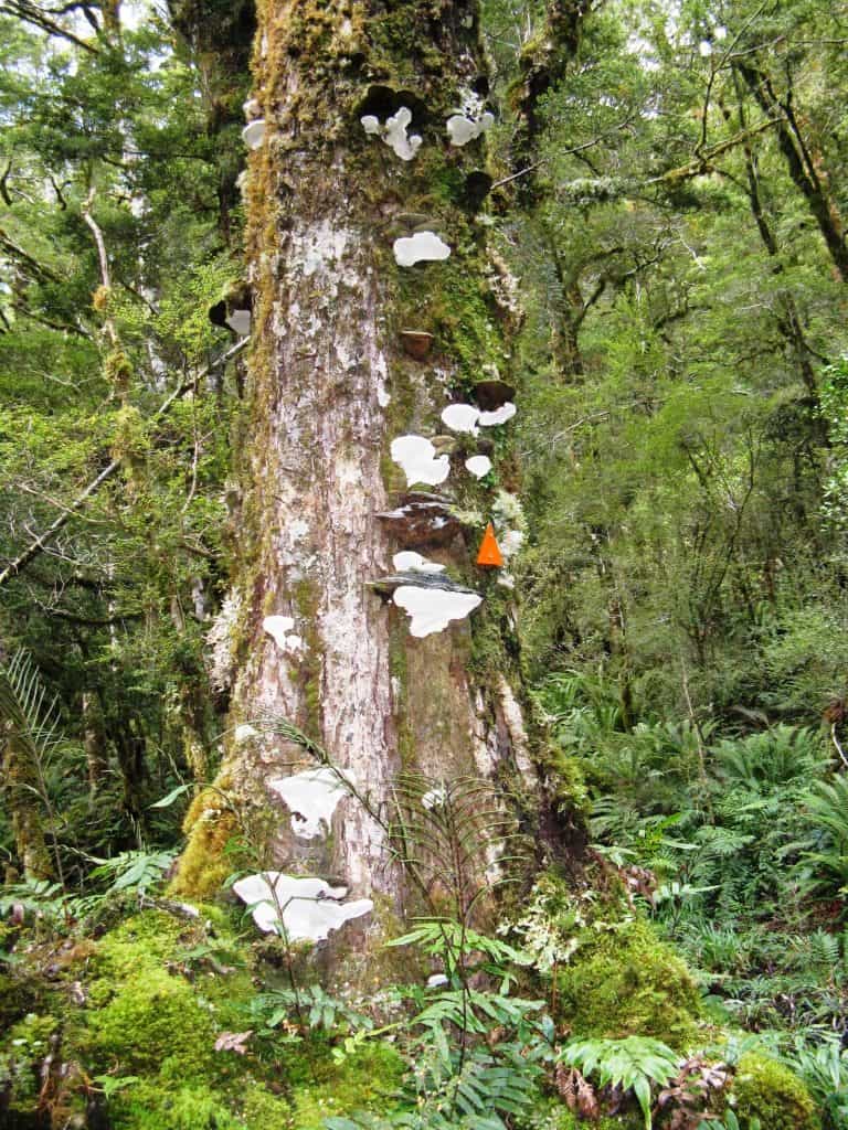
Bracket fungi make excellent fire starters when dry: some fine examples.
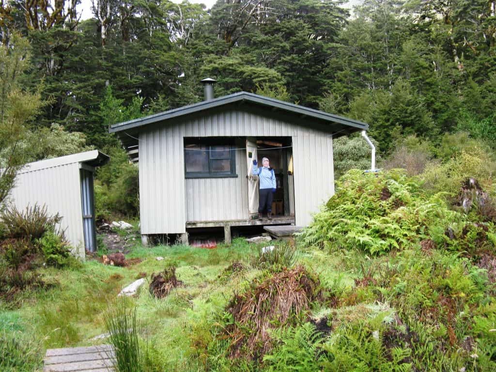
My daughter Irralee at the Halfway Hut 2009.
A note on getting lost: From time to time you will lose the track markers. probably about twice a day! There are many deer paths, and many wrong turnings others have taken to follow. As soon as you realise you have lost sight of the markers, Stop. Before ever thinking of panicking, have a cup of tea. My mother Marie always advised this, and it is damned good advice. Spending s a little time doing something else, then being warmed by a refreshing ‘cuppa’ does wonders to allay fears and settle your thinking. Consult your map. Try to work out where the track must be. Often the track follows one side of a stream or another. Try to remember when you were last on track, and how far back you think you went wrong. Try to remember the last little bit of your path. Mark your current position so you can find it again, eg by a small cairn, breaking branches, etc. Backtrack to where you think you went wrong, marking or at least noting your route as you go (so you don’t get even more lost). You shouldn’t ever be more than a hundred metres from where the last marker was unless you were really wool gathering and there was a very pronounced deer path (or etc) you have followed.
Sometimes it will be the way ahead that is unclear (even if you have the markers behind you.) Again, try to work out (from your map and the lay of the land) where the track must go. Make little forays forward and back to your marked position along obvious routes until you find the path ahead. If this does not work, try forays (back and forth) a little further off what you thought was the ‘line’ of the track until you find it. If you are starting to panic, have another cuppa! Unfortunately the ‘obvious routes’ are not always correct There are a couple of places (eg one below Loch Marie as the track skirts the huge slip which created the Loch) where the track switchbacks unexpectedly, and the markers are missing or hard to see, yet lots of folks have forged straight ahead making a very pronounced path where the real path is just about impossible to see. Remember that whoever fixed the markers ensured that you could always see one before or behind when they nailed them to the trees. I know many will have fallen off, but if you are ‘lost’ and careful, you should after less than 100 metres find one leading one way or another. You should by now have refound the track.
If you really find it impossible to follow the track in one direction, then follow it in the other. It is better to give up the idea of completing the track than to die! In the (very) unlikely event that you cannot find the track in either direction, go back to the map and try to work out where the track must be (eg it is roughly following the true right bank of a stream. If you follow the stream you will find it again (eg at a walk wire where it crosses). Be very careful walking off-track as the ground often has large holes which can open up beneath you. This whole area is an ancient moraine. You are much better carefully trying to find your own way out of a situation like this than immediately setting off an Epirb/Plb which might not work from the location you find yourself in – or the batteries might be flat! I carry both a satellite phone and a satellite messenger/Epirb hybrid (such as this: http://www.theultralighthiker.com/the-poor-mans-satellite-phone/). However both may fail, whilst you should always have your wits about you! You should in any case have let someone know your intentions and when/where to start looking for you. If you have a shelter and warm clothing, and do not stray even further from the general position of the track, you will be found alive, or you will find your own way out.
Perhaps the worst places to get lost are on the tops (which are often not as well marked as they might be). Frequently you cannot see the way ahead (especially in heavy rain, fog or cloud). You need to take extra care in those sections as it is colder, windier and harder to find shelter. Some folks decide they will walk all the way from Lake Hauroko to lake Roe Hut on the first day, for example. Once you break out onto the tops the route is marked by snow poles or such but they are often far apart and you sometimes cannot see the next one. Try to make sure you don’t get in a position where you can’t see the last one too! As the lake Roe hut is not on the direct line of the track (but off it to the right – walking in this direction) you would pass it by in the dark (which could be quite disastrous on a cold, wet night). Try not to have a fire at Lake Roe. There is very little wood thereabouts which should be conserved for real emergencies. I strongly advise people to take each section a day at a time. This is not a race. Haste will only mean you see less of the outstanding beauty of Fiordland. No-one will appreciate that you are some super hero able to run the whole track in one day as some kind of super-marathon. Such haste will also only make it more likely that some disaster will befall you: a fall, serious injury, becoming lost or hyperthermic in the dark, or etc. Plan to take at least seven days to finish this track, and allow for more like ten. It is likely to be nicer than you thought, or nastier – in either case more time will be required.
The Elusive Fiordland Moose: Along the way there is sporadic moose sign if you are alert and keen eyed. Nothing else could reach up 2.5-2.7 metres (8-9′), break off branches as thick as your thumb and strip them, or devour all the lower vegetation of their favourite broadleaf plants, or systematically bark trees, or leave footprints as big as a cow’s.These solitary leviathans yet roam these forests unseen.
This coprosma has been systematically broken off about 2.5 metres up.
And this.
Broadleafs have commonly been stripped to this height.
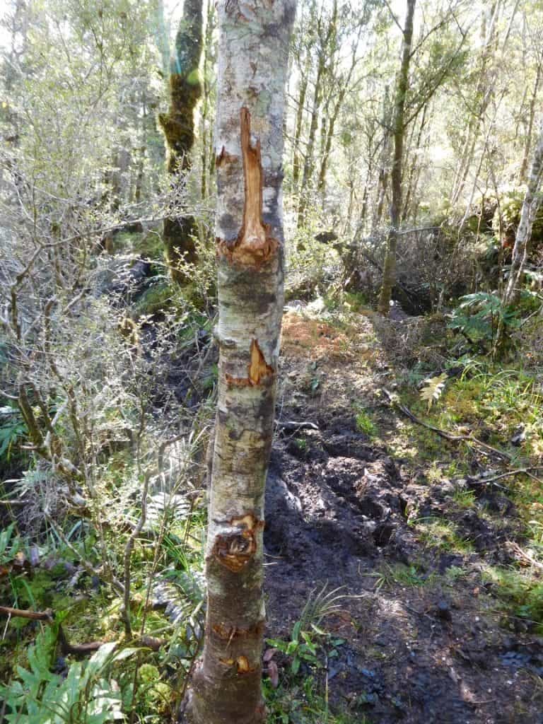
They like to snack on nutritious bark as they amble along.
Note: I have a confession (of stupidity) to make. Somewhere during this section between the two upper walkwires on the Hauroko (You can imagine it is in the photo above) I encountered quite a stong ‘animal’ smell not unlike a goat. I thought to myself at the time, ‘Well, it’s not a deer’. Then I thought, ‘Could it be a plant’. You know how Dogwood in Australasia is so named because it smells somewhat like wet dog. I thought to myself ‘I wonder whether the Leather Wood which you encounter just before the tops in NZ (and which is redolent with the musty odour of countless deer) is so called because it smells of leather?’ There is a sweet cloying honey-like smell you sometimes encounter in these Fiordland forests I have never been able to identify, nor has anyone else I have spoken to been able to pick it for me. (it is not the flower of the ubiquitous tiny epiphytic orchid). I scanned the forest about. Saw nothing. Thought to myself, ‘I do not want to arrive at Lake Roe in the dark’ (The hut is hard enough to find), and carried on. Since then, I have bothered to check what a moose smells like. You guessed it. Just like what I was smelling on the Hauroko that day. There was a moose not 200 metres upwind from me, and I walked on. Despite having a tarp and hammock and weeks of food, so that I could have spent days hunting it! And I would have doubtless ‘put it up’ withing ten minutes! Despite the fact that one of the important reasons I go there is to see a moose. Despite the fact that I had photographed fresh moose barking just back there a little (See: http://www.theultralighthiker.com/from-dawn-to-dusky/). Despite the fact there is a $100,000 reward for a photo of a NZ moose, I walked on! : Lesson: Trust your nose!
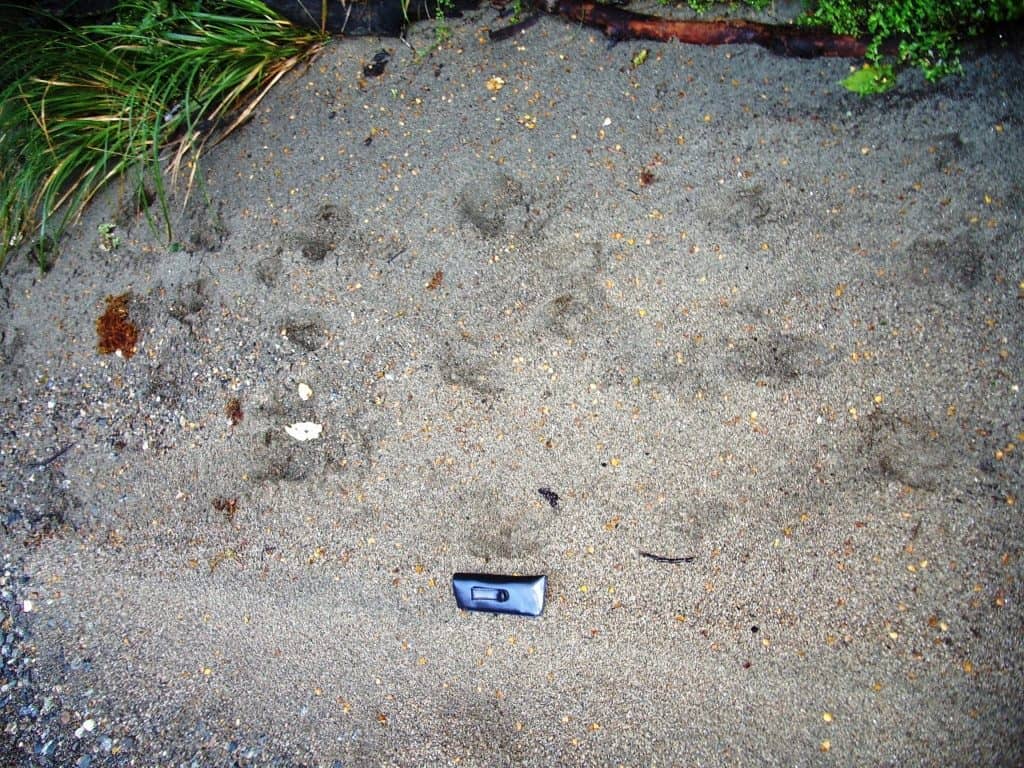
Leaving footprints as long as my glasses case. Like this:
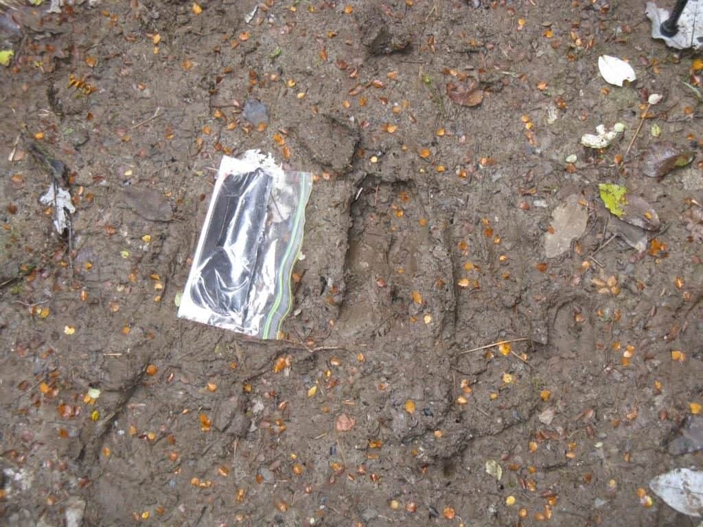
Or this.
Someday someone will stumble round a corner onto one and snap its pic. Already two confirmed C21st DNA samples have been collected, and one indistinct photo. It is only a matter of time…
You are now one seventh of the way – More installments to come…
See also:
The Lure of the Moose – my NZ moose hunting adventures
http://www.theultralighthiker.com/from-dawn-to-dusky/
http://www.theultralighthiker.com/from-dawn-to-dusky-day-2/
http://www.theultralighthiker.com/from-dawn-to-dusky-3/
http://www.theultralighthiker.com/from-dawn-to-dusky-4/
http://www.theultralighthiker.com/from-dawn-to-dusky-5/
http://www.theultralighthiker.com/from-dawn-to-dusky-7/
http://www.theultralighthiker.com/from-dawn-to-dusky-8/
https://www.theultralighthiker.com/2020/03/04/new-evidence-of-fiordland-moose/
http://www.theultralighthiker.com/insects-can-ruin-a-camping-trip/
http://www.theultralighthiker.com/dusky-track-canoeing-the-seaforth/
http://www.theultralighthiker.com/dusky-track-adventures-1/
http://www.theultralighthiker.com/eddie-herrick-moose-hunting-at-dusky-sound/
http://www.theultralighthiker.com/eddie-herrick-moose-hunting-at-dusky-sound/
http://www.theultralighthiker.com/a-friend-i-met-on-the-dusky-track-fiordland-nz/
http://www.theultralighthiker.com/dusky-south-coast-tracks/
http://www.theultralighthiker.com/dreaming-of-the-dusky-track/
http://www.theultralighthiker.com/the-dusky/
http://www.theultralighthiker.com/moose-hunting/
http://www.theultralighthiker.com/fiordland-moose/
http://www.theultralighthiker.com/fiordland-moose-2/
http://www.theultralighthiker.com/hunting-in-fiordland/
http://www.theultralighthiker.com/off-to-fiordland/
http://www.theultralighthiker.com/shadowland-fiordland-video/
http://www.theultralighthiker.com/the-best-toilet-view-in-the-world/
http://www.theultralighthiker.com/10-days-in-fiordland/
http://www.theultralighthiker.com/fiordland-2009/
http://www.theultralighthiker.com/fiordland-nz-with-bryn/
http://www.theultralighthiker.com/fiordland-april-2007/
http://www.theultralighthiker.com/weather-for-fiordland/
http://www.theultralighthiker.com/more-dusky-adventures/
Just discovered your website while looking for ideas on how to add more down to a sleeping bag.I also did the Dusky track few years ago.It was pouring rain the day we were dropped at the Hauroko hut. I will never forget the sandflies and having wet feet most of the hike XD
It is a wet place Melo but I have been there many times and have even been there for periods of ten days in a row without taking my raincoat out of my pack. Yes wet feet. Sandflies vary. There are solutions to all these ‘problems’ though. The beauty of the area negates all the negatives however. Cheers, Steve.
Love your stuff! Keep it up.
Thanks Muzza.