
I have canoed this wonderful river so many times over more than thirty years, from the Thomson Dam to Cowwarr Weir. Much of the water in the section from the dam to the Walhalla Rd Bridge was stolen by Melbourne Water nearly twenty years ago, so it is rare nowadays to be able to canoe it – and if you find enough water you will likely find it rather choked with logs.
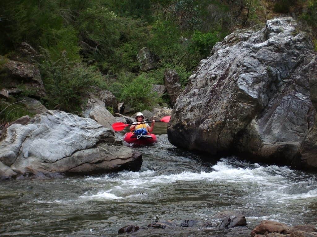
Mini Gorge: Della Jones. See also: http://www.theultralighthiker.com/videos/thomson-river-canoe-trip/
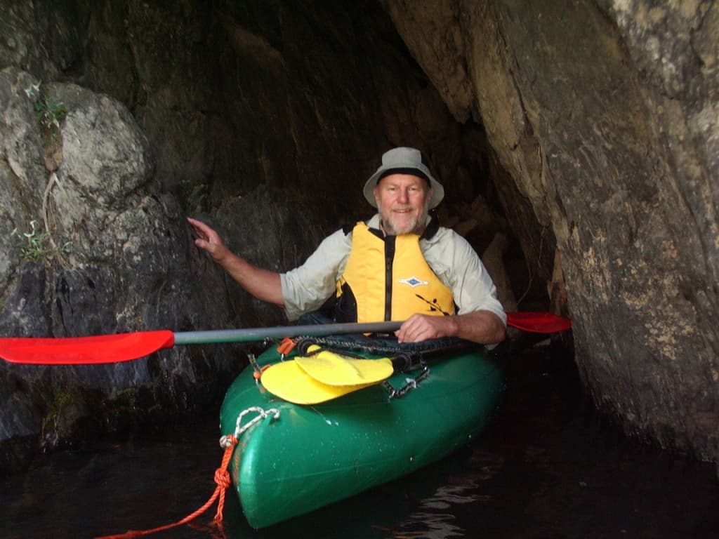
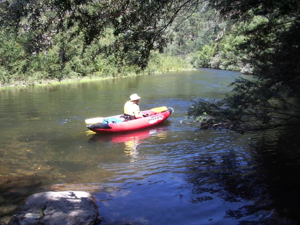
You can put in at the Narrows Gauge if you just want a short trip on a hot day; this also avoids the chute and 3 metre waterfall immediately below the Low Saddle Track which many find somewhat intimidating. I have seen others come to grief there. One would certainly have died had I not been there. And I dropped and spilled my beer when rescuing him. Damn it! I doubt his life was worth one cold beer. Is anyone’s? It is about five hours from the dam, about two from the Narrows Gauge. Best height for this section is above .5 metres at the Narrows Gauge. From the Walhalla Rd Bridge to Coopers Creek the river diverts through a tunnel meaning most folks avoid this section It can be portaged. There is a track on the true right bank but it is probably over a kilometre, however it is flat going and easy with a packraft. The tunnel is hard to spot on the true left bank opposite a sandy beach. In no circumstances get side on near it. if you were sucked in you would die! See pictures: http://www.theultralighthiker.com/upper-yarra-track-sidetrip-horseshoe-tunnelcoopers-creek/
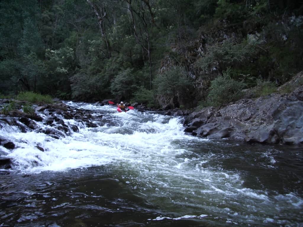
Fun below the Gorge, Bryn Jones
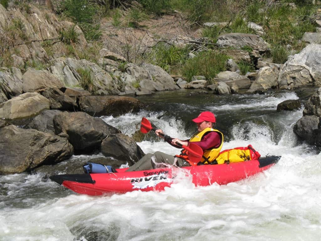
The best section today is a two day trip from Bruntons Bridge to Cowwarr Weir. You can convert this into a very leisurely three day trip in hot weather by putting in at Coopers Creek, which adds about three hours to the trip. When the water level is high, ie .3-.5 metres as measured at the Coopers Creek Gauge – See: http://www.bom.gov.au/cgi-bin/wrap_fwo.pl?IDV60154.html) it can be canoed in a very hectic single day if you start very early. Typical water levels are more likely .2-.25 metres at Coopers Creek which makes it almost impossible to complete the trip in a single day. Most canoe books recommend a minimum height of .3 metres, but if you waited for that you would likely never canoe the river in the warmer months. I have come down it at a gauge height of .18 metres which required me to drag my boat across about a dozen pebble races, but still a lovely trip and great fun. The river can be quite dangerous over .5 metres. I know intrepid paddlers who would wait until it was .8 or even 1 metre, but it would not be me – or you either, if you want to live through it!
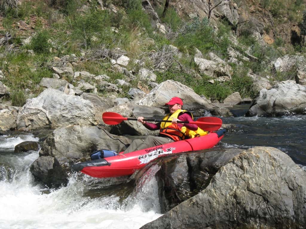
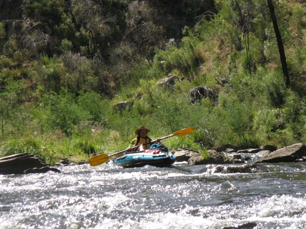
Lovely water: Bryn Jones
The best thing about the two canoeable sections above Bruntons Bridge (for me) was that I could canoe them alone just using a mountain bike to get back to my canoe at the beginning of the trip – and I often did, back in the 80s and early 90s. Beautiful bike rides and a few hours of great canoeing. The section below Bruntons really needs a motorbike as well as a car (if you are going to canoe it alone) as it is quite a long ride from Cowwarr to Bruntons.
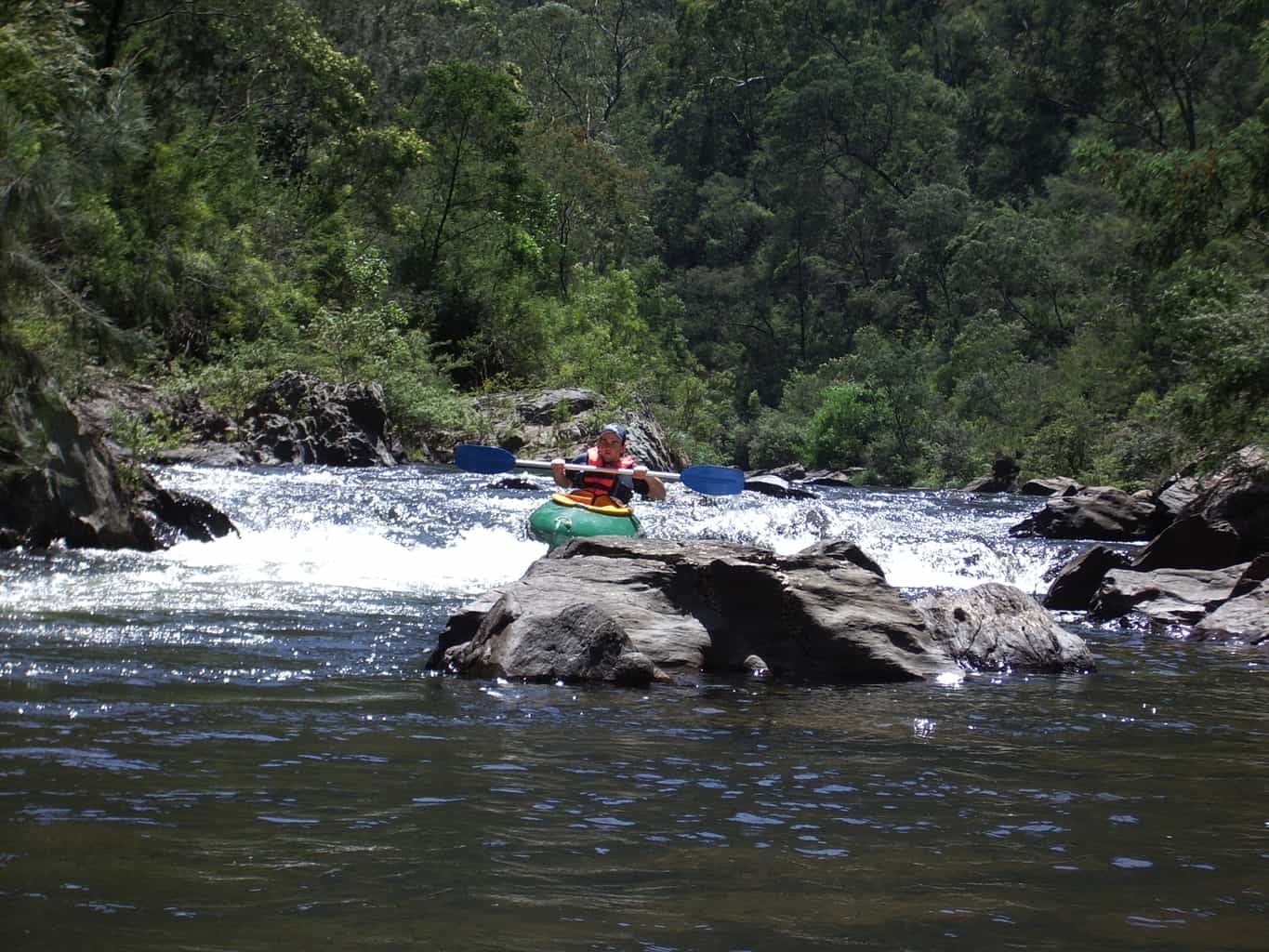
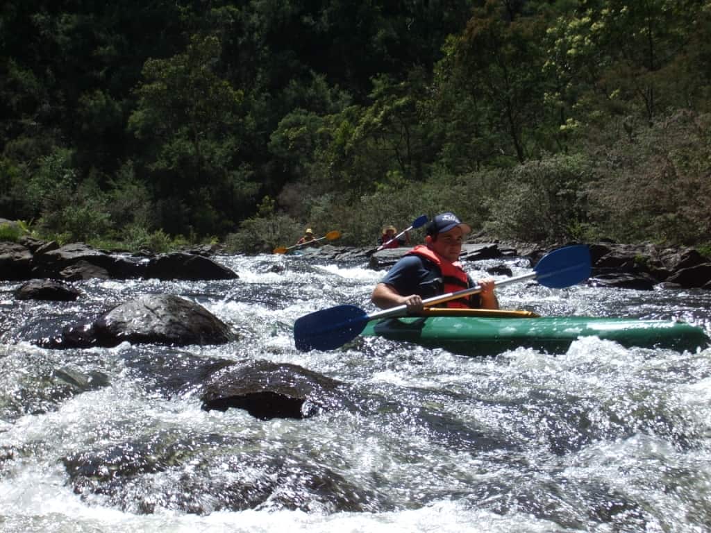
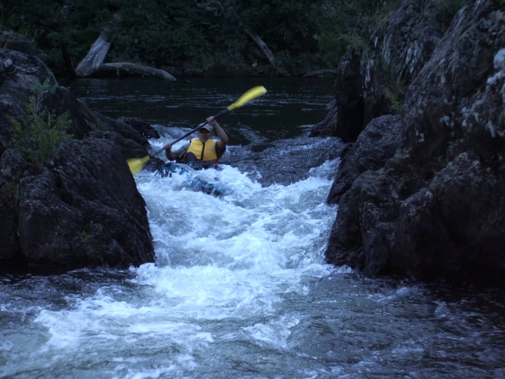
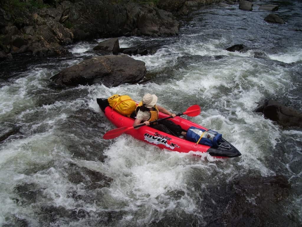
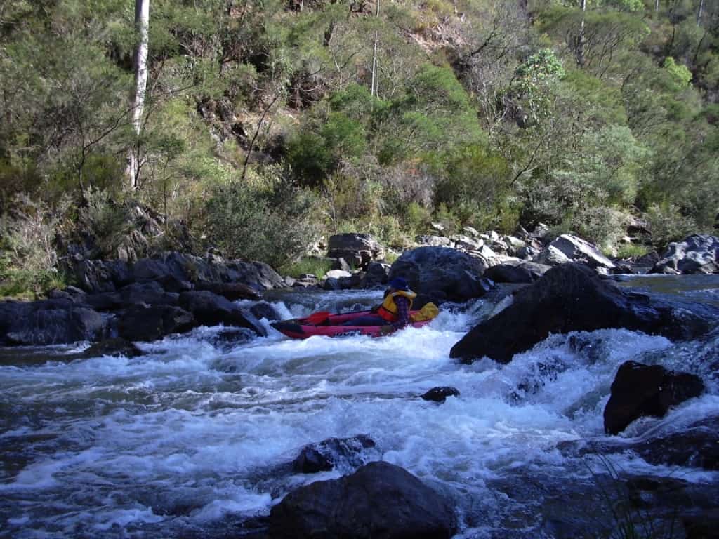
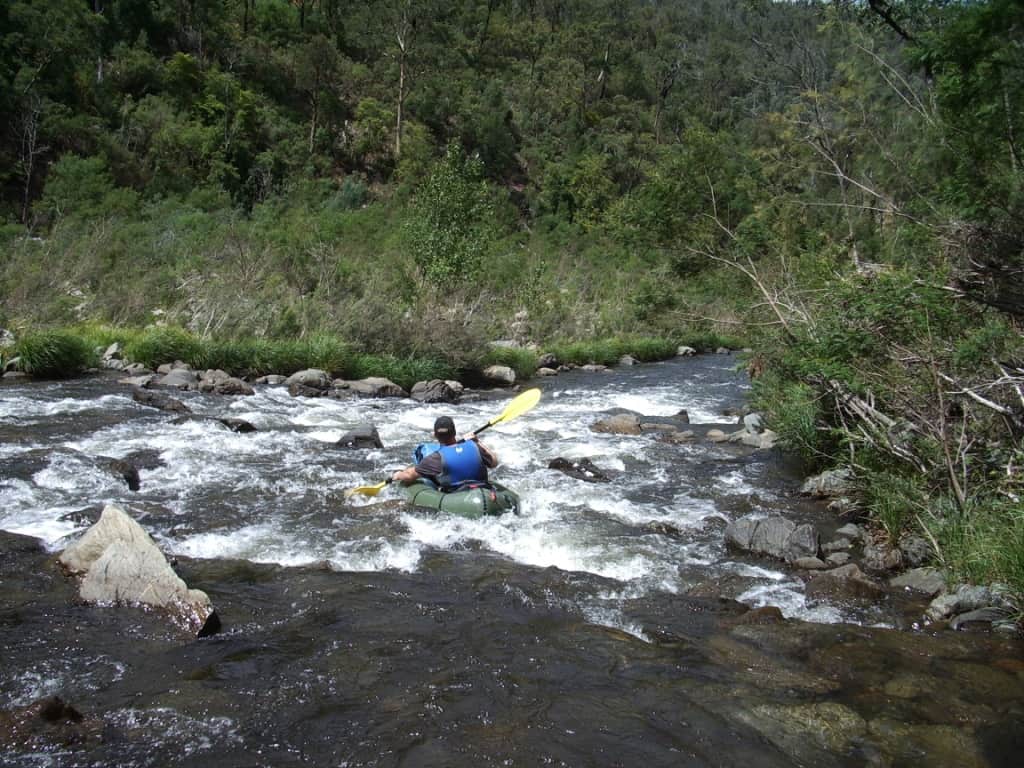
Lots of Grade 2 rapids
Above Bruntons Bridge the river is darker, shadier – and there are many more leeches! Below Bruntons it opens out a lot. It is warmer and sunnier with plenty of opportunities for swimming. In warm weather you can spend many lazy days slowly descending the river which otherwise takes about two 6-7 hour days. You can troll a lure many places and catch a feed of fresh trout for tea every night which taste delicious roasted in some Alfoil in the hot coals with some potatoes. Don’t forget some butter, salt and lemon. Trolling works much better at about .3 metres height as you will snag a lot when it is shallower, but lures are cheap – and can be made from ring-pulls & etc. Otherwise you can bait or fly fish when you camp – or go for a swim with a hand spear. There are seldom many policemen about! There are however many large freshwater crays!
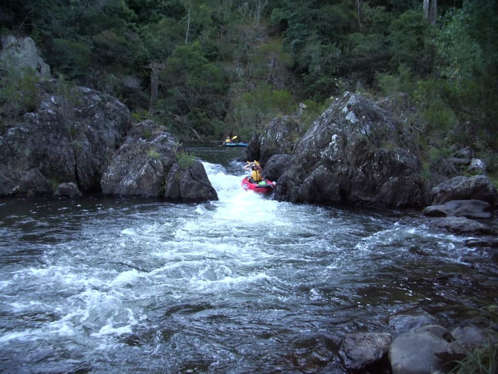
Marble Quarry Chute
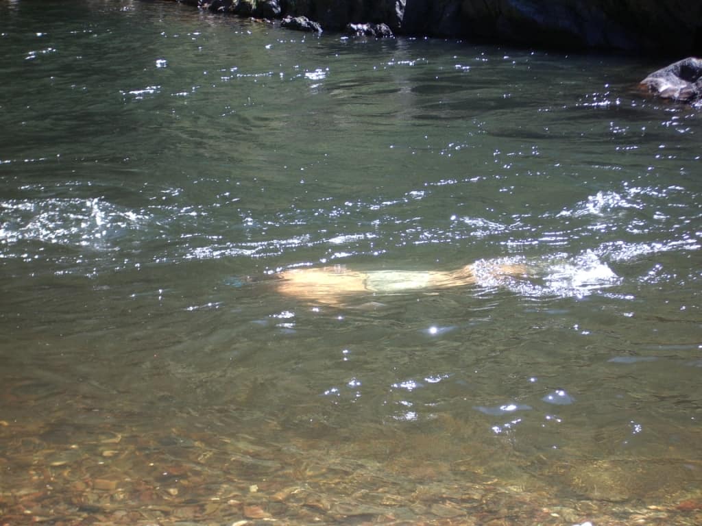
Bryn Jones Swimming
There are many spots along the way you can camp, particularly below the Gorge. Be warned, however: there is about a week in summer when they let out a heap of water from the dam as an ‘environmental flow’. This can put the height up overnight eg from .25 metres to .5 metres, so be sure your camp is a bit higher than this and that your canoes are dragged up well clear of the water – otherwise you may be in for a nasty shock. I have asked those in authority (the MMBW) to post this as a warning on the BOM River Heights Page, but as is usual with public servants, no-one is responsible, or willing to do any work! However the river is now under the control of the West Gippsland Catchment Management Authority and they do post these releases on their site, here: http://www.wgcma.vic.gov.au/our-region/waterways/environmental-water
Pretty much the only spot you cannot camp is at the ‘designated camp spot just below the end of the T9 track which became overgrown twenty years ago! There is a small spot just upstream of there on he right bank. There is another spot just before the Gorge on the left bank. You cannot camp in the Gorge. You can walk out up the T9 track from the first camp I mentioned: there is a large poplar tree on the right bank with the number 20 painted on it at the ‘designated camp site’. (It is only 100 metes to the T9 track) and a much easier walk than the ‘designated escape route’ up onto the Marble Quarry Track, a very steep climb of about a km.
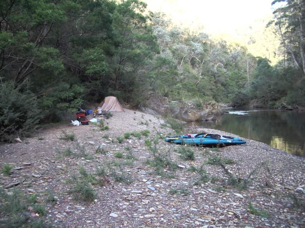
Camp at T9 Track
You can put in for a day trip too at the end of the T9 track, now officially closed – but who cares? Years ago I had a walking track extending upstream and down from its end but it is no doubt overgrown somewhat now. Feel free to clear it again though. You need a (good) 4WD for the last approx 1 km on the T9 and there is very limited room to perform a six-point turn. Be warned. It is a good place to put in for a day’s pack rafting though, as you can easily walk down. Another good spot to put in for a day trip (before the fire) used to be off the end of the Mitchell Creek C34.4 Track where a walking track to a campsite by the river used to exist, a spot I have always called ‘The Poplars’ as will be obvious to you when you get there. It would be nice to restore this too! You can also enjoy a day’s packrafting by accessing the river from the T6 track off the Stony Creek Rd.
I have done this day trip recently: Thomson Autumn Packraft
Bryn Jones
From Bruntons to Marble Quarry Track there are many entertaining Grade 2 rapids which may be somewhat more difficult to negotiate at lower water levels. After Marble Quarry there is a minor gorge section which is very pretty. The first chute rapid after Marble Quarry has a boulder in it near the bottom which can tip you over to your right. Beware of doing so and hitting your head. I usually stop for a cold drink at the base of the ridge off the Marble Quarry Track where there used to be an excellent camp site constructed by some miners who used to drive down the ridge from the B3.1 track. Feel free to clear that track too.
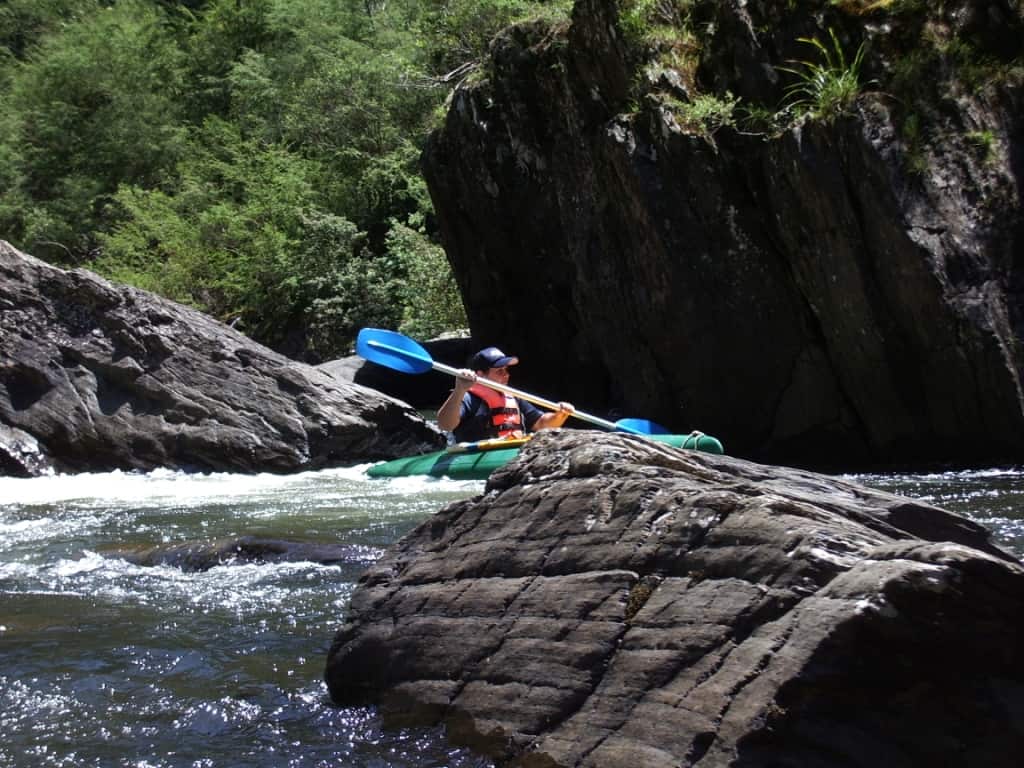
Gorge: Steve Cleaver
It is quite pleasant to walk up some of the beautiful creeks which enter the Thomson in this section, particularly Lammers and Deep Creek. Both can hold excellent blackfish in deep pools. You can walk all the way up Deep Creek, climb the ridge where it splits in two (you will find an old track there) and exit at Binns Junction. It is an excellent day or overnight walk. Very private now too since our ‘masters’ have closed all the access tracks to Deep Creek (T10, D1 & 2 etc). If you are quiet you are likely to see a deer or two. There are some pleasant little flats to camp on bends in the stream. It is an astonishingly beautiful valley! You can walk down the (closed) T10 track from the Stony Creek Rd to gain vehicular access – or feel free to bring the chainsaw and open it again! It is on the West side of the Stony Creek Rd opposite the only fire dam.
Mini Gorge: Brett Irving
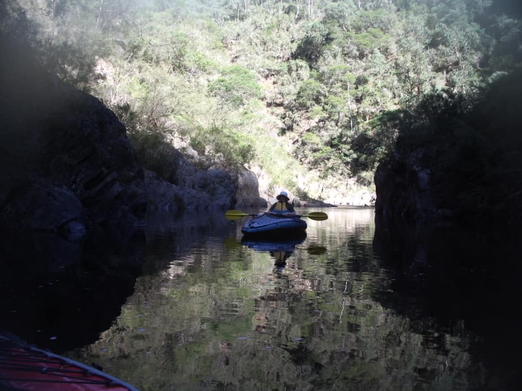
The Gorge is the section which most daunts Della now she has lost so much of her eyesight, and I don’t wonder. If I had less than 50% sight it would daunt me too. It is such a shame though that she can no longer canoe the Thomson because of this, as it is an astonishingly beautiful (and varied) river. It takes about an hour to get through the Gorge which begins about a quarter hour below the 20 km Tree. There is not much stopping; it can be difficult to find a spot to empty your boat if it becomes swamped particularly above .3, or .5 metres. Last time I was down the river there was a quite dangerous log jam towards the end – which would be a very dangerous trap for unwary players. Watch out for it. You could stop just before it (on the right) and walk around. There are some wonderful camps starting below the Gorge. You don’t need to stop at the very first one (on the left) which is very nice as there are lots more!
Gorge: Steve Jones
Gorge: Alan Hall.
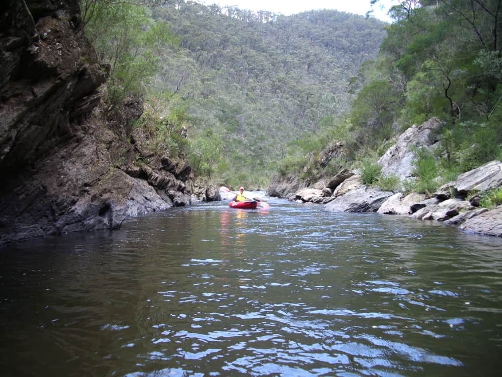
Below the Gorge (and elsewhere) there are delightful flat, placid sections where you can just about go to sleep in the boat.

Della loves these clear, quiet sections.
Della Jones: asleep?
Della Jones
About a half hour below ‘The Poplars’ you come to ‘The Triple Stager’. It is certainly a Grade Three rapid! You should not be asleep then; I once was – a very dangerous descent of the left hand channel (Don’t!) suddenly sans canoe! Fortunately I was wearing a life jacket else I would not be here to tell the tale! It is on a left hand bend. The river forks. Take the right fork. There are three distinct drops. It may be a good idea to get out on the right bank before the first and reconnoiter. You can carry your boat all the way to the bottom of the third drop (about 100 metres of rock hopping) if you so desire. Or, you can carefully descend each in turn keeping to the right, choosing to portage the third if your courage or foolhardiness is not up to it! The first two are best approached on the right side of the river, and you can finish each in a small still pool. To shoot the third you need to start on the left side of the river, then cross to the right as you enter it. There is a large boulder just left of centre which needs to be passed on the right. It can tip you our very nastily! Here is a photo of Della descending the Third Stage backwards, as it turns out – a very dangerous practice, but we have had lots of practice at being dangerous!
Della Jones: Triple Stager: Third Stage.
Della Jones: Triple Stager: 1st and 2nd stages.
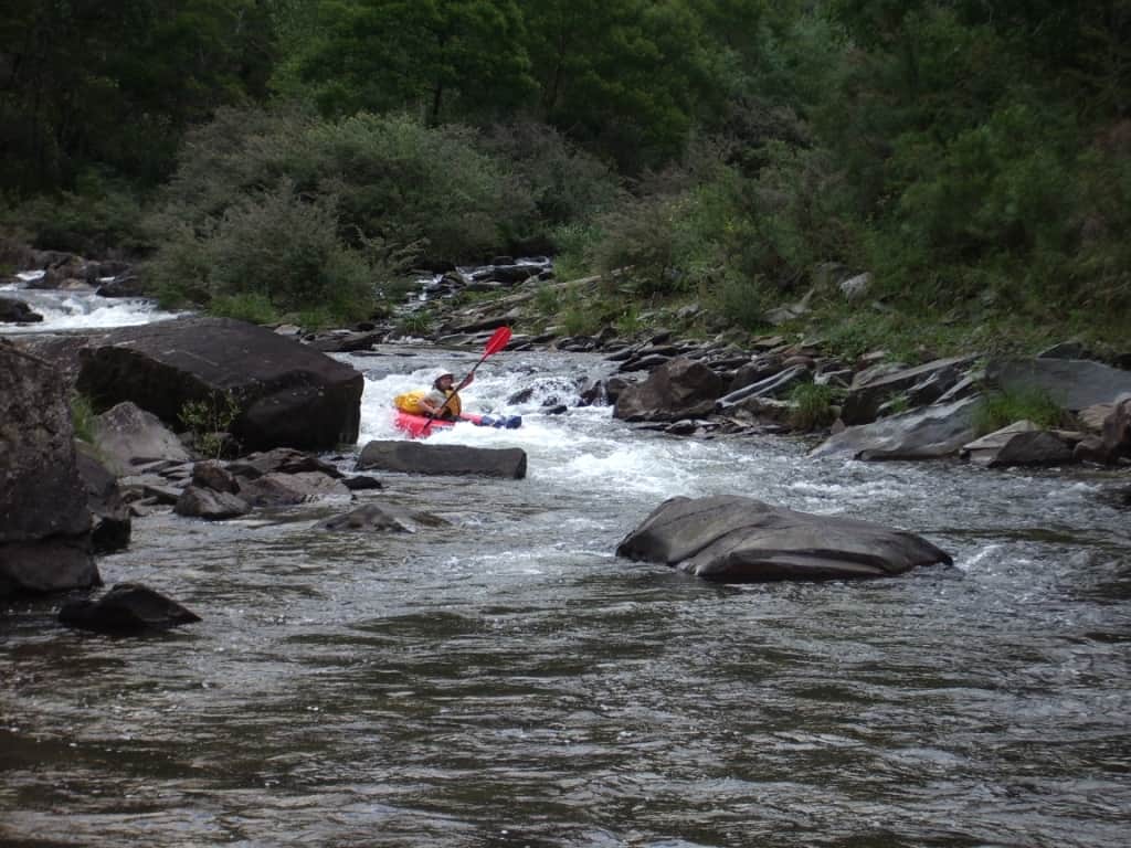
The next Grade Three rapid is the Boulder Rapid which comes after about a half hour of a wonderful downhill section. It is a huge boulder which just about completely blocks the river – but that is not he worst bit of it. You should pull out on the left bank and inspect this rapid. If you have any doubt about it, drag your boat right around it on the left hand side. I have thought about clearing a complete new route around the right hand side of this rapid but I fear it is probably too much hard lifting for my back now. Otherwise there is a very sharp left turn followed very abruptly by a right turn, then you must go down the exact correct (centre) chute or you will be on the rocks and may break your arm. Be warned! That being said, it is a wonderful fun rapid and I have sometimes dragged my boat back up it to have a second go! Some of us are mad! Might not now I am nearly 70. I hope to see it again this summer though!
Below the Gorge: Fred Bowman
Strange things the river has wrought: Fred Bowman

Boulder Rapid: Della Jones
Boulder Rapid: Brett Irving
The last Grade 3 rapid is less than another half hour downriver and is called ‘The Chute’. The whole river goes through a narrow cut less than six foot wide. It goes through very fast I can tell you, so you had better be lined up dead square or you will think you have just been through a washing machine. If your boat gets side on to it, it will snap it in two in a trice and plough you straight through it to boot. Lined up straight, it is a doddle. You may not see it coming, (though there is a steel ladder on your left just before it which gives access to the gauge there). Keep to the right in the pool above it from where you will be able to spot it OK and line yourself up. You can drive down to it in a decent 4WD. It is the T2 track off the Stony Creek Rd. It is quite a popular swimming hole where suicidal youths jump off the rocks allowing themselves to be deliberately sucked through it. Some will not live long!
Bryn Jones
About a km above ‘The Chute’ there is a much more daunting rapid (I think) which I call ‘Crocodile Falls’ on account of finding once a toy crocodile there. It is on a right hand bend below a substantial still pool. The river runs rapidly downhill for perhaps 200 metres over quite broken rocks. It is much worse at low water levels such as you are liable to find there now. I have spent a number of hours moving large rocks there trying to make the run safer, but it needs more work. Feel free. If you come out near the top (likely) you will tumble over a lot of rocks before you get to the bottom. It can be portaged on the left hand side but there are many blackberries.
Crocodile Falls: Simon Schutte
After the chute there are a number of small entertaining drops, but soon you are in the backwaters of the weir and if the wind is blowing upriver (it almost always is) it can be a substantial paddle the last half hour or so. I usually aim for the point on the far left hand side at the weir where the old (closed) bridge shortcut to Stony Creek Road is to be found. Do not walk barefoot in the weir. Many idiots over the years have smashed glass bottles there!
Nearly there: Della Jones
See also:
https://www.theultralighthiker.com/2018/03/09/only-the-moon-and-me/
https://www.theultralighthiker.com/2018/03/09/how-green-was-my-river/
http://www.theultralighthiker.com/gippsland-pack-rafting-routes/
I filmed a one hour video of myself and Steve Cleaver canoeing the Thomson in 2006. How young we were! Here it is:
Thomson River Canoe Trip Video
Chuffed to get a mention Steve. Had a paddle on the Weir this morning. Pretty unrecognisable after the flood. Looking at taking the kids on this trip finally.
I hope to be with you on the river again this summer Simon. You missed a day with me in autumn I think. BTW 1 I have fixed the photos on this post which had somehow become blurred. BTW2 You can now get down the T9 track (off the Stoney Creek Rd) for a one day trip again. I don’t know how far but as you live nearby you should take a look. Likewise the Mitchell Track (See the Autumn Packraft post). Cheers, Steve.