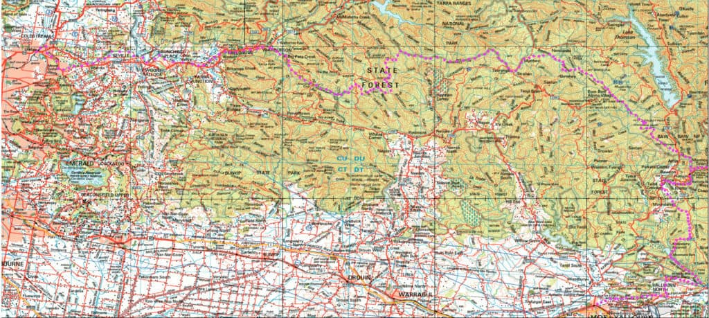
Upper Yarra Track Map:
Here is a map showing the whole of the (Extended) Upper Yarra Track from Lilydale all the way to Moe, approximately 250 km and 8-10 days: Australia’s oldest and best long distance hiking track. It could be a better map, but it is better than no map. I have used the 1:250,000 Australian Topo map […]