My friend Gerard White walked the Upper Yarra Track last week – from Waburton to Walhalla. With his kind permission here is his account of the trip:
Day 1: Big Pats Creek to New Federal Mill (21km) (4 people)
Last week (Sunday) I set off from Warburton headed for Walhalla on the Upper Yarra Track. I’d read some negatives about the amount of road walking involved but was keen to see it for myself and the close proximity to home meant I didn’t need to travel far to start. My usual walking partner had work commitments so it was solo for me this time, something I wasn’t that used to. I allowed 7 days to cover the 130k so we agreed to meet in Walhalla lunchtime the following Sunday. Many of the tracks had closed 1st May so I expected it to be pretty quiet. The weather forecast predicted snow falls on Baw Baw the following weekend so I thought that would add another dimension to the walk. Originally it was to be a bike ride but restrictions on vehicles after closures unfortunately included bikes.
It was also my first outing with some new lighter gear; Granite Gear pack, Zpacks Duplex, EE Quilt, NeoAir, 15g diy fuel stove (made from a couple of beer cans) and diy CF poles which was strong enough to use as a walking pole (I used one and carried the other). I was happy to have dropped 4 kg off my base weight.
To avoid the 6k road walk from Warby I started at Big Pats on the ‘Walk into History’ towards Ada Tree, a section I’d done before in cold wet muddy conditions, stopping at Starlings Gap for lunch. On reaching Federal Crossroads I dropped my pack and strolled down to Ada Mill No.2 site (a nice camp) to take some photos teh continued on. About 1k later I realised my diy CF tent pole wasn’t in my hand and I’d left it leaning against a tree back at the crossroads. I dropped the pack and raced back to get it, all the way telling myself I wouldn’t do that again. After collecting water from Little Ada River (filtered) I eventually reached New Federal Mill around 5pm. It certainly gets dark early this time of year. Had my usual dinner of dehy rice, veg and tuna and settled into bed.
 Viewed 172 times")
- Start of the ‘Walk into History’ track
- Big Pats Creek
- Tree ferns
- Typical track conditions
- Starling Gap
- Fallen tree
- Boiler
- Little Ada River log bridge
- Eucalypt
- New Federal Mill camp
Day 2: New Federal Mill to Boundary Road (21km) (2 people)
Today’s walking would take me past Ada Tree onto New Turkey Spur Track, Lashos Link Track, McCarthy Spur Track then north on Boundary Road along the eastern edge of the catchment towards Road 20. Info on water sources was sketchy so the forecast for rain was welcome. There was supposedly a dam on Boundary Rd I was hoping to reach. After completing the Ada Tree river walk and reaching the carpark it was time for some of the road walking. With no cars, beautiful forest each side, wind and birds the gravel road walking wasn’t as bad as I thought. Rain started pelting down as I reached Lashos. The shower only lasted 30 minutes but it was enough to fill the road runoffs with water. I arrived at the dam around 4pm and camped on a rather unattractive clearing by the road. The dam was full but brown and murky. I filtered the water.
- Little Ada River Walk
- Ada Tree
- New Turkey Spur Rd
- Lashos Link Track
- Lashos Link Track
- McCarthy Spur Rd
- Boundary Rd
- Boundary Rd
- Boundary Rd
- Boundary Rd
Day 3: Boundary Road to Mt Horsfall (20km) (3 cars)
Up and at it early I was heading north on Boundary Road towards Road 20 (Whitelaw Track) by 5.30am with a full moon and headlamp (not that were any obstacles). Again tall forests each side of the road and the rising sun made it quite relaxing. I reached Road 20 by 8am then headed east along the southern edge of the catchment within the Yarra Ranges NP. Road 20 was surprisingly unroad like as it meandered between the trees along a 30m firebreak. Most of the water from the rain had disappeared and with plans to camp on Horsfall a detour down North Loch Rd 2k was needed for water, which I collected from a gully then took a track north through a logged area back to Road 20. Shortly after Road 20 becomes Forty Mile Break. I arrived at Horsfall at 3.30pm settled in and enjoyed the views to the north to Lake Mountain and south toward Mt Toorongo. Mt Horsfall is 1134m and has a large clearing on the summit. Just as the sun was setting three 4wd came past lights on heading west down Road 20. I gave them a wave and thought to myself aren’t these roads closed? I had phone reception so called the missus. I also have a Spot which I set off each night.
- Early morning on Boundary Rd
- Road 8 into the catchment
- Track marker
- Road 20
- Road 20
- Shortcut from North Loch Rd to Road 20
- Forty Mile Break
- Forty Mile Break near Mt Horsfall
- Sunset on Mt Horsfall
- Camp
Day 4: Mt Horsfall to Newlands Rd (22km) (1 person + 2 trucks)
Todays route would take me along Forty Mile Break to Toorongo Rd, Block 10 Rd and Newlands Rd near the base of Baw Baws NW end where the Thomson River runs. I headed off early along FMB aiming to reach Toorongo Picnic Ground by lunch. One of the 4wd passed me as I was packing up heading east. There were a couple of ‘Fire Suppression Streams’ marked on the map a few km further on 500m south of the road which were likely water sources. Walking along FMB I could hear a chainsaw in the distance. It was the chap that passed me on Horsfall who worked for PV. We had a quick chat and told him my plans. What a great office he has! The stream at the water point was flowing well and the water was crystal clear. I didn’t treat it. FMB turns SE at Road 12. At this point you’re only 800m from the Yarra Falls to the north but I wasn’t taking the risk and going in there. After reaching Toorongo Rd I made my way to the picnic ground. The place was in a state of total disrepair; not even a table and chairs. A couple of logging trucks passed by as I ate lunch, you can hear them coming for miles. The 6k along Toorongo Rd was a bit of a drag so I was glad to reach Block 10 Rd, climbed the gate and head east towards the Thomson River to Newlands Rd (marked as Neuylands on the Rooftop). I’d read there was a nice dam 1k north of Newlands Rd so that’s where I was headed for the night. The tracks around here don’t appear to have had much traffic for a while. I found myself a spot on the track up from the dam and settled in for the night. I was kind of wishing I had a fishing line, trout for dinner would be nice.
- Forty Mile Break
- Track to ‘Fire Suppression Stream’ off FMB
- Forty Mile Break near Toorongo Rd
- Toorongo Picnic area (a bit of a mess)
- Block 10 Rd
- Newlands Rd
- Newlands Rd
- Newlands Rd
- Track to dam north of Newlands Rd
- Camp near the dam
Day 5: Newlands Rd to Whitelaw Hut (15km) (0 people)
Today would involve the climb up to Baw Baw from Newlands to meet the AAWT NW of Mt Whitelaw. I’d looked down this track from the AAWT a couple of years ago and thought OMG and any info I could find suggested it was totally overgrown and hard to follow. Sounds like fun! I made my way back to Newlands Rd from the dam and continued SE toward Frangipani Saddle for lunch, crossing the Thomson River 4 times. The track leading up to the AAWT has a sign leading into the scrub about 400m before Frangipani Saddle which would be a great place to camp. Well fed on salami/cheese flatbread I headed back to the turnoff, took a few deep breaths, checked the time and headed east up into the scrub. It’s only 3km to the AAWT from here but I expected it to take just as many hours. You could see the remnants of a road and the gap in the trees above but there were plenty of fallen trees and bushes to push through. A couple of times I lost the way, in particular where the route dog-legged but I was able to pinpoint my position on the map and get back on track. Eventually I reached the last Thomson river crossing only 700m from the AAWT. The river is only 30cm wide at this point and was flowing well. I bit more of a bush bash and I could see the blue sign at the track junction with the AAWT. I’d made it. What a relief to be out of that hell hole and back in familiar territory. It had taken me 3 hours to cover the 3k. It was only 5km to Whitelaw so I could take my time arriving by 4pm. I’d expected other walkers to arrive at Whitelaw but nobody did…good. The wind increased and it got pretty cold so I quickly cooked dinner in the chimney and retired to the tent.
- Dam north of Newlands Rd
- One of four Thomson River crossings on Newlands Rd
- Another dam
- Approaching Frangipani Saddle on Newlands Rd – route to Whitelaw on the left
- Frangipani Saddle
- Sign post pointing the way
- Overgrown track up to the AAWT
- Crossing the Thomson
- I recognise that sign – at the AAWT
- Camp at Whitelaw Hut
Day 6: Whitelaw Hut to Talbots Hut (15km) (0 people)
Today was an easy day…all I had to do was get to Talbots. I slept in and left Whitelaws 9am along the AAWT to Phillack Saddle for lunch. Again I had phone reception. It was still pretty windy and the forecast was for gale force and damaging winds in West Gippsland tonight …woohoo…but where’s the snow? I arrived at Talbots about 3pm, nestled myself between the rocks and battened down the hatches. At about 6pm it started to pour and the wind was howling through the trees but I was as snug as a bug in a rug. My only concern was a tree falling on me as I slept crushing me in an agonising death but obviously that didn’t happen because you’re reading this. The Duplex performed great (as did my CF poles and other new gear) and I didn’t have any dramas with condensation.
- Baw Baw Turnoff
- Phillack Saddle, very windy
- Baw Baw
- Mt St Phillack
- Snow poles near St Gwinear
- View from AAWT
- Rest near a rock
- More views
- AAWT
- Camp at Talbots Hut
Day 7: Talbots Hut to O’Sheas Mill (15km) (6 people)
Another easy day with only 1200m descent to the Tyers River. That’s easier than going up…right? Left Talbots around 9am, mucked around at Mushroom Rocks looking for THE Mushroom Rock but I couldn’t remember where it was. Arrived at Erica carpark by 11.30am, a real toilet…what a luxury. Sat at the table, had some lunch when a van pulls up with 5 people, one of who’s face I recognise. Fellow BW member JohnStrider who runs a group called the Hiking Society. They were headed to Mushroom Rocks and Talbots for the night. From here to Walhalla was a section of the AAWT I hadn’t done. Down Mt Erica Rd to the turnoff onto Firebreak Track to the Tyers River. There’s a nice waterfall near the campground which also has a toilet and table/chairs and fireplace. Shortly after dinner it started to rain heavily so it was into the tent and radio on for ‘Dreamtime at the G’…go the Tigers. . What a life. It rained steadily most of the night but again the Duplex was excellent.
- Mushroom Rocks
- Mt Erica Carpark
- AAWT turnoff from Mt Erica Rd
- Firebreak Track
- Huge eucalypt
- Firebreak Track
- Firebreak Track
- Firebreak Track
- Waterfall at O’Sheas
- O’Sheas campground
Day 8: O’Sheas Mill to Walhalla (14km) (10 people)
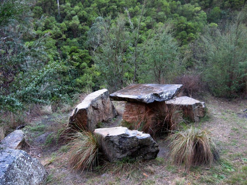
I’d agreed to meet my missus (Bridgette my walking companion) in Walhalla at the rotunda between 11-12 so got moving pretty early, crossing Thomson Valley Rd and down the Fingerboard Spur towards Poverty Point Bridge. It’s a nice walk along the valley high above the Thomson River. For some reason I thought the track was down on the river but that wasn’t the case. The rock table and chairs along the way was interesting and crossing Poverty Point Bridge offers some nice views up and down the valley. Only a few km to go now I could hear cars below me on Walhalla Rd then the town comes into view. Past Long Tunnel Mine and down the stairs to the rotunda and there’s the missus…I’m right on time. Let’s grab a hot pie and sauce.
Wasn’t a bad walk and best done when the roads have closed. I just wish it had of snowed two days earlier.
- Gate on the AAWT near O’Sheas
- Fingerboard Spur Track on Thomson Valley Rd
- Fingerboard Spur Track
- High above the Thomson River
- Table for two please
- Poverty Point Bridge
- View back to Baw Baw
- Walhalla
- Long Tunnel mine
- Rotunda and end of journey
- It is without a doubt Victoria’s (if not Australia’s) premier hiking track. Many more people should be doing ti. From now (31 May 2019 until spring) you should follow the ‘Winter Route’ along the Tyers river -as there will be too much snow along the Baw Baw Plateau.He did tell me by private communication that my posts about the track had been a big help.
- Here are my main pages about it:
- Upper Yarra Walking Track
- Upper Yarra Track Instructions
- Upper Yarra Track Map
- I have heaps of posts about this fabulous track as you will find if you do a search in the facility in the upper right hand corner of one of my pages, eg: https://www.theultralighthiker.com/?s=upper+yarra
A fine account, many thanks for posting this; yet another source of inspiration for a future trek.
Thanks Scott.