I know Huck had the mighty Mississippi and Mark Twain to extol its virtues but the scale of that is just too vast for me. Instead I reckon one could spend much of one’s life just exploring a small river such as the Tyers, Tanjil, Latrobe, Thomson or Wonnagatta in Gippsland. I know I have but I have still only barely touched on their beauty and wonder.
We took the afternoon ff from our (fallen) tree clean-up activities to have a pleasant drive featuring parts of the Tyers River catchment and lunch at the Erica Hotel (recommended). The Moondarra dam was still overflowing nicely as in the post Moondarra Maelstrom. It should be even more spectacular after some more rain next weekend and early the week after that. Take a look.

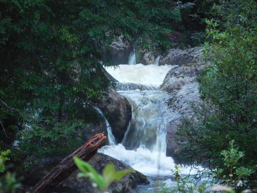
You turn off at the Moondarra dam turn-off on the Moe-Erica Rd. It is only about 5 km on a tar road to this bridge. If you go another 300 metres to the beginning of the Wirilda Walking Track you can walk down about half a kilometre to look up ate this spectacular waterfall.


Lots of timber has been coming over the spillway.

The view from the top. We were standing on the top of the bank just right of centre to take the previous photos – about a five minute walk and well worth it.

If you are on Facbook this is what the spillways looked like a couple of weeks ago during our major rainfall event: https://www.facebook.com/anne.smogavec1/posts/10224728546943860 It is spectacular.
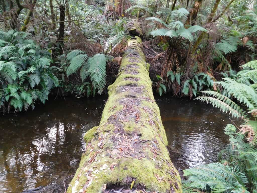
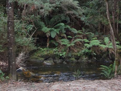
After you have had lunch at Erica you can drive out along the South Road to Baw Baw and Tanjil Bren (usually – the road from Baw Baw to Tanjil Bren was closed by a slip yesterday). It is a very well-built wide gravel road and perhaps the most beautiful drive in Victoria. You should stop at the three bridges to take a look up the beautiful streams they span. The first crosses the eastern Tyers. View upstream:

And downstream:

The second crosses Christmas Creek. BTW: The Tyers River is canoeable ( moderately) though best via pack raft from Christmas Creek Road down to the Morwell River confluence (nearly a week away through beautiful remote forest. All the way the river is alive with trout, blackfish and spinyback crays. View upstream of teh Christmas Creek bridge:

And downstream:

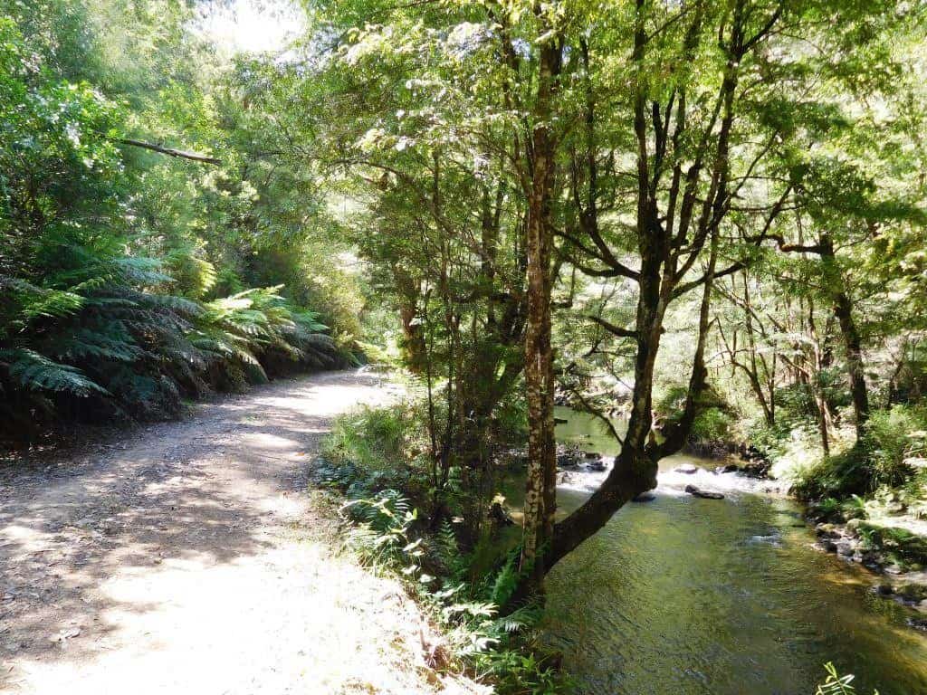
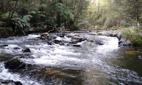
The third and most spectacular bridge (the John Wanke Bridge over the Wester Tyers) has the most superb views if you get out of your car to look. If you do not the concrete sides of the bridge block the view altogether. It is a view not to be missed. people would queue and pay $s anywhere else in the world to see something as enchanting s this. The view upstream:

Likewise:
And downstream:

A close-up:

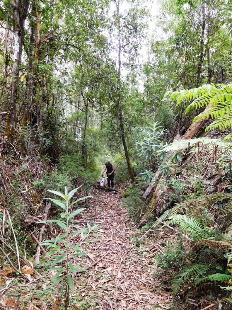
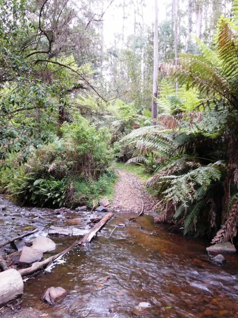
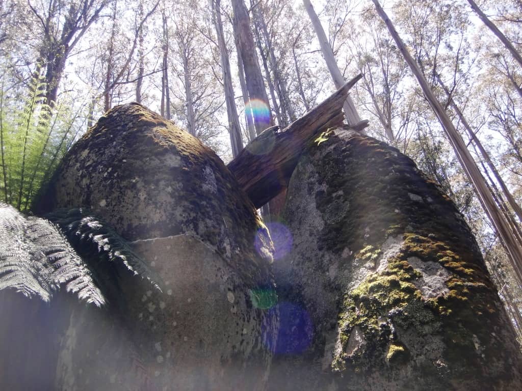
There are so many other delightful things to see along the Tyers. When I was younger (40 + years ago) I used to beat my way up along that stream with my hound Harpoon hunting sambar deer. Neither the National Park nor the South Road existed then though there were many other timber tracks and even tramways.
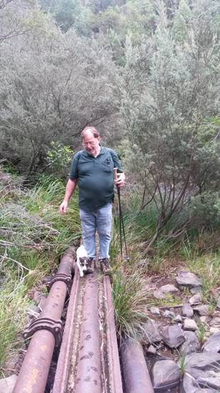
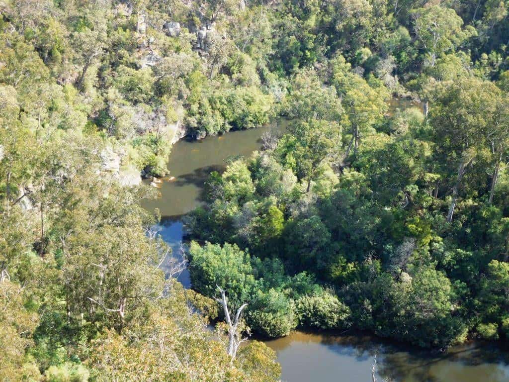
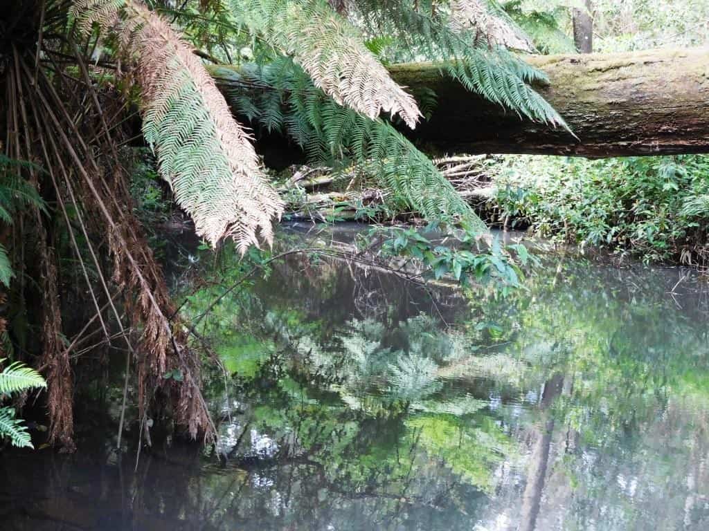
I have often camped along it (especially along the Western Tyers Road — one of the most beautiful (and coolest on a hot day) spots on earth where the Antarctic Beech overhang the river majestically (as here) and I have canoed most sections of it from Growlers down. The section from Growlers to Palmers is a must! If you have not done it you really should. It has some Grade 3 sections though – so beware.
It would be wonderful to spend a week or two clearing it enough so that it became an easy and really enjoyable experience but I am old! Something for you younger folk to work at. There are innumerable splendid camping spots along the way.
Here are some other ‘explorations of the Tyers River watershed:
The Eastern Tyers Walking Track
Morgans Mill and Skinners Camp

The river rises on the top of the Baw Baw Plateau along this section
Mushroom Rocks to Phillack Saddle
Perhaps the above snippets will convince you that you could at least spend a small lifetime exploring such an endearing waterway.
The river is ‘only’ 57 km long and drains an area of 317 square kilometers (123.2 square miles (according to this report) ie 31,700 hectares or 78,848 acres. See: https://en.wikipedia.org/wiki/Tyers_River Nonetheless you would have it admit it would take quite some time to explore all of it! Because if the high humidity and precipitation on the South face of the Baw Baw Plateau the river is an enormously reliable water source making it ‘canoeable’ pretty much year-round although because of its small dimension you will often scrape the bottom of your boat.

http://www.theultralighthiker.com/upper-yarra-track-winter-route-caringal-scout-camp-tyers-junction/
This set of photographs will give some idea of what these old forest tramways were like in their heyday: https://www.victoriasforestryheritage.org.au/showcase/galleries/tramlines.html
Partial map of the Tyers and district tramways: https://www.victoriasforestryheritage.org.au/maps/ericatyerstramlines/ericamap13082020/index.html#12/-37.8608/146.3061
Tramway maps: https://www.lrrsa.org.au/Lrr_Maps.htm
Some local hiking trails: https://www.alltrails.com/parks/australia/victoria/yarra-state-forest
See also:
http://www.finnsheep.com/THE%20UPPER%20YARRA%20WALKING%20TRACK.htm
http://www.finnsheep.com/Track%20Instructions.htm
http://www.theultralighthiker.com/upper-yarra-track-update-section-one-moe-yallourn-rail-trail/
http://www.theultralighthiker.com/upper-yarra-track-update-section-three-wirilda-to-moondarra/
http://www.theultralighthiker.com/upper-yarra-track-section-four-moondarra-to-erica/
See also Upper Yarra Track Winter Route:
http://www.theultralighthiker.com/western-tyers-river-great-for-crays/
http://www.theultralighthiker.com/the-western-tyers/
http://www.finnsheep.com/THE%20UPPER%20YARRA%20WALKING%20TRACK.htm
http://www.theultralighthiker.com/upper-yarra-track-update-section-one-moe-yallourn-rail-trail/
http://www.theultralighthiker.com/upper-yarra-track-update-section-three-wirilda-to-moondarra/
http://www.theultralighthiker.com/upper-yarra-track-section-four-moondarra-to-erica/
http://www.theultralighthiker.com/upper-yarra-track-section-five-erica-to-walhalla/
http://www.theultralighthiker.com/upper-yarra-track-st-gwinear-track-junction-to-whitelaws-hut/
http://www.theultralighthiker.com/upper-yarra-track-summary-cumulative-distancestimes/
http://www.theultralighthiker.com/upper-yarra-track-osheas-mill/
http://www.theultralighthiker.com/a-beautiful-world/
http://www.theultralighthiker.com/upper-yarra-track-winter-route-western-tyers-to-tanjil-bren/
http://www.theultralighthiker.com/kirchubel-if-you-go-nowhere-else-in-the-world-at-least-go-here/
http://www.theultralighthiker.com/upper-yarra-track-winter-route-downey-to-newlands/