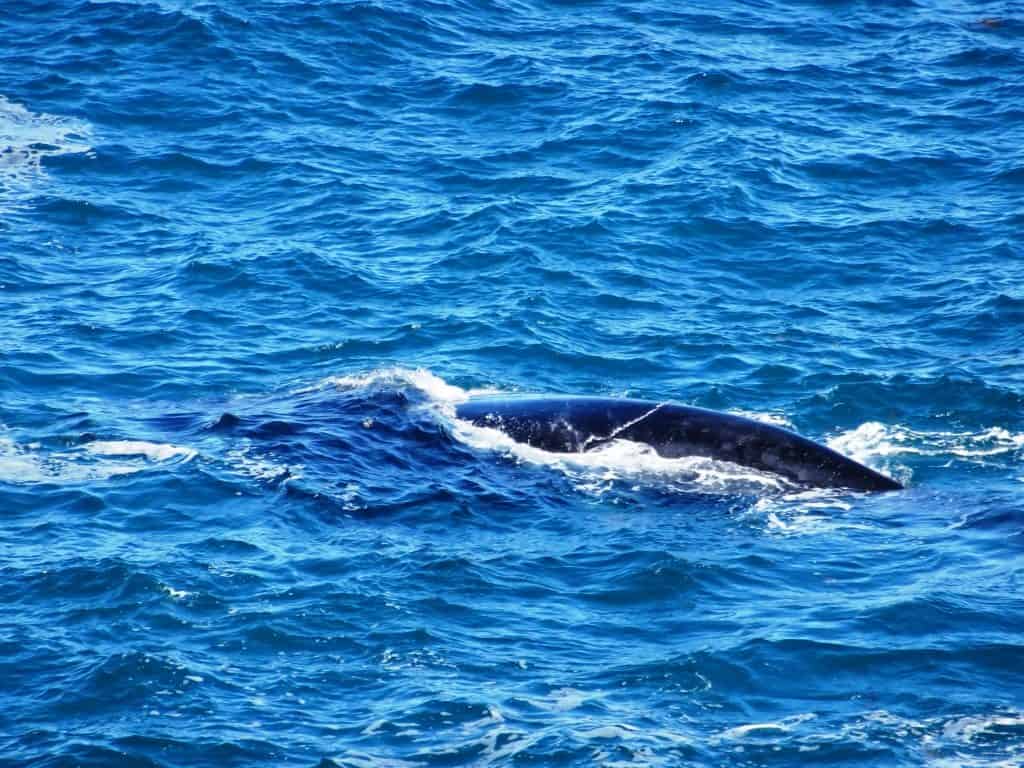
Gippsland

Upper Yarra Track Map:

Here is a map showing the whole of the (Extended) Upper Yarra Track from Lilydale all the way to Moe, approximately 250 km and 8-10 days: Australia’s oldest and best long distance hiking track. It could be a better map, but it is better than no map. I have used the 1:250,000 Australian Topo map […]

Upper Yarra Track Map: Read More »

Upper Yarra Walking Track

My friend Gerard White walked the Upper Yarra Track last week – from Waburton to Walhalla. With his kind permission here is his account of the trip: Day 1: Big Pats Creek to New Federal Mill (21km) (4 people) Last week (Sunday) I set off from Warburton headed for Walhalla on the Upper Yarra Track.

Upper Yarra Walking Track Read More »

Wirilda Reflection

We knocked off early on Anzac Day to have a stroll along the Wirilda Track from the W3 ‘road’ downstream. (I am still recovering, slowly). You can put a canoe in here and with some difficulty paddle down to the old Morwell pumping station at Wirilda Park. The river used to be clearer (and may

Wirilda Reflection Read More »

Sand and Sea Training

I am starting to recover a bit from my back op so time for a wedding anniversary toddle around Sandy Point/Shallow Inlet South Gippsland Vic. As usual Spot leads the way through the Tea Tree tunnel to the inlet. Where we are greeted by this wonderful view. Wilsons Prom in the distance. You can see

Sand and Sea Training Read More »

Wonnangatta: Waterford to Angusvale Day One:

This is a truly wonderful section of the river. One of Australia’s greatest treasures and one of our last wild rivers! It took us fourteen hours (paddling and portaging) to make it from Meyers Flat (15 minutes below Waterford by canoe – but easier to put in) to the first take-out point at Angusvale. The

Wonnangatta: Waterford to Angusvale Day One: Read More »