We spent the afternoon poking around on the Wilsons Prom Isthmus, an area easily ignored as you roar down from Foster to the National Park, but in many ways it is scenically superior to the park itself. We had time only to drive down five roads to the sea, and take a peek: Foster Beach Road (off Lower Franklin Road) Foster, Charles Hall Road (off Black Swamp Road) Yanakie, Shelcotts Road Yanakie and Hourigan Camp Lane (off Millars Road) Yanakie and Lester Road (off Meeniyan- Prom Road Yanakie.
As you know I am working towards a Great Gippsland Circuit (http://www.theultralighthiker.com/the-great-gippsland-circuit/) that will walk along the entire Gippsland Coast from Phillip Island to Eden then return to Melbourne along the Alps Walking Track. Today we were checking out just a small part of that.
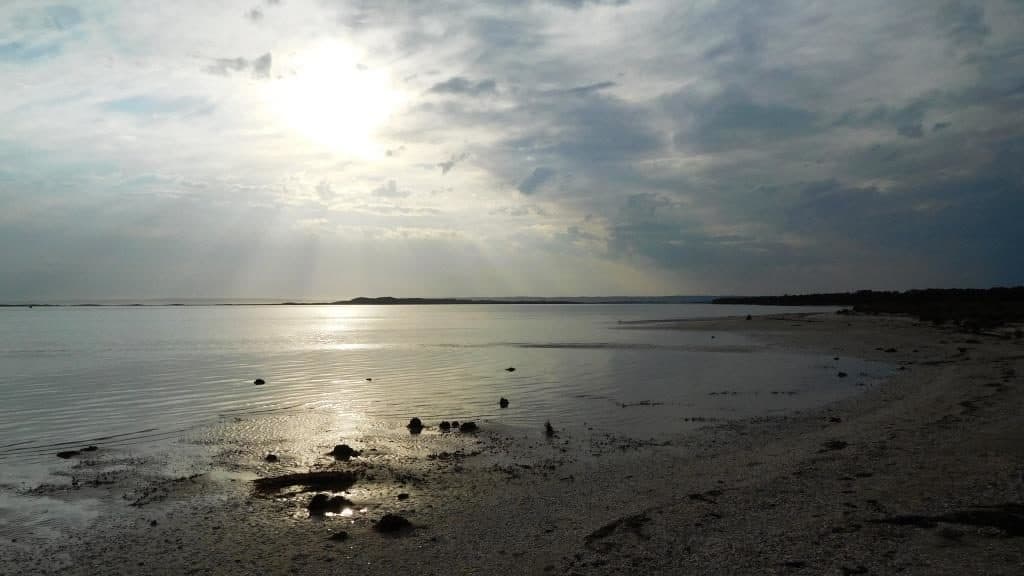
A view from Foster Beach towards Wilsons Prom across Corner Inlet

Red Billed Shearwaters amongst the mangroves Foster Beach 
Mangroves Foster Beach looking across to the Yanakie Isthmus

Mangrove crab Foster Beach

Mangroves Foster Beach looking towards Wilsons Prom

Charles Hall Road looking towards Doughboy Island. Wilsons Prom in the background.

Charles Hall Road looking towards Foster

A close up of the above – so easy and pleasant walking along most of Corner Inlet particularly at low tide.

Shelcotts Road looking towards Charles Hall Road and Foster. The good walking continues

Shellcotts Road looking past Red Bluffs towards the Prom. At low tide at least you can easily walk past Red Bluff Road at least as far as Foleys Road

Close up of the above. Red Bluffs centre.

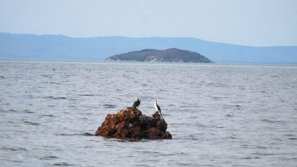
Shelcotts Road: shags on a rock, Doughboy Island and the Prom in the background.
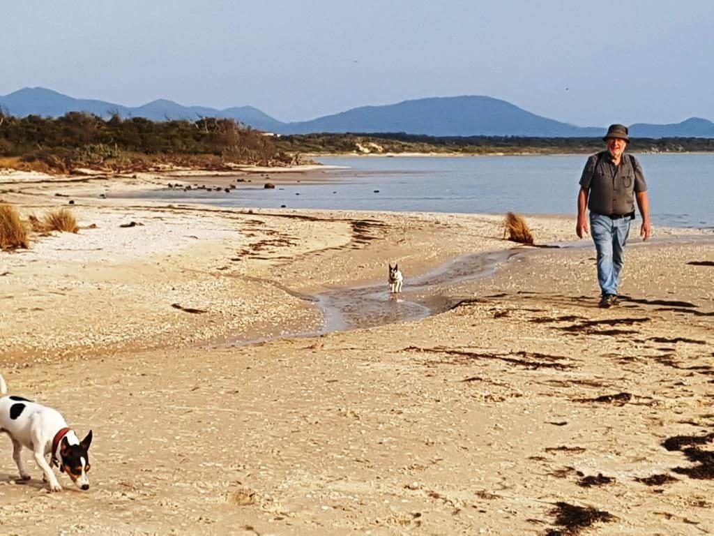
Della beachcombing Hourigans Camp Lane looking back up Shallow Inlet towards Lester Road camping grounds. There is a freshwater creek to cross before you get there. It would have to be swum.

There are plenty of spots you can do a bit of beach camping along here though in the National Park part it may not be strictly legal. Someone has near the stream below, and you can see they had a pleasant campfire with a fine view of the water. You can also easily walk from here along the beach all the way to the Darby River.

This is the view towards the Shallow Inlet entrance. There is plenty of firewood on the beach here.

Close up of the same view. Wilsons Prom in the background. There are many freshwater streams such as this one as you walk along the coast or around Shallow Inlet. Perhaps filter the water with your Sawyer Mini filter as there is run-off from paddocks containing stock such as sheep. Mind you, I never have. See: http://www.theultralighthiker.com/water-filter/
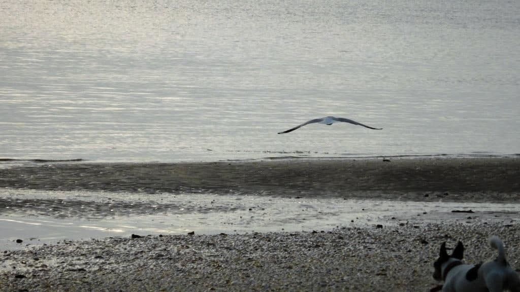
A gull enjoys the sunset

Until Spot disturbs him
Leaving the sunset over Shallow Inlet for us alone to enjoy. Very nice

I think there will be some places on this long walk where a packraft such as the Klymit LWD (http://www.theultralighthiker.com/klymit-packraft/) will be needed, eg for crossing Shallow Inlet. The same applies at Andersons Inlet (Inverloch), Hollands landing, Mueller River & etc.
In this case it may be possible to walk all the way around Shallow Inlet though there are a number of streams still to cross (and as I mentioned earlier) there is a campground at the end of Lesters Road. Otherwise you would walk around the (Sandy) Point and back along the inshore of the inlet about 2 km then paddle the couple of hundred metres across at lowish tide on the downstream side of Fisherman’s Creek below the campground opposite. Don’t cross near the inlet as you could be swept out to sea! Then you can walk all the way to the Darby River, indeed to Tongue Point (http://www.theultralighthiker.com/on-the-tip-of-the-tongue-2/).
The crossing can be avoided by a long but pleasant walk along quiet country roads: Waratah Road, Soldiers Road, Daveys Road, Meeniyan-Prom Rd, Millars Road, Hourigan Camp Lane.
A packraft would also help where there is some difficulty walking along the shore (eg where there are mangroves, or at high tide). With a packraft I think you could journey all along the inside of Corner Inlet from Millars Landing to Port Franklin.
See Also: http://www.theultralighthiker.com/advanced-elements-ultralight-paddle/
Steve
Let’s get in touch. I know every inch of Shallow Inlet; the most beautiful place in the world. I think it’s easily possible to walk Corner inlet, watching the tides and mangroves. Let’s do it together and test it out! Don’t let anything as minor as spinal surgery dampen your plans. Trusting all is well.
Tom
It is rather nice – and there are clearly a few spots with fresh water to camp overnight on your way from Phillip Island up (whether it is legal or not- I daresay if I/we work out a route with instructions as envisaged http://www.theultralighthiker.com/the-great-gippsland-circuit/, the DOC will then ‘create’ the Track!) It looks to me as if folk could walk along Corner Inlet too (at low tide anyway) but someone will have to do it. Here I am in my 70th year and still so many things to do! I need to work out the section from Foster to Lakes Entrance (and Marlo too). I think there can be a number of alternatives, as well as alternatives for coming back eg on the Alps Track (and getting to it). I will just potter away at it, and maybe I will get a little help from people like you just as I have with the Upper Yarra. I am mostly someone who walks in trackless bush, but I think there needs to be decent instructions for people who are otherwise – and especially where to camp, get water, buy supplies and find transport and photos and commentary. It is a big job, but I am not daunted by that. PS: I think my back surgery went well. I have just been up walking around 4 hours after coming out of theatre. Now just my knee to fix. Cheers, Steve.
Hello – Tom here.
I’ve walked the entire perimeter of Shallow Inlet – it’s easy.
I wonder if anyone else has done it? Please get in touch on 0407 045 195 as I would be interested in walking from Philip Island to Eden and back over the mountains.
Tom Manning
Hi Tom, That is very useful information and I thank you for it. I will add it to the posts about he ‘Gippsland Circuit’ somewhere. Now wondering whether one can walk along the inside of Corner Inlet from the Prom to Foster. I will gradually get this information done (as with the Upper Yarra Track – which you should also try) and will also do the same with a better route for the Alps Track – one which goes past resupply points so it can be walked continuously without backup support. I will be in touch. I have just now woken up an hour ago in hospital from spinal surgery. Cheers, Steve.