Many people may not know that the famous C19th Wonnangatta Station was ‘serviced’ by a pack track up the true right bank of that river (ie the right bank facing downstream) along which all its supplies came (including even a large piano).
No doubt other sections still exist below the Moroka Junction, but this post concerns its remnant from the Moroka Junction to the Hernes and Wombat Spurs. Clearly it also went on after that but as with the lower section there is now a road or track which can more easily be followed, eg by those wishing to pack raft the river or explore it for other purposes – deer hunting (excellent), fishing (which is good), bush walking & etc. Map and instructions below.
I have found sections of its continuance way down below Waterford eg below Wattle Creek above Angusvale. Sections of the Mitchell River walking track too may even date from this era. There are similar remnant pack tracks in various places in the Victorian bush many dating back to the gold rush era – along the Avon River for example where some is preserved in a walking track – but it actually continues above Huggets on the opposite bank.
Years ago I found one wending around the vast Blue Jacket Valley – and so on. Such old-time tracks are historical treasures which ought to be preserved. Such work does not have to ‘wait around’ for government to be involved. There was much (more – dare I say?) useful work done before there was ever any government and there will be more long after government is no more (bring it on).
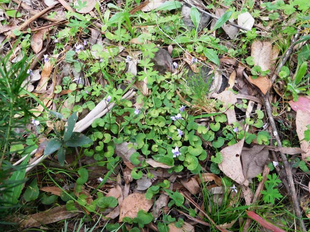
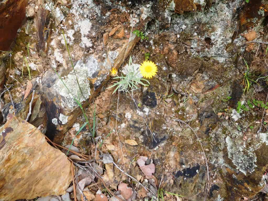
The things you find:
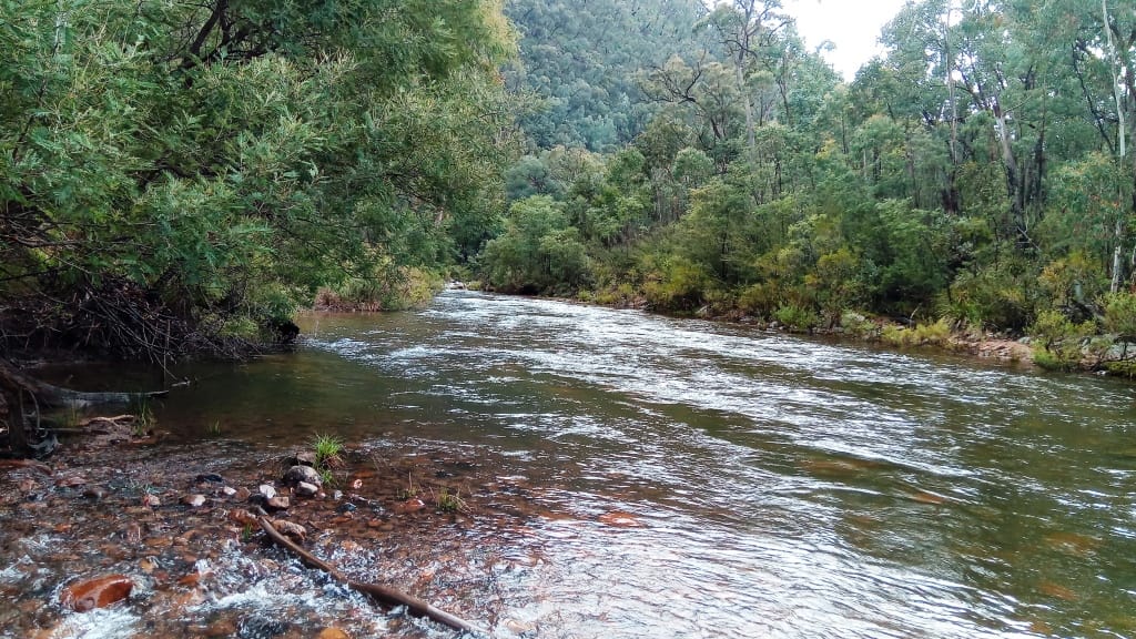
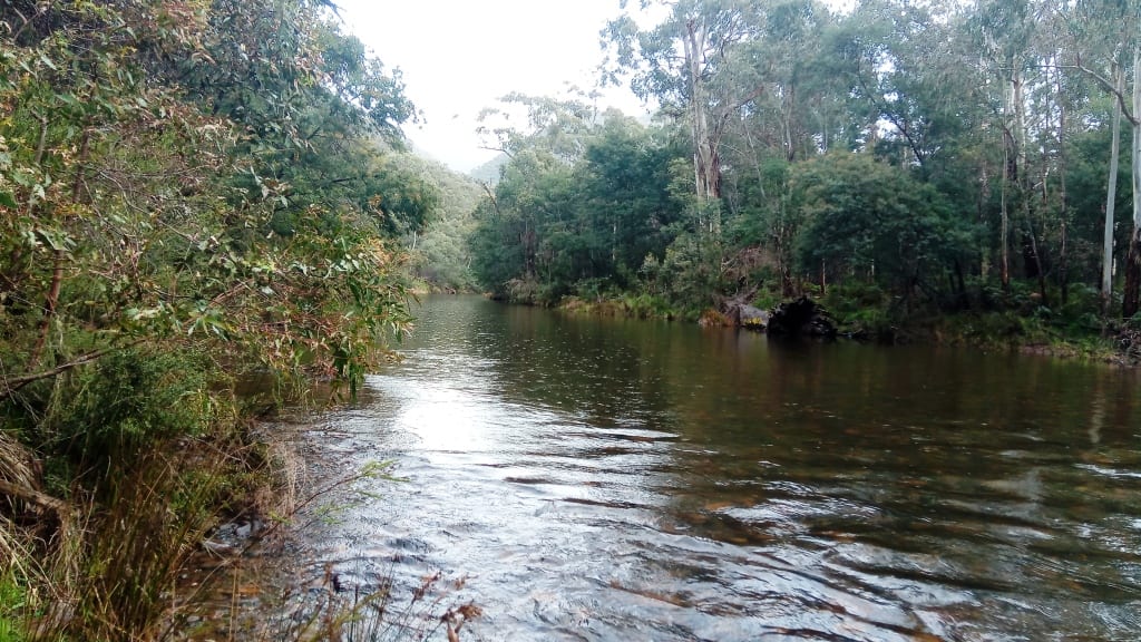
Mostly the canoeable section of the river begins at the Humffray Confluence (Wombat Spur).
I have walked and cleared this particular track many times over the years, (I guess over thirty kilometres of it) and have used it many times also to pack raft the river. I also used to often take a (a large = ‘Fiord Explorer’) Alpacka raft in with me so that I could easily retrieve any meat back to my car when deer hunting there. I have also incidentally used this raft to explore some real fiords in NZ. At 74 I am regretfully coming to the conclusion that this work ought now fall on younger, (stronger) shoulders. Nowadays too by choice, I rarely take a deer – but I do still love to encounter them.
However, I have just been revisiting the area over the last few days having once more become fit enough to do so. It is harder going now (at 74 with a new knee – and back) than it was twenty years ago, but mostly because of changes to the bush (fire particularly) – and the lack of track clearing makes it slower. There is a lot of timber down at present and long grass which needs some stepping over.
Mt Darling Creek
When I had it nicely cleared so that my partly sighted wife Della could walk it easily and enjoyably (ten years and more ago) I could easily walk all the way to or from the Hernes (or Wombat) Spur to the Moroka confluence (car park) in a single 6-7 hour day. I could come back by canoe in about 4 1/2 hours, so a two day trip usually, but it could be done in one, starting early.
Of course you can launch your raft for the return trip any time you are done with walking upstream. We had one to pull out in the vicinity of the Mt Darling Creek once because Della developed pneumonia.
It is still not such hard going as when I found it decades ago. There were sections sometimes of more than a hundred yards then with a blackberry thicket ten feet high completely blocking the way. Some minor blackberry spraying needs to be done again but mostly the work needed is just some machete clearing and throwing timber (and rocks) off the path so that it is a pleasure to toddle along. A jack saw would also rid the track of all but the largest fallen timber.
I believe that it would be possible to restore it to a bridle path or even a mountain bike path but that would entail much more work. Chainsawing and in places much mattocking and rock-breaking.
It would be very pleasant to be able to access the main park in the winter though (when the gates are closed) in this way. Cycling upriver from the Humffray entails no river crossings and is generally very easy going (for over thirty kilometres).
Of course it is pitifully easy to shoot deer from horseback as they do not detect any danger from another quadruped. (I personally would not). They show little fear of people on bicycles too from my own experience, often indeed emerging from the bush for a look! I have no idea whether our current ‘Nanny State’ laws actually allow one to carry a firearm in a bicycle, so I am not advocating it.
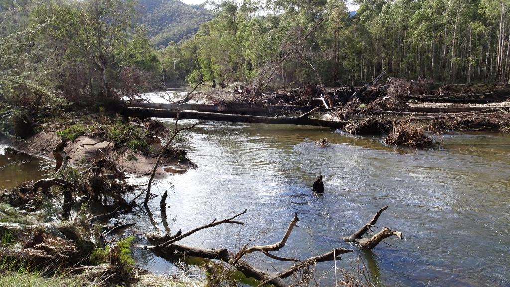
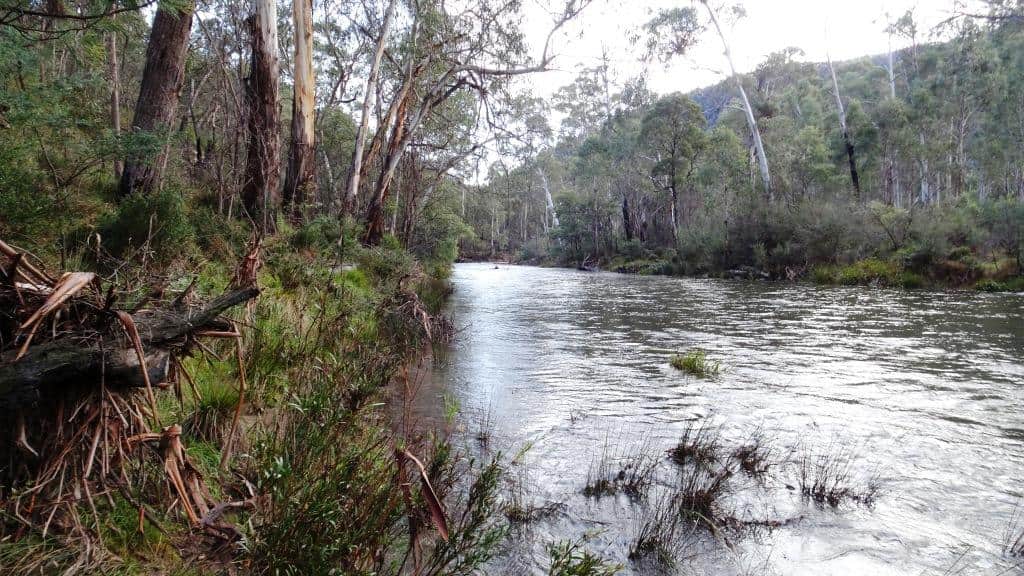
The only river this pack track has to cross (and its raison d’etre really) is the Moroka which is a much smaller stream and relatively easily crossed at a number of points in the first kilometre upstream from the confluence. (There is also the Conglomerate Creek just below the ‘homestead’ but it is just a gully really).
Precisely where it is most congenial to cross (the Moroka) changes over time. At present it is I guess nearer a kilometre upstream but not so long ago it was easiest to cross within the first hundred yards.
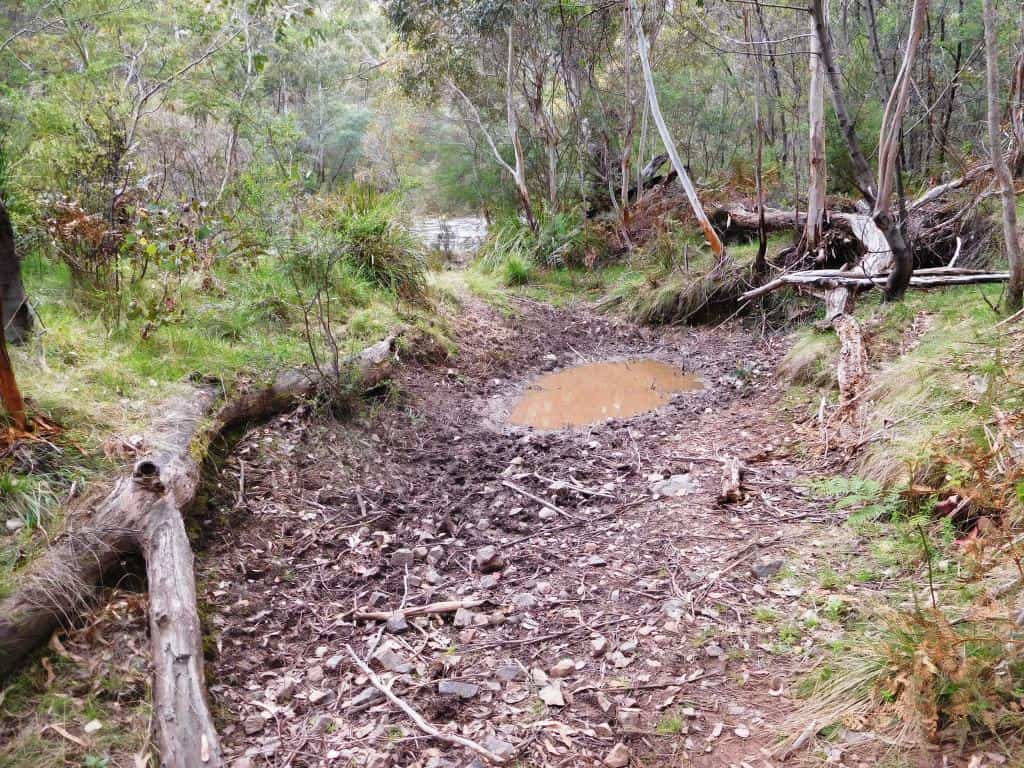
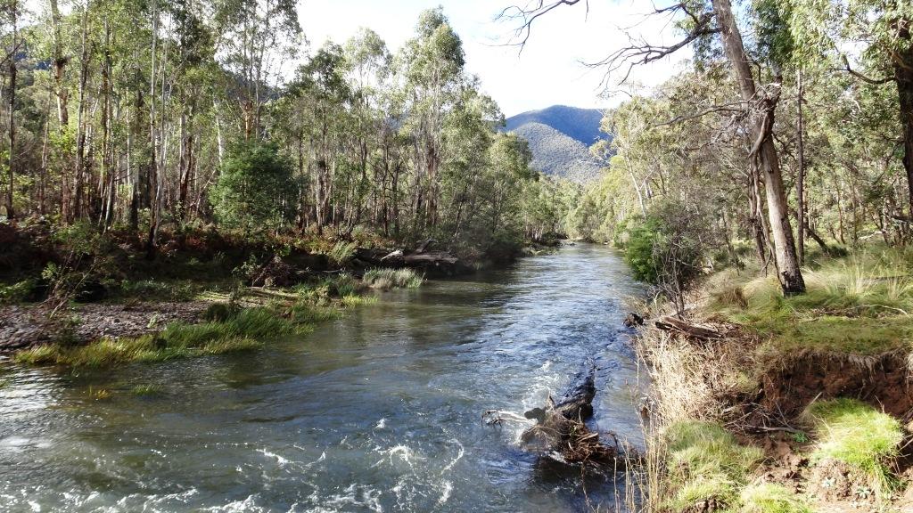
There is a good sandbar completely crossing the river in the vicinity of the end of the made track (just above the turning circle). This area used to to be accessible by vehicle twenty years ago but a rock fall closed the last two kilometres to wheeled transport. It is often walked though (lots of people hunt up the Moroka especially) and is very flat well-formed and easy to follow. There was once a bulldozer track all the way to Higgins Yards but there is very little sign of it today.
This type of adventure is what (after all) pack rafts were made for. First you walk, and then you raft (back to your vehicle, etc). If you only have a 2WD you will have to walk up the 4WD track to the Moroka confluence which will probably take you the most of a day. It is 40 minutes by car – but that at speeds of 20-30 kph at best. There are many spots you can camp and access water along the way. You need not walk for any more than an hour without water.
You could pack raft back to your car from the Moroka confluence in less than a single day (about five hours) which would make a for a very pleasant weekend excursion – apart from the long drive to Eaglevale from wherever you live. It is around 1 1/2 hrs drive from Eaglevale to the main tar Dargo Road. There are intermediate launching spots if you don’t make it all the way.
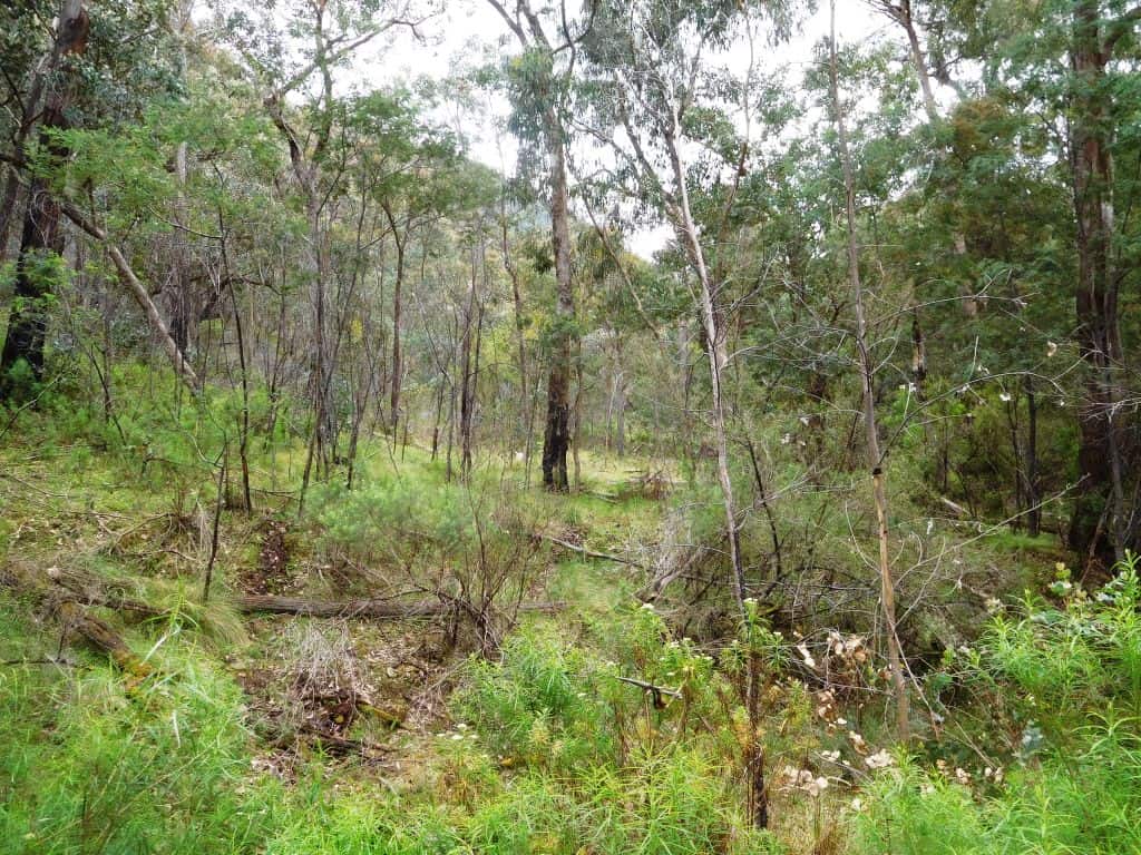
This section is mainly forest with maybe its best feature being the quite untouched Mt McAdam Reference Area (on the true left bank) but there is some picturesque farmland too. There are also a number of informal car camps along the way – but many more very private canoe camps!
As an aside, you can also (or as an alternative) walk the Moroka River up the McMillans Walking Track (a misnomer too as it needs even more clearing) say up to the Moroka Creek Track or even the old Higgins Yards site and from there pack raft back again.
Mostly it is easier to walk along on the true left bank of the Moroka, though the ‘track’ is mostly on the true right bank. This could be performed in a single day once, but it will probably consume closer to two days at present.
There used to be a vehicle track from the Moroka Creek Track up to Higgins Yards on the true left bank but it is rather overgrown with blackberries now so that it s easier to walk on the opposite (right) grassy side.
Once you have cleared the Wonnagatta pack track again (which might take one fit person three days) it will again only take a single day to walk up to the Hernes Spur, say. Starting from the Wombat Spur adds about a 1 1/2 hours to the canoe trip.
You can canoe all the way back from Hernes Spur to Eaglevale in one very long day (10 hours, say) but it is much more enjoyable to do it over two, and even better to enjoy three delightful wilderness days – with fish.
There are no roads or tracks between the Hernes Spur and the Moroka Junction (except a hunter’s track which extends downstream on the true left bank for about a kilometre to a lonely grave – which can be viewed from the river) so it is a very serene and untroubled section of forest indeed, inhabited very thinly by a handful of like-minded folks. I have only twice encountered anyone else in there in perhaps a hundred visits.
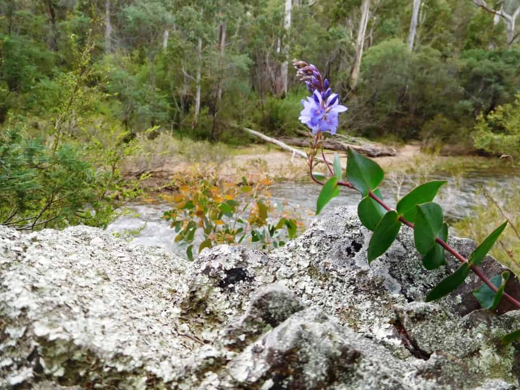
It is always worth taking a fishing line on either of these rivers as they abound in trout, bass and eels, etc. You should seldom fail to secure fresh fish (baked in Alfoil – in the ‘native’ manner) for your tea.
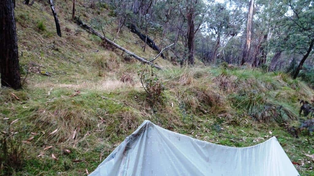
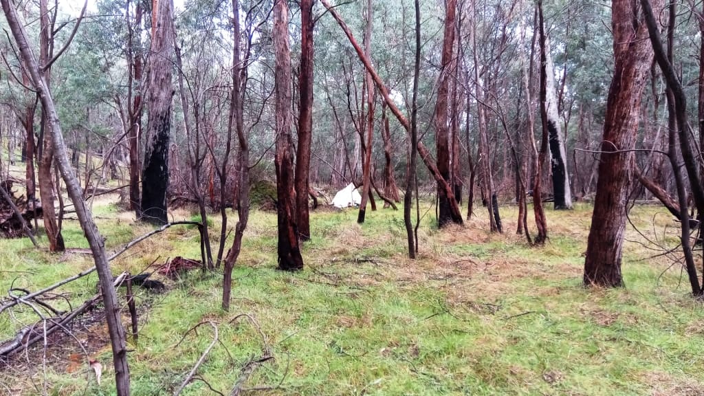
I have written about what you can expect packrafting this section of the Wonnangatta in the two posts Pack Rafting the Remote Wonnangatta Day One and The Remote Wonnangatta Day Two . On those occasions I stopped for an overnight camp in the vicinity of Mount Von Guerrard Creek on the true left bank. There are many grassy flats seldom visited by anyone because of the difficulty of crossing the river for much of the year and lots of fallen timber for a cheery fire (though not needed except in winter).
I guess you realise that I have visited the Wonnangatta Valley over the years a hundred ties or so most often completely by myself. I am never ‘lonely’ though I frequently prefer to be ‘alone’. Apparently (I am told) city folks frequently suffer from loneliness in those terrible rat-nests that urban areas are, a reality which I find hard to believe. But I have noticed in my infrequent visits there how the people will refuse to look you in the face when they pass you on the streets which seems very strange and alien to me.
Maybe you feel it would have been a ‘lonely life’ growing up on the Wonnangatta Station surrounded on all sides by tens of miles of trackless bush (one little girl who is buried in the homestead cemetery lived her entire short life there) – with no neighbours, but I grew up in a similar circumstance so I do not think so.
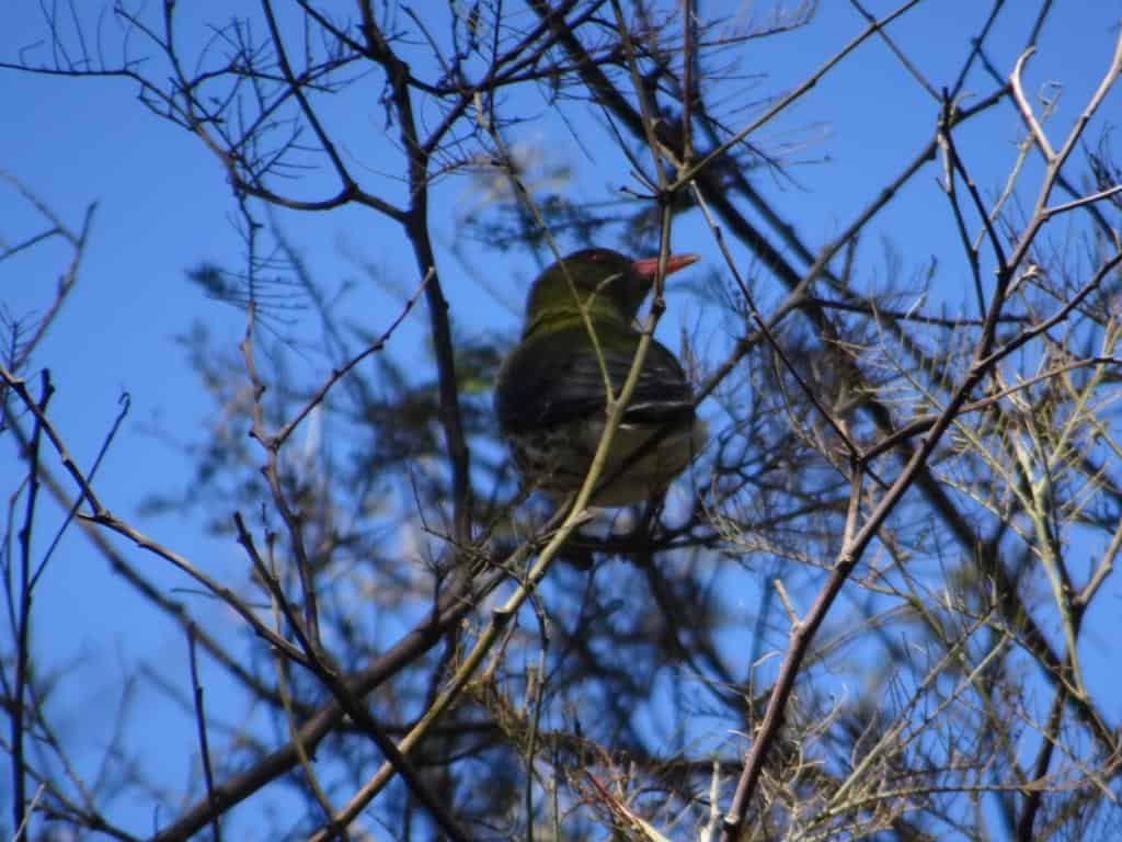
At least my mother would make me a packed lunch on the rare occasions I wanted to go play with any neighbouring children because it would be an hour’s walk or so there and back to do so. Sometimes I set out but did not arrive, being distracted by some other fascination of the bush – a strange bird such as I spent some time watching along the river just he other day.
A ‘packed lunch’ in those days would be carried (as with many things) in your (tucked-in) shirtfront where I often too carried a pet ferret – but not at the same time! A sandwich wrapped in greaseproof paper in a brown-paper bag was standard fare. Of course we brought the wrapper and the bag home in our pocket for re-use. Once there was no such thing as ‘waste’. Seems a world away today, I know. In time (and meaning) it is.
I don’t know whether growing up you read the marvelous ‘We Of the Never Never’ by Mrs Aeneus Gunn of Victoria Downs Station, the largest that ever was in the world. Millions of extremely remote acres in the NT. I recall they had a boundary rider who opined that the world thereabouts was becoming too crowded for his liking – he yearned to move ‘further out’. Seems he said something like that you could scarce ride a hundred miles in any direction anymore without seeing some sign of human beings – which was too much for him!
I do like that idea and long to visit such places. I do so love the feeling of solitude and that you are (or could be) the very first or only person to gaze out over the vast distances before you.
I also think it is strange how meaning and significance are warped by one’s very narrow upbringing. I believe that though people seem to be party to more ‘information’ than ever before that their perceptions are becoming increasingly narrowed – particularly by left-wing ideology.
For example, if I use the sentence “I hear the lonely dingo’s cry” – as I did just the other night in the Wonnagatta Valley – and have done many times before, I believe you may take a wholly different meaning to what I intended – because of your narrow urbanized perceptions and upbringing.
You may perceive some redolence of sadness maybe in my use of the words ‘lonely’ and ‘cry’ for example – but nothing could be further from the truth. The dingo is just ‘alone’ or ‘lone’ else I would have said “I heard the dingoes’ chorus”. His vocalisation is just his ‘call’ or his ‘cry’ and does not denote any sadness at all, no matter how mournful you may find the sound. He or she is not sad at all. His meaning will be very different than that – and other dingoes had better “Beware”.
Why sometimes I glance up from gazing into the glowing coals of my winter’s fire to see a brace or more of shining greenish dingo eyes not twenty yards away peering at me (balefully perhaps?) over the firelight, though more often it is deer eyes (and vocalizations). Their curiosity so attracts them to a single solitary campfire. When this happens to you too you will not think the dingo is suffering any such psychosis as ‘loneliness’- but it is one reason why I always carry a gun when camping alone in the High Country.
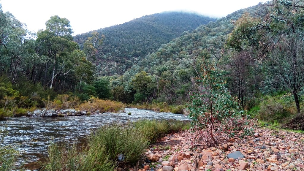
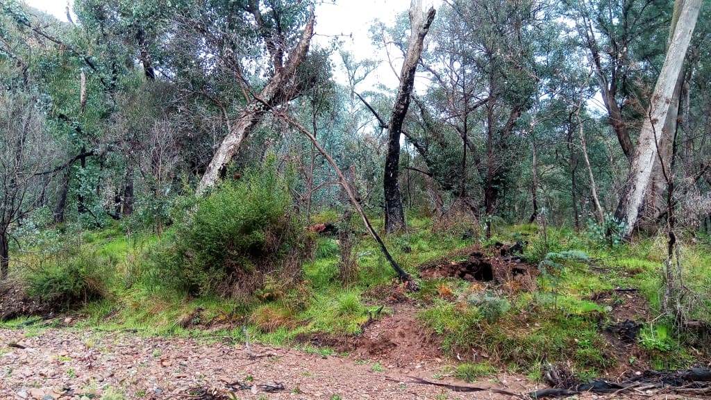
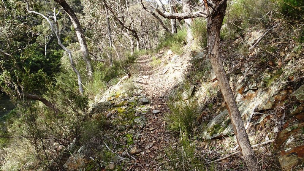
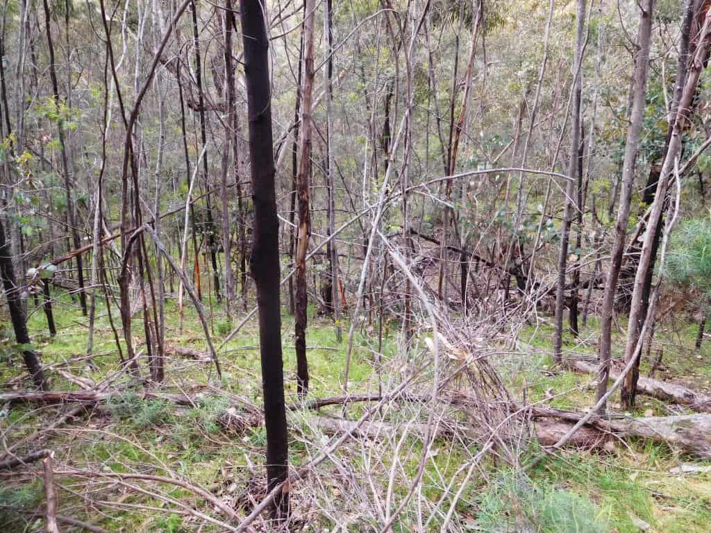
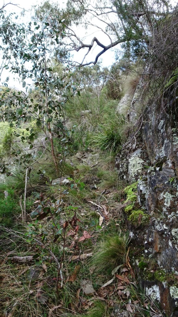
In what follows I will try to describe (and if possible supply a rough map) of what to expect along this Wonnangatta Pack Track. Let’s assume you begin where the 4WD track ends a couple of km below the Moroka Confluence. As I said before the track follows the Wonnangatta along its true right bank. In places it goes quite high to get round an obstacle. You definitely need to locate these sections. In other places where there are river flats it disappears altogether. In some spots it is hidden in the thick scrub and one just ‘bush bashes’ along in the flatter going near the river.
When the river is low enough so you can cross it readily (but say it is still raftable – roughly above 1.8 metres on the Waterford Guage) you can forego large sections of the track and just walk along grassy clearings on either side of the river. You need to know your way if you are going to do this though because you can get ‘bluffed out’ by precipices falling into the river (but maybe where it is too deep to cross – not a serious problem when you are carrying a raft though obviously). This strategy can make for a quicker and scenically different trip. Sometimes I do this too – but this post is about the track.
The best map to use for this section is the Vicmap Moroka North (8223-2-N).
Here is a shortened annotated version of it which (I think) you can download. It may not be georeferenced. The route is hand-drawn so not exact as to distance. The numbers refer to those in bold in the text below:
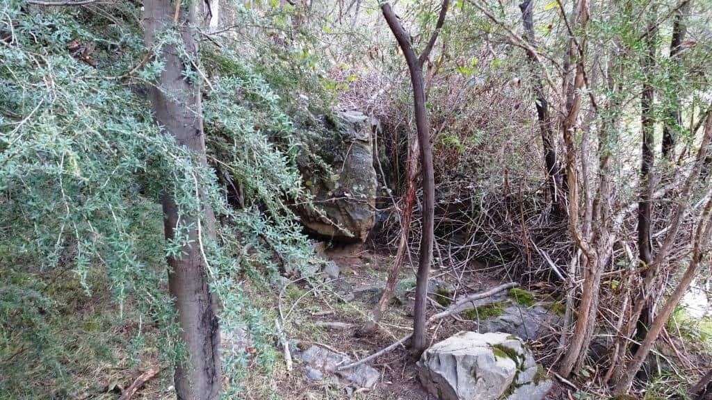
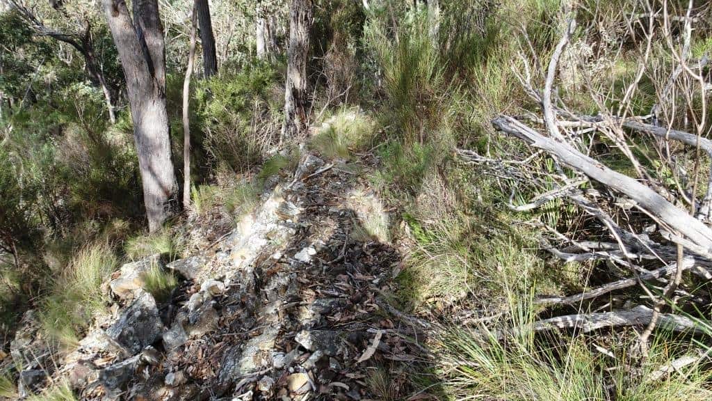
Just at the beginning there is a nasty scramble over fallen rock (and at present a large fallen tree) just at the beginning for a hundred yards or so. Don’t be put off by that. Follow the track up the hill for a kilometre or so until it appears to split in two (in actuality a turning circle). Take the right fork. (1) About fifty metres along from the fork follow a deer path down towards the river on your right. You will notice here (and elsewhere) that ‘others’ have snapped down small branches to ‘mark’ the trail.
At the bottom of a very steep fifty metre descent you cross a swampy anabranch and head straight across to the Moroka past a large log. Don’t be tempted to wander up a clear lead to your left as the swampy area between these two branches is full of fallen timber and holes and will just slow you down.
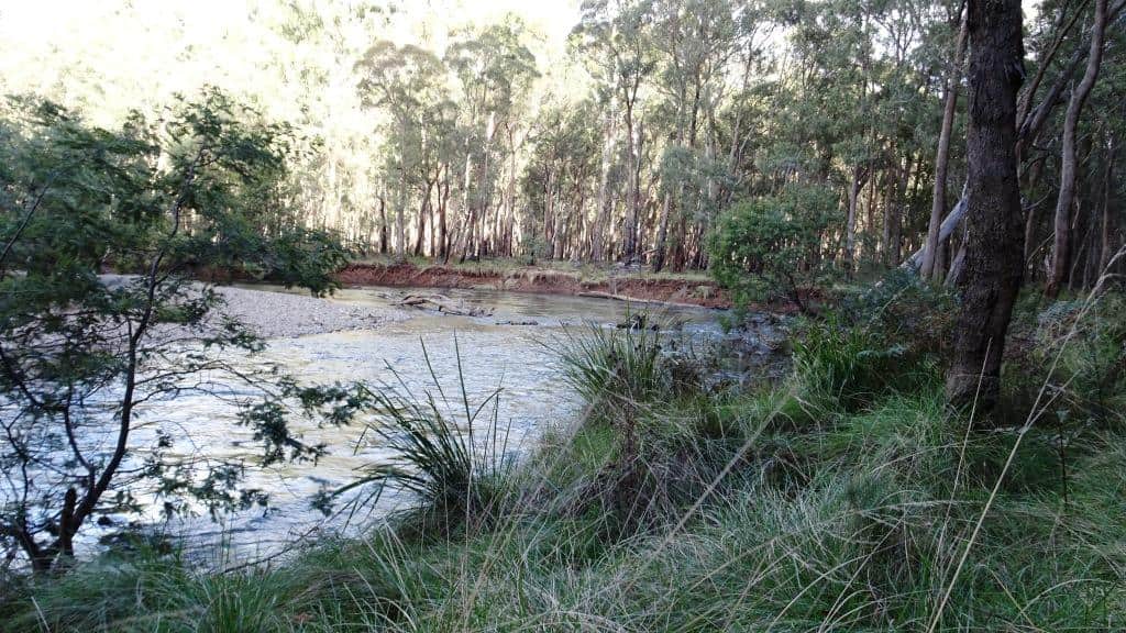
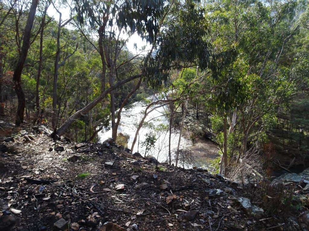
When you each the river after thirty yards or so just walk up its (true right) bank for a couple of hundred yards until you come to the sandbar I mentioned before. You can cross at a couple of rapids you come to first but you will be bush-bashing on the other side if you do, and they are more unstable. (2) This sandbar is the safest and easiest crossing at present. Don’t forget to undo your waist and chest straps on your pack in case you are swept off your feet. Too many people have been drowned that way.
After the crossing I used to just follow the flat downstream around the bottom of a ridge on your left but it is a bit overgrown at the moment so that you might find it more congenial to scramble up the steep bank (opposite) on the other side from the top of which you will see a grassy lead going downhill and then to your right past a couple of wallows, then veering left along the river. (3) Follow the grassy lead, then when it cuts out drop down onto the grassy riverbank flats. Just follow your nose along the flats.
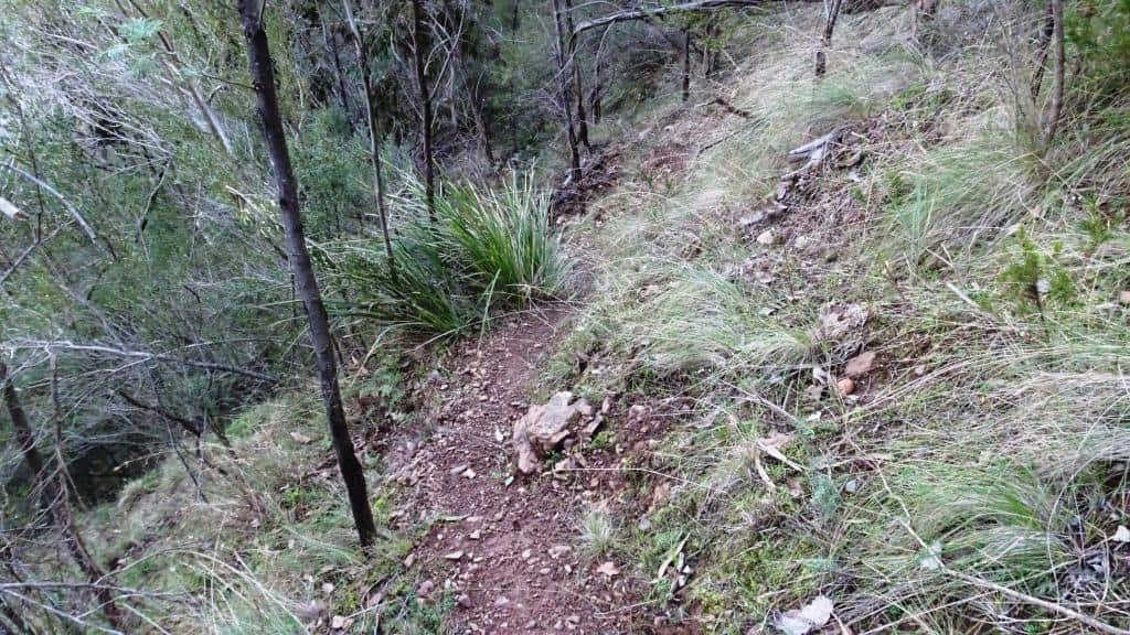
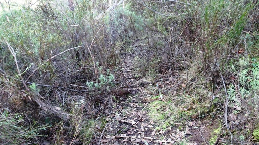
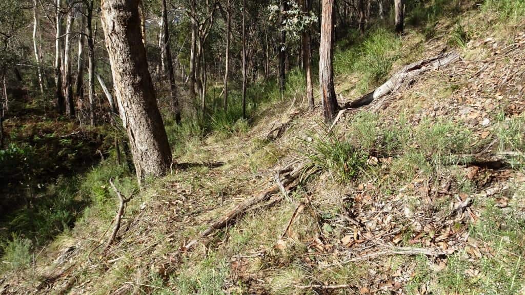
Most of the going is easy but if you have brought that machete it will be useful (for those who follow – or return journeys) to make the clear path more obvious. Generally follow a deer path which often as before has been ‘marked’ by others breaking small branches downwards. As the bank narrows it will be more obvious that you are on the Pack Track but sections of it have become a little rocky and there are too many tussocks, particularly sword grass.The judicious application of a little Roundup here would be useful. And someone to kick the rocks off the path.
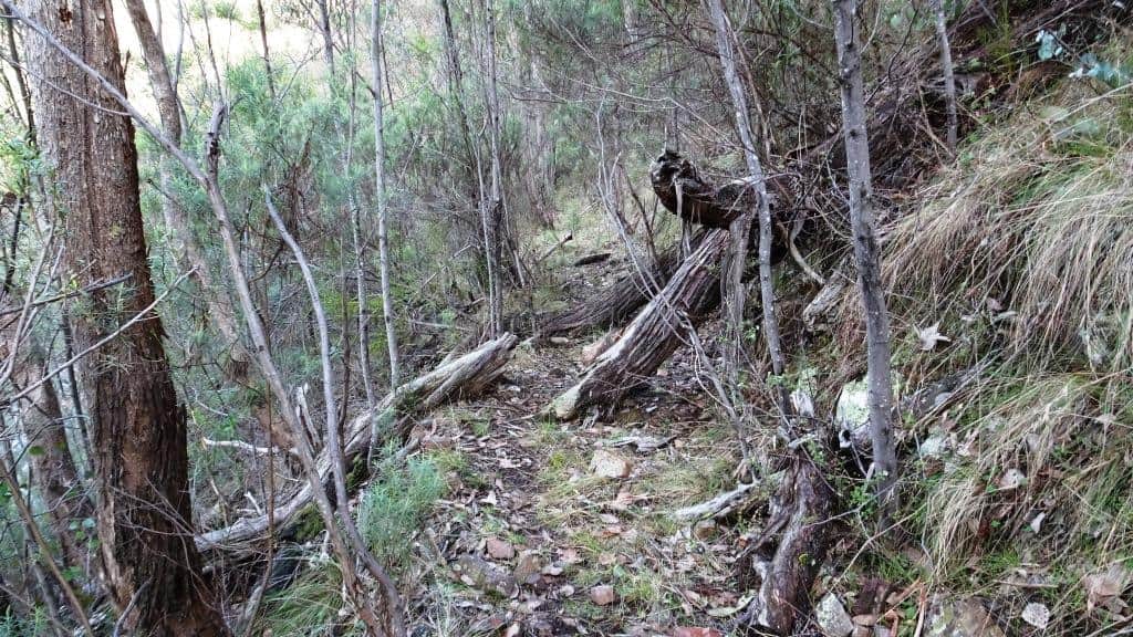
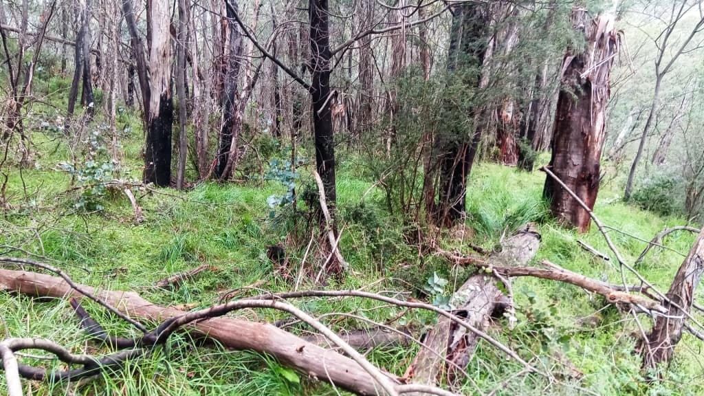
When you come to a rocky cleft you have to step over, the going will become a bit rougher and thicker. This section desperately needs some clearing. Mind you one person just walking it and breaking it down a bit improves it enormously. I went more than two-thirds of the way to Hernes Spur over last weekend (and back). My return journey was hours quicker than my going because of the slight improvement I had made on my outward journey. I had intended to clear the track with my machete on my way back but as it turned out really vile (wet, icy windy) weather came in which suggested to me a hasty retreat was judicious.
(4)After about a kilometre this thick section opens into a grassier flat for another kilometre till you come to a large rock which pretty much blocks your path. You can get around it at either end but (this is important) immediately after that rock the path angles very steeply up the ridge to your left. It wasn’t always this steep but it has fallen down. For fifty yards you will go up a very steep deer path then you will realise you are on a well-defined pack track. Nil desperandum. This track goes over a promontory which would otherwise be very difficult indeed if you were following the river.
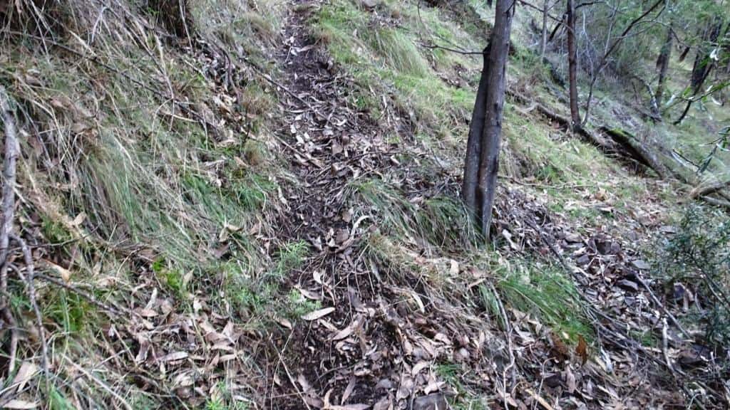
Looks like this from the top:
And like this from the bottom
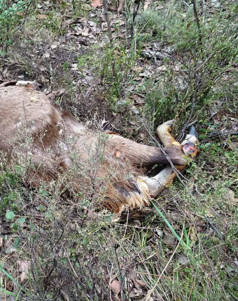
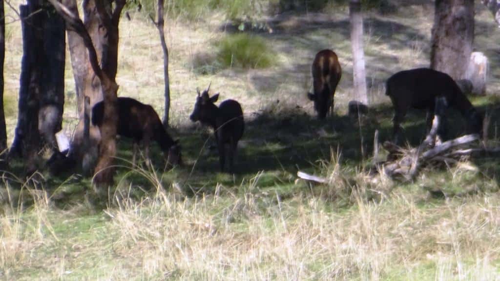
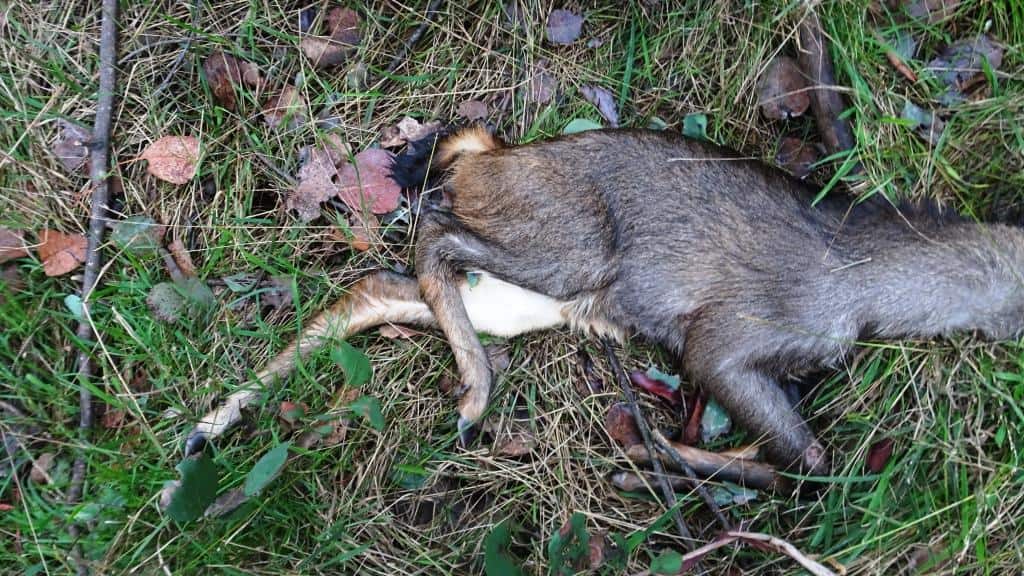
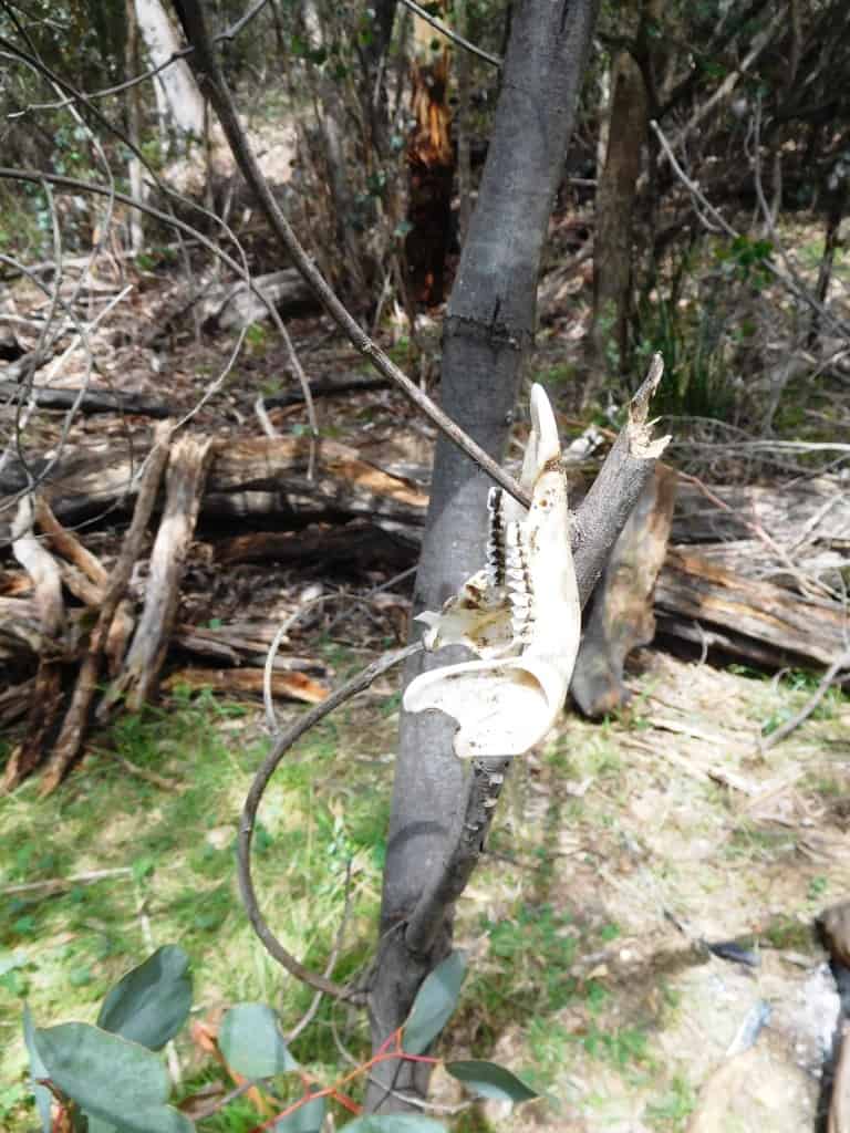
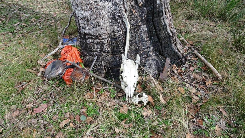
When it comes down to the river again you just follow along the flats once more. (5)After about another kilometre the going gets pretty thick and you will see that others (and the deer) have cut up twenty yards to your left and skirted above the thick patch until they intersect the well defined track again. There was a huge dead doe lying here which was not down to me, maybe not too any hunter. Helicopter culling perhaps? Nothing was taken. I had earlier (a couple of kilometres back) found a tiny faun which had starved to death without is mother.
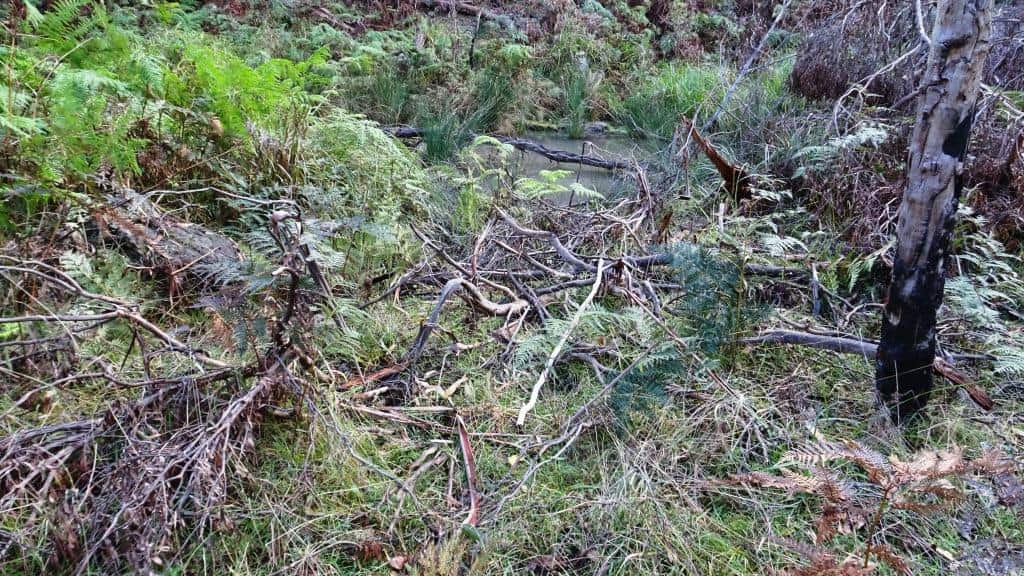
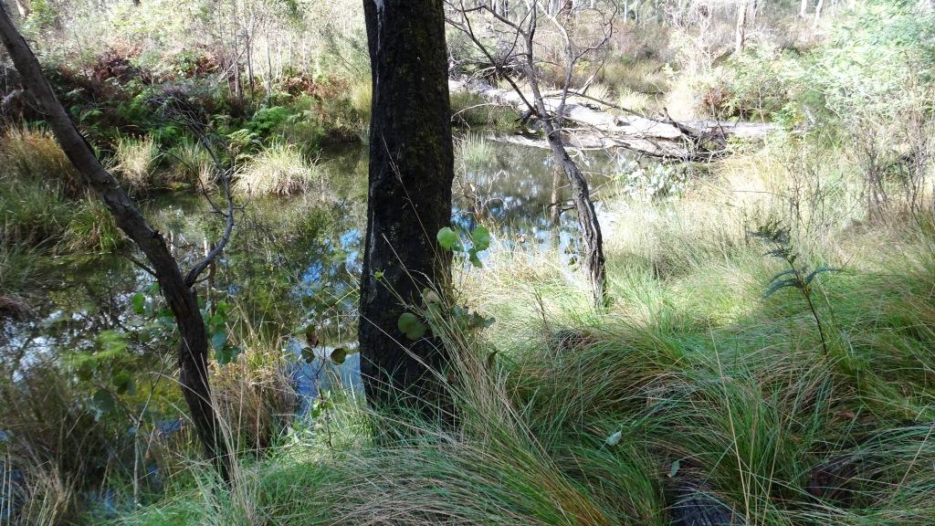
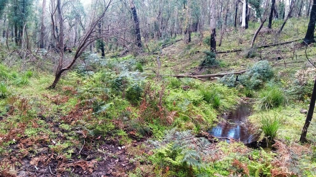
At the bottom of the track go around the corner above and around the left hand end of a large log. Follow the clearest lead along here either on the ridge between the river and its old anabranch (there is a fine wallow on the river side of this ridge), or the anabranch itself but eventually getting back onto the flat above the river where you will discover the old track in a couple of places and anyway wind your way along until you reach Mt Darling Creek in about a kilometre.
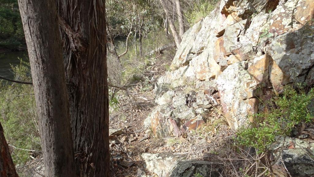
(6)There is evidence of a clear camp just above the junction. There are other flats (on both sides) up the Mt Darling Creek for a kilometre or so which can provide congenial camps. You cross the stream about twenty yards up then head straight across to the river to your right. The track around the cliffs here has fallen away and there is a bit of rock scrambling for perhaps thirty yards then follow the river along. Some blackberry spraying (again) here would be helpful.
The pack track used to angle up to your left as soon as you get around the cliff but it has fallen down in a rock-slide so it is easier to just walk along the bank for about half a kilometre until you come to a grassy clearing leading upwards to your left.
 (7) If you follow this grassy lead the track will appear about thirty metres up. It is essential you find it as this next couple of kilometres would be impossible without it. It must have entailed enormous amounts of work. It goes up and over the next big loop in the river. There is a great view from the top before you begin your descent and I usually stop for a break on a log to enjoy it.
The pack track breaks down into loose rock just before it meets the river then there is some track clearing needed for half a kilometer or so when the flat gong begins to improve. (8)It is clearest and easiest to walk around the inside of the next flat on the bend in the river than to follow the river. You can camp on this flat but the wind is treacherous here and the wood is poor.
After this small flat you just follow the flat along the river as best you can. It has been opening out since much of he fire regrowth died but much tussock grass has come up, Follow the obvious deer paths and contribute to them with your machete. (9) About half a kilometre beyond a small side gully on your left the (made) track reappears (as a deer path at first) angling up to your left. It is essential you follow it as you can’t get along the river to the first really big flat beyond any other way.
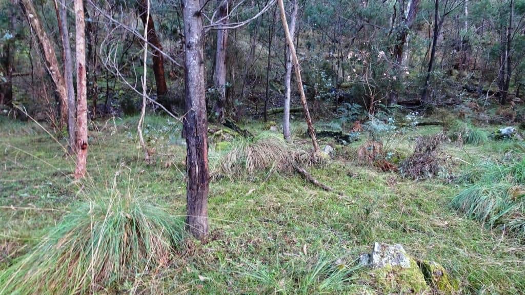
This flat is around twenty acres and is lightly timbered but rather overgrown. Sometimes there are huge piles of flooded debris deposited on it which can be used for firewood. (10) It is best to walk along the inside of this flat closest to the ridge in your left. There used to be a wonderful wallow about half way along it but a tree has fallen into it. The deer have moved to a new wallow.
As you walk upstream from this flat stay as far away from the river as you can as the river is undercutting the track here and you could fall in. The river has also recently just changed its course just above this flat. It has done so several times in my experience. It is also an area where truly huge log-jams form in the river for no reason I can understand. (11)The present one is a dwarf compared with one which used to be there for over twenty years – which covered acres. When you are canoeing back down the present one can be best portaged on your left.
It is rough uneven going for about a kilometre until you get around he anabranch. Don’t be tempted to cross it hoping for better going. You won’t find it. When you get around the end there is half a kilomettre of pleasant flat grassy walking across to the river again but just before you get there walk up on to the ridge on your left. (12)The made track will emerge along the edge of the ridge about twenty metres above the river.
The flat along the river here is too difficult for walking most of the way to a small gully then it opens out into easy fat grassy walking again. Here and there you will be driven off the flat on to the track along the side of the ridge until you come to a steep little gully.
(13)After this gully you can either scramble along the river at the base of the cliff (if the river is low) or you have to climb over he ridge and descend the gully on the other side to another 20-30 acre flat with lots of fallen trees which you cross on the clear inside edge.
You can cross the river at a ford just below the top end of this flat. The deer do. It is possible to criss-cross back and forward across the river walking on flats all the way to Hernes Spur in a bit over an hour or you can go via the pack track through to the Wombat in about two – and keep your feet dry.
The track follows along the river after the flat for nearly a kilometre then (14) climbs up on the ridge until it comes to a side gully, then it plunges into a strange hollow (15) then out again and along the ridge till it reaches the next valley (permanent flowing water -worth checking upstream here).
It used to levelly cross this valley about 200 metres up then head across the large open slope for about a kilometre until it reached the next gully but I have found it easier recently to walk down the point of the ridge to where the first gully meets the river and cross it there (16) . The riverside is quite flat and clear almost all the way (past two large interesting wallows) to the next gully.
You walk up this next gully on its left had side until you see the ‘cut’ of the track going up its right hand side. (17) You must find the track here as you can’t walk along this section of the river (for miles) unless you are on the track which goes up quite high (and amongst camping deer) for kilometres. You will soon be able to see Hernes Spur Track coming down the ridge upriver opposite.
Once you find this end of the track you will have little difficulty finding it (save one spot) until you get to the ridge just above Hernes Spur which you will walk down. This section of track is the best preserved and has remained clearest. It is also the most scenic with some incredible views.
(18)When it breaks out onto a flat ridge about half way along (probably a kilometre after you first see Hernes Spur Track it seems to disappear. You have to walk down the other side heading sightly (say 30 degrees) to your left into the next gully (which is a real beauty). When you get to the bottom you will see the track angling up to your right. It is all clear going until the ridge above Hernes Spur.
(19) You need to spot this corner when you come to it as you will want to walk down its left hand side until you met an old 4WD track coming up from the Wonnangatta Track at the bottom. I will have marked a couple of gums on the corner as best I can with blazes so look out for them.
If you continue on to Wombat Spur the next section is the most difficult as the track seems to disappear in loose soil and scree for a couple of hundred yards but stay with your contour and you will find it again and follow it till it comes out onto the main road at the bottom.Follow the road along.
Just before the next crossing the track shoots off to the left along a sort of low ridge. There is stream crossing and a low section through some regrowth blackberries ahead of you which may have closed over – I have not been there for years. If you can pick up the track after that it contours along about 20-50 metres above the river and exits on the main road just before the road crests after the last river crossing above the Wombat Spur. The section above Hernes Spur needs quite a bit of work but it is easy going.
If you are at one of the Wonnangatta crossings above the Hernes Spur (on the true left bank) looking across the river and downstream you will see the track contouring along roughly horizontally around 20-40 metres above the river You need only go find it, follow it then clear it.
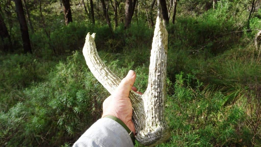
I was camped on the next flat above Hernes Spur years ago when just before dark a lot of deer came down towards the river. I walked down an old overgrown vehicle track to see whether I could get a ‘crack’ at one as there was a nice stag amongst them. I had them sort of ‘cornered’ in a small patch of bush not much bigger than a suburban back yard. The other deer exploded out of there and I let them go but the stag would not come out. He just stayed in there, growling at me and clawing at the ground with his hooves, crashing his antlers against the trees, making rushes towards me then backing off. Just generally behaving in a very aggressive fashion.
It was getting darker and darker. He could see better than me and I reckoned he could (probably) be on me before I got a shot off, so I just let him ‘win’ and walked away back to my camp fire.
A couple of other times I have nearly been knocked over by deer (I won’t say deliberately) but rushing past close enough to touch, and once I accidentally stepped over a sleeping deer mistaking it for a log and ended up being catapulted into the air as it came suddenly very, very alive. I can’t recommend grabbing them by the antlers (when they are alive) either. We were all young once and thought we would live forever.
For most people getting to (just above) Hernes Spur will be good enough for a wonderful pack rafting adventure.
Good luck, and have fun.
Oh, and about canoeable height. It is about (or above) 1.8 metres on the Waterford Gauge.I use the BOM’s River Heights Site. See also the post (about canoeing the Wonnangatta: Catching the Wave.
Hi Steve, wow what a detailed and enjoyable read.
I haven’t pack rafted before but I am a keen deer hunter. I have backpacked hunted a lot around Hernes , down towards the junction and also vehicle based from the the bottom of Hernes spur.
I have come across the bridle track that you talk about a few times and photographed it. It’s very interesting part of our history.
I often hunt solo and enjoy the peace and tranquility of the bush. I enjoy reading about your trips
Hi Matt, I hope my map enables you to locate it near to Hernes Spur. If you walk up the ridge indicated you will cross it. It gives good access high into the next valley downstream on the true right bank and proceeds for a few kilometres high enough to intercept the level at which deer camp. I was a bit reluctant to post about this but the track does need to be cleared and maintained and I am getting too old for this work. I am only hoping that people don’t use too much wood. Recently some people camped at my new campsite (alerted to it by the post about my New Knee etc) and burned literally tonnes of wood so that soon I will not be able to camp there either. I realise one needs a small fire in the winter but people need to understand that they can remove all of this resource which is near to desirable campsites (flat areas near enough to the river). I will be working on my designs for a small tent stove to overcome this difficulty. Something which only burns 500 grams of twigs an hour will not exhaust the fuel supply. I am also progressing my designs for winter tents which will be available to make copies of soon. Thank you for your sentiments. I am hoping I still have a few trips still in me (at 74). Cheers, Steve. PS: I would appreciate being able to add any of your photographs of the track to the article. I know I have photos of the area closer to Hernes Spur but somehow I am having trouble locating them amongst the hundreds of thousand of photos I have taken over he years. You can email me at stevendella@finnsheep.com